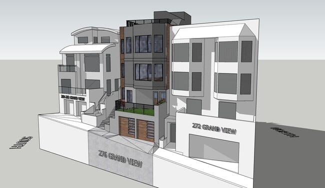
Property Record
276 Grand View Ave, San Francisco, CA 94114


NEARBY LISTINGS FOR SALE OR LEASE
Property Detail
276 Grand View Ave
San Francisco
Market Street Homestead Association
San Francisco-San Mateo-Redwood City, CA
San Francisco
2764-012
California
Sfr
0.06 AC
735 SF
Southern City
DEMOGRAPHICS near 276 Grand View Ave
1 Mile
3 Mile
5 Mile
2024 Total Population
53,799
556,544
852,038
2029 Population
49,973
514,214
788,654
Pop Growth 2024-2029
(7.11%)
(7.61%)
(7.44%)
Average Age
44
43
42
2024 Total Households
25,220
235,337
355,095
HH Growth 2024-2029
(7.66%)
(7.98%)
(7.79%)
Median Household Inc
$189,299
$128,816
$124,226
Avg Household Size
2.10
2.20
2.30
2024 Avg HH Vehicles
1.00
1.00
1.00
Median Home Value
$1,118,270
$1,102,663
$1,093,389
Median Year Built
1948
1948
1949
Nearby Places
Map Layers
Map Styles
 Street
 Aerial
- Restaurants
- Banks
- Shops
- Fitness
- Groceries
PUBLIC TRANSPORTATION
TRANSIT/SUBWAY
Castro (K Ingleside - San Francisco Municipal Railway (MUNI Metro), L Taraval - San Francisco Municipal Railway (MUNI Metro), M Ocean View - San Francisco Municipal Railway (MUNI Metro), S Castro Shuttle - San Francisco Municipal Railway (MUNI Metro), T Third Street - San Francisco Municipal Railway (MUNI Metro))
DRIVE
WALK
Distance
Castro (K Ingleside - San Francisco Municipal Railway (MUNI Metro), L Taraval - San Francisco Municipal Railway (MUNI Metro), M Ocean View - San Francisco Municipal Railway (MUNI Metro), S Castro Shuttle - San Francisco Municipal Railway (MUNI Metro), T Third Street - San Francisco Municipal Railway (MUNI Metro))
4 min
16 min
0.8 mi
21st Street (J Church - San Francisco Municipal Railway (MUNI Metro))
DRIVE
WALK
Distance
21st Street (J Church - San Francisco Municipal Railway (MUNI Metro))
4 min
18 min
0.9 mi
Market and Castro (F Market - San Francisco Municipal Railway (MUNI Metro))
DRIVE
WALK
Distance
Market and Castro (F Market - San Francisco Municipal Railway (MUNI Metro))
4 min
18 min
0.9 mi
Church and 20th Street (J Church - San Francisco Municipal Railway (MUNI Metro))
DRIVE
WALK
Distance
Church and 20th Street (J Church - San Francisco Municipal Railway (MUNI Metro))
4 min
19 min
1.0 mi
Church and 24th Street (J Church - San Francisco Municipal Railway (MUNI Metro))
DRIVE
WALK
Distance
Church and 24th Street (J Church - San Francisco Municipal Railway (MUNI Metro))
4 min
19 min
1.0 mi
COMMUTER RAIL
San Francisco 4th & King (Caltrain - Caltrain (Caltrain))
DRIVE
WALK
Distance
San Francisco 4th & King (Caltrain - Caltrain (Caltrain))
10 min
3.8 mi
DRIVE
WALK
Distance
10 min
3.8 mi
AIRPORT
San Francisco International
DRIVE
WALK
Distance
San Francisco International
24 min
13.9 mi
Metro Oakland International
DRIVE
WALK
Distance
Metro Oakland International
37 min
22.3 mi
Norman Y Mineta San Jose International
DRIVE
WALK
Distance
Norman Y Mineta San Jose International
59 min
45.5 mi
SALE & LEASE HISTORY
LISTING DATE
SALE/LEASE

Mar 31, 2025
For Sale
Apr 10, 2023
For Sale
Nearby Properties
Address
Land Use
TOTAL SIZE
Lot Size
Zoning
Address
Land Use
TOTAL SIZE
Lot Size
Zoning
1,015,000 SF
2.43 AC
RC4
Address
Land Use
TOTAL SIZE
Lot Size
Zoning
750,370 SF
3.25 AC
MBR3
Address
Land Use
TOTAL SIZE
Lot Size
Zoning
248,303 SF
4.35 AC
Address
Land Use
TOTAL SIZE
Lot Size
Zoning
717,234 SF
3.47 AC
UMU
Address
Land Use
TOTAL SIZE
Lot Size
Zoning
266,143 SF
4 AC
C-3-R
Address
Land Use
TOTAL SIZE
Lot Size
Zoning
508,714 SF
1.29 AC
C3R
Address
Land Use
TOTAL SIZE
Lot Size
Zoning
696,431 SF
0.97 AC
C3G
Address
Land Use
TOTAL SIZE
Lot Size
Zoning
1.52 AC
C3G
Address
Land Use
TOTAL SIZE
Lot Size
Zoning
1,424,230 SF
2.60 AC
C3G
Address
Land Use
TOTAL SIZE
Lot Size
Zoning
263,640 SF
0.72 AC
C3R
Address
Land Use
TOTAL SIZE
Lot Size
Zoning
2.74 AC
Address
Land Use
TOTAL SIZE
Lot Size
Zoning
313,306 SF
1.23 AC
WMUG
Address
Land Use
TOTAL SIZE
Lot Size
Zoning
922,758 SF
1.94 AC
C3R
Address
Land Use
TOTAL SIZE
Lot Size
Zoning
393,918 SF
3.36 AC
WMUG
Address
Land Use
TOTAL SIZE
Lot Size
Zoning
24.37 AC
Address
Land Use
TOTAL SIZE
Lot Size
Zoning
674,317 SF
3.36 AC
UMU
Address
Land Use
TOTAL SIZE
Lot Size
Zoning
649,376 SF
0.93 AC
C3S
Address
Land Use
TOTAL SIZE
Lot Size
Zoning
2.93 AC
Address
Land Use
TOTAL SIZE
Lot Size
Zoning
342,727 SF
1.36 AC
C3G
Address
Land Use
TOTAL SIZE
Lot Size
Zoning
411,904 SF
21.74 AC
C2
Address
Land Use
TOTAL SIZE
Lot Size
Zoning
291,522 SF
6.66 AC
CM
Address
Land Use
TOTAL SIZE
Lot Size
Zoning
250,884 SF
1.66 AC
MB-RA
Address
Land Use
TOTAL SIZE
Lot Size
Zoning
718 SF
18.55 AC
RH2
Address
Land Use
TOTAL SIZE
Lot Size
Zoning
243,612 SF
1.94 AC
Address
Land Use
TOTAL SIZE
Lot Size
Zoning
345,000 SF
1.74 AC
WMUG
Address
Land Use
TOTAL SIZE
Lot Size
Zoning
2.22 AC
M1
Address
Land Use
TOTAL SIZE
Lot Size
Zoning
564,614 SF
0.90 AC
C3S
Address
Land Use
TOTAL SIZE
Lot Size
Zoning
246,069 SF
0.69 AC
Address
Land Use
TOTAL SIZE
Lot Size
Zoning
89,551 SF
0.73 AC
RC4
Address
Land Use
TOTAL SIZE
Lot Size
Zoning
332,221 SF
1.17 AC
The World's #1 Commercial Real Estate Marketplace
Connect with us
© 2026 CoStar Group
The information above has been obtained from sources believed reliable. While we do not doubt its accuracy we have not verified it and make no guarantee, warranty or representation about it. It is your responsibility to independently confirm its accuracy and completeness. Any projections, opinions, assumptions, or estimates used are for example only and do not represent the current or future performance of the property. The value of this transaction to you depends on tax and other factors which should be evaluated by your tax, financial, and legal advisors. You and your advisors should conduct a careful, independent investigation of the property to determine to your satisfaction the suitability of the property for your needs.