Property Record
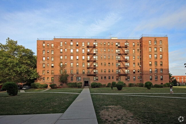
2781 Shell Rd, Brooklyn, NY 11223


Property Detail
2781 Shell Rd
07233-0210
Kings
Recreationalentertainmentgeneral
New York
R5
81
C and X Area of minimal flood hazard, usually depicted on FIRMs as above the 500-year flood level.
3.31 AC
2024
Gravesend
2025
Long Island (New York)
037402
New York-Jersey City-White Plains, NY-NJ
107,958 SF
NEARBY LISTINGS FOR SALE OR LEASE
DEMOGRAPHICS near 2781 Shell Rd
1 mile
3 mile
5 mile
2024 Total Population
109,559
546,683
1,226,732
2029 Population
108,255
537,080
1,201,535
Pop Growth 2024-2029
(1.19%)
(1.76%)
(2.05%)
Average Age
45
42
41
2024 Total Households
42,898
193,174
421,828
HH Growth 2024-2029
(1.37%)
(2.01%)
(2.20%)
Median Household Inc
$55,590
$64,697
$71,692
Avg Household Size
2.40
2.70
2.80
2024 Avg HH Vehicles
1.00
1.00
1.00
Median Home Value
$670,433
$853,855
$842,549
Median Year Built
1959
1949
1948
Nearby Places
Map Layers
Map Styles
 Street
 Aerial
Transit
 Traffic
 Biking
Places
Listings with unknown addresses are not visible on the map
- Restaurants
- Banks
- Shops
- Fitness
- Groceries
Nearby Properties
Address
Land Use
TOTAL SIZE
Lot Size
Zoning
Address
Land Use
TOTAL SIZE
Lot Size
Zoning
1,078,317 SF
10.45 AC
R4
Address
Land Use
TOTAL SIZE
Lot Size
Zoning
965,600 SF
6.65 AC
R5
Address
Land Use
TOTAL SIZE
Lot Size
Zoning
54.78 AC
PARK
Address
Land Use
TOTAL SIZE
Lot Size
Zoning
353,600 SF
55.79 AC
R3-1
Address
Land Use
TOTAL SIZE
Lot Size
Zoning
301,400 SF
22.27 AC
M3-1
Address
Land Use
TOTAL SIZE
Lot Size
Zoning
139,557 SF
11.47 AC
M1-1
Address
Land Use
TOTAL SIZE
Lot Size
Zoning
275,163 SF
9.69 AC
R3-1
Address
Land Use
TOTAL SIZE
Lot Size
Zoning
846,056 SF
20.71 AC
R5
Address
Land Use
TOTAL SIZE
Lot Size
Zoning
59,063 SF
21.56 AC
PARK
Address
Land Use
TOTAL SIZE
Lot Size
Zoning
209,346 SF
18.29 AC
PARK
Address
Land Use
TOTAL SIZE
Lot Size
Zoning
702,770 SF
4.47 AC
R6
Address
Land Use
TOTAL SIZE
Lot Size
Zoning
292,528 SF
1.05 AC
R6
Address
Land Use
TOTAL SIZE
Lot Size
Zoning
356,000 SF
8.19 AC
R5
Address
Land Use
TOTAL SIZE
Lot Size
Zoning
351,762 SF
1.65 AC
R7A
Address
Land Use
TOTAL SIZE
Lot Size
Zoning
208,015 SF
1.52 AC
R7X
Address
Land Use
TOTAL SIZE
Lot Size
Zoning
221,704 SF
0.83 AC
R5B
Address
Land Use
TOTAL SIZE
Lot Size
Zoning
128,170 SF
0.87 AC
R7A
Address
Land Use
TOTAL SIZE
Lot Size
Zoning
470,000 SF
3.40 AC
R6
Address
Land Use
TOTAL SIZE
Lot Size
Zoning
105,328 SF
0.11 AC
M1-6
Address
Land Use
TOTAL SIZE
Lot Size
Zoning
521,976 SF
13.59 AC
R5
Address
Land Use
TOTAL SIZE
Lot Size
Zoning
2,000 SF
73.29 AC
PARK
Address
Land Use
TOTAL SIZE
Lot Size
Zoning
60,288 SF
0.76 AC
R5
Address
Land Use
TOTAL SIZE
Lot Size
Zoning
305,046 SF
8.76 AC
R6
Address
Land Use
TOTAL SIZE
Lot Size
Zoning
211,552 SF
7.39 AC
R3-2
Address
Land Use
TOTAL SIZE
Lot Size
Zoning
411,500 SF
3.48 AC
R5B
Address
Land Use
TOTAL SIZE
Lot Size
Zoning
470,000 SF
3.30 AC
R6
Address
Land Use
TOTAL SIZE
Lot Size
Zoning
335,475 SF
7.23 AC
R5
Address
Land Use
TOTAL SIZE
Lot Size
Zoning
547,448 SF
12.50 AC
R5
Address
Land Use
TOTAL SIZE
Lot Size
Zoning
222,265 SF
0.74 AC
R6
Address
Land Use
TOTAL SIZE
Lot Size
Zoning
141,830 SF
0.22 AC
C64X
The World's #1 Commercial Real Estate Marketplace
Connect with us
© 2026 CoStar Group
The information above has been obtained from sources believed reliable. While we do not doubt its accuracy we have not verified it and make no guarantee, warranty or representation about it. It is your responsibility to independently confirm its accuracy and completeness. Any projections, opinions, assumptions, or estimates used are for example only and do not represent the current or future performance of the property. The value of this transaction to you depends on tax and other factors which should be evaluated by your tax, financial, and legal advisors. You and your advisors should conduct a careful, independent investigation of the property to determine to your satisfaction the suitability of the property for your needs.