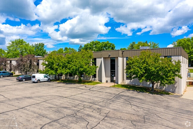
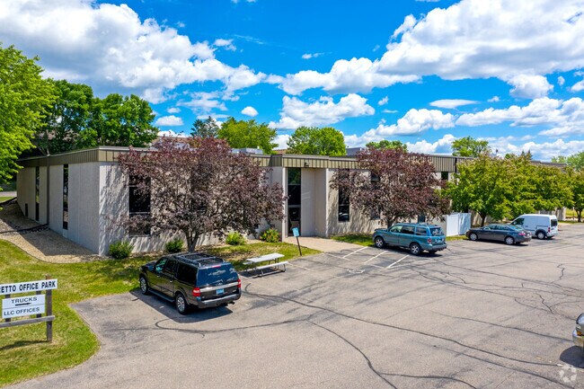
Property Record
279 N Medina St, Loretto, MN 55357
NEARBY LISTINGS FOR SALE OR LEASE
Property Detail
279 N Medina St
Minneapolis-St. Paul-Bloomington, MN-WI
Hillview West Addn
06-118-23-42-0023
LOT 001 BLOCK 001 A HILLVIEW WEST ADDN SUBJECT TO ROAD W264X285X264X287
Industrialgeneral
Hennepin
X
Minnesota
27171C0550D
1
2024
1.73 AC
2024
I-394 Corridor
027101
Minneapolis/St Paul
DEMOGRAPHICS near 279 N Medina St
1 Mile
3 Mile
5 Mile
2024 Total Population
821
4,100
13,933
2029 Population
805
4,017
13,740
Pop Growth 2024-2029
(1.95%)
(2.02%)
(1.39%)
Average Age
41
42
41
2024 Total Households
326
1,441
4,923
HH Growth 2024-2029
(2.15%)
(2.22%)
(1.46%)
Median Household Inc
$104,687
$147,518
$144,176
Avg Household Size
2.50
2.80
2.80
2024 Avg HH Vehicles
2.00
3.00
2.00
Median Home Value
$348,148
$510,728
$534,698
Median Year Built
1986
1981
1986
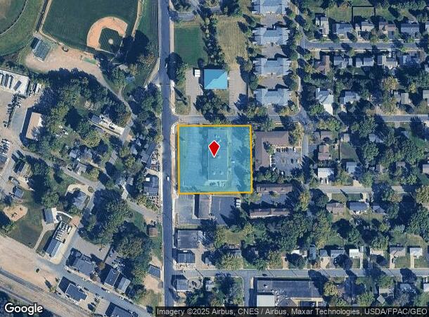
Nearby Places
Map Layers
Map Styles
 Street
 Aerial
- Restaurants
- Banks
- Shops
- Fitness
- Groceries
PUBLIC TRANSPORTATION
AIRPORT
Minneapolis-St Paul International/Wold-Chamberlain
DRIVE
WALK
Distance
Minneapolis-St Paul International/Wold-Chamberlain
46 min
32.7 mi
SALE & LEASE HISTORY
LISTING DATE
SALE/LEASE

Sep 25, 2016
For Lease
Jun 07, 2019
For Lease
Jul 21, 2017
For Lease
Jul 20, 2020
For Sale
Feb 08, 2021
For Lease
Aug 22, 2017
For Lease
Nearby Properties
Address
Land Use
TOTAL SIZE
Lot Size
Zoning
Address
Land Use
TOTAL SIZE
Lot Size
Zoning
21.09 AC
Address
Land Use
TOTAL SIZE
Lot Size
Zoning
Address
Land Use
TOTAL SIZE
Lot Size
Zoning
25.53 AC
Address
Land Use
TOTAL SIZE
Lot Size
Zoning
33.02 AC
Address
Land Use
TOTAL SIZE
Lot Size
Zoning
42.54 AC
Address
Land Use
TOTAL SIZE
Lot Size
Zoning
26.54 AC
Address
Land Use
TOTAL SIZE
Lot Size
Zoning
11.52 AC
Address
Land Use
TOTAL SIZE
Lot Size
Zoning
Address
Land Use
TOTAL SIZE
Lot Size
Zoning
10.29 AC
Address
Land Use
TOTAL SIZE
Lot Size
Zoning
15.21 AC
Address
Land Use
TOTAL SIZE
Lot Size
Zoning
10.01 AC
Address
Land Use
TOTAL SIZE
Lot Size
Zoning
17.91 AC
Address
Land Use
TOTAL SIZE
Lot Size
Zoning
2.02 AC
Address
Land Use
TOTAL SIZE
Lot Size
Zoning
0.95 AC
Address
Land Use
TOTAL SIZE
Lot Size
Zoning
4.59 AC
Address
Land Use
TOTAL SIZE
Lot Size
Zoning
8.40 AC
Address
Land Use
TOTAL SIZE
Lot Size
Zoning
1,582 SF
74 AC
Address
Land Use
TOTAL SIZE
Lot Size
Zoning
17.04 AC
Address
Land Use
TOTAL SIZE
Lot Size
Zoning
63.67 AC
Address
Land Use
TOTAL SIZE
Lot Size
Zoning
60.18 AC
Address
Land Use
TOTAL SIZE
Lot Size
Zoning
1.89 AC
Address
Land Use
TOTAL SIZE
Lot Size
Zoning
Address
Land Use
TOTAL SIZE
Lot Size
Zoning
4.67 AC
Address
Land Use
TOTAL SIZE
Lot Size
Zoning
5.85 AC
Address
Land Use
TOTAL SIZE
Lot Size
Zoning
41.66 AC
Address
Land Use
TOTAL SIZE
Lot Size
Zoning
1.25 AC
Address
Land Use
TOTAL SIZE
Lot Size
Zoning
22.75 AC
Address
Land Use
TOTAL SIZE
Lot Size
Zoning
17.60 AC
Address
Land Use
TOTAL SIZE
Lot Size
Zoning
53.19 AC
Address
Land Use
TOTAL SIZE
Lot Size
Zoning
29.90 AC
The World's #1 Commercial Real Estate Marketplace
Connect with us
© 2026 CoStar Group
The information above has been obtained from sources believed reliable. While we do not doubt its accuracy we have not verified it and make no guarantee, warranty or representation about it. It is your responsibility to independently confirm its accuracy and completeness. Any projections, opinions, assumptions, or estimates used are for example only and do not represent the current or future performance of the property. The value of this transaction to you depends on tax and other factors which should be evaluated by your tax, financial, and legal advisors. You and your advisors should conduct a careful, independent investigation of the property to determine to your satisfaction the suitability of the property for your needs.