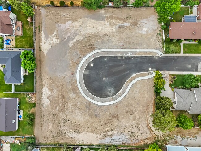
Property Record
279 W 1600 N, Orem, UT 84057


NEARBY LISTINGS FOR SALE OR LEASE
Property Detail
279 W 1600 N
Provo-Orem-Lehi, UT
COM S 237.41 FT & W 1805.85 FT FR E1/4 COR SEC 3, T6S, R2E, SLM; S 268.19 FT; S 88 DEG 5947W 158.25 FT; N 4109W 274.70 FT; N 82 DEG 3308E 99.99 FT; S 1 DEG 0807E 17.98 FT; N 88 DEG 5153E 62.03 FT TO BEG. AREA 1.01 AC. ALSO: COM S 237.41 FT & W 1805.8
17-013-0094
Utah
Agriculturalland
Utah
2024
1.90 AC
2025
Utah County
000706
Salt Lake City
280 SF
DEMOGRAPHICS near 279 W 1600 N
1 Mile
3 Mile
5 Mile
2024 Total Population
18,635
101,807
196,354
2029 Population
20,092
110,869
215,210
Pop Growth 2024-2029
+ 7.82%
+ 8.90%
+ 9.60%
Average Age
34
34
33
2024 Total Households
5,308
30,900
60,093
HH Growth 2024-2029
+ 8.59%
+ 9.70%
+ 10.41%
Median Household Inc
$103,607
$94,952
$94,247
Avg Household Size
3.50
3.20
3.20
2024 Avg HH Vehicles
3.00
2.00
2.00
Median Home Value
$573,905
$558,568
$567,633
Median Year Built
1987
1991
1995
Nearby Places
Map Layers
Map Styles
 Street
 Aerial
- Restaurants
- Banks
- Shops
- Fitness
- Groceries
PUBLIC TRANSPORTATION
COMMUTER RAIL
Vineyard Station (FrontRunner - Utah Transit Authority (UTA))
DRIVE
WALK
Distance
Vineyard Station (FrontRunner - Utah Transit Authority (UTA))
5 min
2.6 mi
Orem Central Station (FrontRunner - Utah Transit Authority (UTA))
DRIVE
WALK
Distance
Orem Central Station (FrontRunner - Utah Transit Authority (UTA))
9 min
4.4 mi
AIRPORT
Provo Municipal
DRIVE
WALK
Distance
Provo Municipal
16 min
10.4 mi
Freight Ports
Port of Stockton
DRIVE
WALK
Distance
Port of Stockton
750 min
733.0 mi
Nearby Properties
Address
Land Use
TOTAL SIZE
Lot Size
Zoning
Address
Land Use
TOTAL SIZE
Lot Size
Zoning
206,178 SF
16.64 AC
Address
Land Use
TOTAL SIZE
Lot Size
Zoning
1,003,185 SF
9.57 AC
Address
Land Use
TOTAL SIZE
Lot Size
Zoning
530,326 SF
8.14 AC
Address
Land Use
TOTAL SIZE
Lot Size
Zoning
472,365 SF
15.90 AC
Address
Land Use
TOTAL SIZE
Lot Size
Zoning
736,672 SF
7.04 AC
Address
Land Use
TOTAL SIZE
Lot Size
Zoning
349,971 SF
11.43 AC
Address
Land Use
TOTAL SIZE
Lot Size
Zoning
326,355 SF
15.12 AC
Address
Land Use
TOTAL SIZE
Lot Size
Zoning
310,818 SF
1.17 AC
Address
Land Use
TOTAL SIZE
Lot Size
Zoning
233,302 SF
15.03 AC
Address
Land Use
TOTAL SIZE
Lot Size
Zoning
199,119 SF
17.18 AC
Address
Land Use
TOTAL SIZE
Lot Size
Zoning
333,719 SF
11.99 AC
Address
Land Use
TOTAL SIZE
Lot Size
Zoning
430,273 SF
15.74 AC
Address
Land Use
TOTAL SIZE
Lot Size
Zoning
122,784 SF
12.46 AC
Address
Land Use
TOTAL SIZE
Lot Size
Zoning
401,381 SF
3.50 AC
Address
Land Use
TOTAL SIZE
Lot Size
Zoning
154,685 SF
13.20 AC
Address
Land Use
TOTAL SIZE
Lot Size
Zoning
222,803 SF
18.48 AC
Address
Land Use
TOTAL SIZE
Lot Size
Zoning
268,060 SF
11.73 AC
Address
Land Use
TOTAL SIZE
Lot Size
Zoning
364,248 SF
22.77 AC
Address
Land Use
TOTAL SIZE
Lot Size
Zoning
311,697 SF
6.49 AC
Address
Land Use
TOTAL SIZE
Lot Size
Zoning
212,466 SF
25.89 AC
Address
Land Use
TOTAL SIZE
Lot Size
Zoning
139,462 SF
3.93 AC
Address
Land Use
TOTAL SIZE
Lot Size
Zoning
124,242 SF
9.33 AC
Address
Land Use
TOTAL SIZE
Lot Size
Zoning
194,483 SF
10.66 AC
Address
Land Use
TOTAL SIZE
Lot Size
Zoning
179,347 SF
13.55 AC
Address
Land Use
TOTAL SIZE
Lot Size
Zoning
72,761 SF
5.92 AC
Address
Land Use
TOTAL SIZE
Lot Size
Zoning
128,992 SF
12.39 AC
Address
Land Use
TOTAL SIZE
Lot Size
Zoning
4,053 SF
18.21 AC
Address
Land Use
TOTAL SIZE
Lot Size
Zoning
170,536 SF
2.16 AC
Address
Land Use
TOTAL SIZE
Lot Size
Zoning
204,655 SF
8.10 AC
Address
Land Use
TOTAL SIZE
Lot Size
Zoning
211,929 SF
1.30 AC
The World's #1 Commercial Real Estate Marketplace
Connect with us
© 2026 CoStar Group
The information above has been obtained from sources believed reliable. While we do not doubt its accuracy we have not verified it and make no guarantee, warranty or representation about it. It is your responsibility to independently confirm its accuracy and completeness. Any projections, opinions, assumptions, or estimates used are for example only and do not represent the current or future performance of the property. The value of this transaction to you depends on tax and other factors which should be evaluated by your tax, financial, and legal advisors. You and your advisors should conduct a careful, independent investigation of the property to determine to your satisfaction the suitability of the property for your needs.