Property Record
2811 W Imperia Dr S, Sugar Land, TX 77479
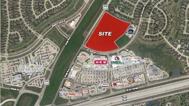

Property Detail
2811 W Imperia Dr S
Houston-Pasadena-The Woodlands, TX
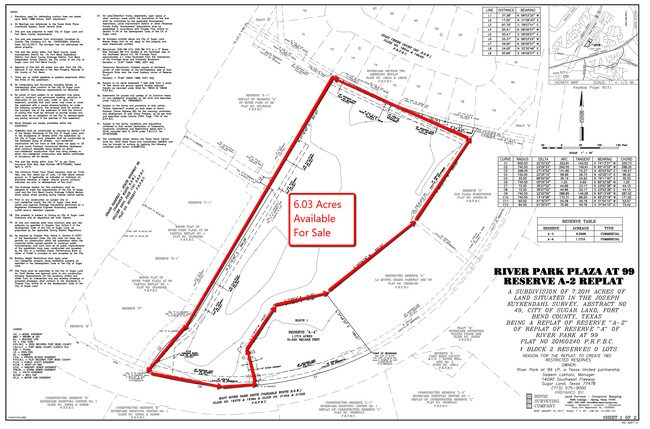
0049 J KUYKENDALL, BLOCK 1, ACRES 3.563, RIVERPARK RIDGE BUSINESS AND MEDICAL OFFICES RESERVE A-3 MINOR REPLAT, RESTRICTED RESERVE A-5 (COMMERCIAL)
0049-00-000-0747-901
Fort Bend
Commercialnec
Texas
2024
3.56 AC
2025
Southwest Outlier
674701
Houston
NEARBY LISTINGS FOR SALE OR LEASE
DEMOGRAPHICS near 2811 W Imperia Dr S
1 mile
3 mile
5 mile
2025 Total Population
8,369
66,822
168,444
2030 Population
9,406
75,189
190,727
Pop Growth 2025-2030
+ 12.39%
+ 12.52%
+ 13.23%
Average Age
41
40
40
2025 Total Households
2,682
21,714
56,537
HH Growth 2025-2030
+ 12.79%
+ 13.03%
+ 13.74%
Median Household Inc
$167,618
$138,996
$123,106
Avg Household Size
3.00
3.00
2.90
2025 Avg HH Vehicles
2.00
2.00
2.00
Median Home Value
$378,902
$425,669
$420,509
Median Year Built
2002
2002
2004
Nearby Places
Map Layers
Map Styles
 Street
 Aerial
Layers
 Traffic
 Biking
Places
Listings with unknown addresses are not visible on the map
- Restaurants
- Banks
- Shops
- Fitness
- Groceries
PUBLIC TRANSPORTATION
AIRPORT
William P Hobby
Drive
Walk
Distance
William P Hobby
48 min
32.4 mi
Freight Ports
Port of Houston
Drive
Walk
Distance
Port of Houston
49 min
33.1 mi
SALE & LEASE HISTORY
LISTING DATE
SALE/LEASE

Sep 24, 2016
For Sale
Mar 22, 2017
For Sale
Nearby Properties
Address
Land Use
TOTAL SIZE
Lot Size
Zoning
Address
Land Use
TOTAL SIZE
Lot Size
Zoning
401,314 SF
16.61 AC
Address
Land Use
TOTAL SIZE
Lot Size
Zoning
189,381 SF
167.45 AC
Address
Land Use
TOTAL SIZE
Lot Size
Zoning
198,085 SF
9.79 AC
Address
Land Use
TOTAL SIZE
Lot Size
Zoning
133,259 SF
9.99 AC
Address
Land Use
TOTAL SIZE
Lot Size
Zoning
378,797 SF
10.97 AC
Address
Land Use
TOTAL SIZE
Lot Size
Zoning
11.65 AC
Address
Land Use
TOTAL SIZE
Lot Size
Zoning
203,739 SF
13.28 AC
Address
Land Use
TOTAL SIZE
Lot Size
Zoning
85,021 SF
12 AC
Address
Land Use
TOTAL SIZE
Lot Size
Zoning
102,715 SF
14.99 AC
Address
Land Use
TOTAL SIZE
Lot Size
Zoning
310,144 SF
7.19 AC
Address
Land Use
TOTAL SIZE
Lot Size
Zoning
10,000,000 SF
54.91 AC
YQS
Address
Land Use
TOTAL SIZE
Lot Size
Zoning
89,753 SF
10.61 AC
Address
Land Use
TOTAL SIZE
Lot Size
Zoning
Address
Land Use
TOTAL SIZE
Lot Size
Zoning
312,108 SF
24.39 AC
Address
Land Use
TOTAL SIZE
Lot Size
Zoning
Address
Land Use
TOTAL SIZE
Lot Size
Zoning
126,080 SF
0.76 AC
Address
Land Use
TOTAL SIZE
Lot Size
Zoning
50.31 AC
Address
Land Use
TOTAL SIZE
Lot Size
Zoning
Address
Land Use
TOTAL SIZE
Lot Size
Zoning
Address
Land Use
TOTAL SIZE
Lot Size
Zoning
Address
Land Use
TOTAL SIZE
Lot Size
Zoning
Address
Land Use
TOTAL SIZE
Lot Size
Zoning
16.48 AC
Address
Land Use
TOTAL SIZE
Lot Size
Zoning
Address
Land Use
TOTAL SIZE
Lot Size
Zoning
100,000 SF
12.01 AC
Address
Land Use
TOTAL SIZE
Lot Size
Zoning
86,856 SF
10 AC
X
Address
Land Use
TOTAL SIZE
Lot Size
Zoning
Address
Land Use
TOTAL SIZE
Lot Size
Zoning
26.11 AC
Address
Land Use
TOTAL SIZE
Lot Size
Zoning
151,130 SF
16.42 AC
Address
Land Use
TOTAL SIZE
Lot Size
Zoning
88,728 SF
5.04 AC
Address
Land Use
TOTAL SIZE
Lot Size
Zoning
87,094 SF
12.50 AC
QYS
The World's #1 Commercial Real Estate Marketplace
Connect with us
© 2026 CoStar Group
The information above has been obtained from sources believed reliable. While we do not doubt its accuracy we have not verified it and make no guarantee, warranty or representation about it. It is your responsibility to independently confirm its accuracy and completeness. Any projections, opinions, assumptions, or estimates used are for example only and do not represent the current or future performance of the property. The value of this transaction to you depends on tax and other factors which should be evaluated by your tax, financial, and legal advisors. You and your advisors should conduct a careful, independent investigation of the property to determine to your satisfaction the suitability of the property for your needs.