Property Record
281 Bobs Run Rd, Ferris, TX 75125

Property Detail
281 Bobs Run Rd
178333
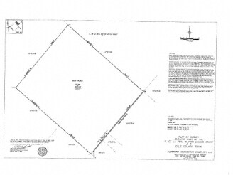
3 R PENA 10.1 ACRES
Farms
ELLIS
B and X Area of moderate flood hazard, usually the area between the limits of the 100-year and 500-year floods.
Texas
2024
10.10 AC
2025
Ellis County
060105
Dallas/Ft Worth
6,174 SF
Dallas-Fort Worth-Arlington, TX
NEARBY LISTINGS FOR SALE OR LEASE
DEMOGRAPHICS near 281 Bobs Run Rd
1 mile
3 mile
5 mile
2025 Total Population
128
3,841
14,220
2030 Population
147
4,470
16,630
Pop Growth 2025-2030
+ 14.84%
+ 16.38%
+ 16.95%
Average Age
41
38
37
2025 Total Households
44
1,277
4,622
HH Growth 2025-2030
+ 13.64%
+ 16.44%
+ 17.07%
Median Household Inc
$94,999
$78,628
$73,701
Avg Household Size
2.90
3.00
3.10
2025 Avg HH Vehicles
3.00
2.00
2.00
Median Home Value
$420,000
$221,014
$236,131
Median Year Built
1998
1996
1995
Nearby Places
Map Layers
Map Styles
 Street
 Aerial
Transit
 Traffic
 Biking
Places
Listings with unknown addresses are not visible on the map
- Restaurants
- Banks
- Shops
- Fitness
- Groceries
PUBLIC TRANSPORTATION
AIRPORT
Dallas Love Field
Drive
Walk
Distance
Dallas Love Field
43 min
30.2 mi
Freight Ports
Port of Shreveport
Drive
Walk
Distance
Port of Shreveport
223 min
206.2 mi
SALE & LEASE HISTORY
LISTING DATE
SALE/LEASE

Mar 03, 2017
For Sale
Mar 03, 2017
For Sale
Nearby Properties
Address
Land Use
TOTAL SIZE
Lot Size
Zoning
Address
Land Use
TOTAL SIZE
Lot Size
Zoning
37,348 SF
10.08 AC
Address
Land Use
TOTAL SIZE
Lot Size
Zoning
116,081 SF
19.03 AC
Address
Land Use
TOTAL SIZE
Lot Size
Zoning
49,320 SF
25.10 AC
Address
Land Use
TOTAL SIZE
Lot Size
Zoning
15,000 SF
133.63 AC
Address
Land Use
TOTAL SIZE
Lot Size
Zoning
4,820.86 AC
Address
Land Use
TOTAL SIZE
Lot Size
Zoning
26,779 SF
11.29 AC
Address
Land Use
TOTAL SIZE
Lot Size
Zoning
8,544 SF
1.65 AC
Address
Land Use
TOTAL SIZE
Lot Size
Zoning
44,644 SF
1.87 AC
Address
Land Use
TOTAL SIZE
Lot Size
Zoning
93,525 SF
5.47 AC
Address
Land Use
TOTAL SIZE
Lot Size
Zoning
49.48 AC
Address
Land Use
TOTAL SIZE
Lot Size
Zoning
4,256 SF
242.63 AC
Address
Land Use
TOTAL SIZE
Lot Size
Zoning
26.34 AC
Address
Land Use
TOTAL SIZE
Lot Size
Zoning
14,856 SF
1.38 AC
Address
Land Use
TOTAL SIZE
Lot Size
Zoning
18,364 SF
37.66 AC
Address
Land Use
TOTAL SIZE
Lot Size
Zoning
4,307 SF
3.14 AC
Address
Land Use
TOTAL SIZE
Lot Size
Zoning
6,244 SF
19.79 AC
Address
Land Use
TOTAL SIZE
Lot Size
Zoning
4,793 SF
5.94 AC
Address
Land Use
TOTAL SIZE
Lot Size
Zoning
12,656 SF
3 AC
Address
Land Use
TOTAL SIZE
Lot Size
Zoning
81,664 SF
4.96 AC
Address
Land Use
TOTAL SIZE
Lot Size
Zoning
6,400 SF
5.16 AC
Address
Land Use
TOTAL SIZE
Lot Size
Zoning
31.44 AC
Address
Land Use
TOTAL SIZE
Lot Size
Zoning
6,380 SF
5.60 AC
Address
Land Use
TOTAL SIZE
Lot Size
Zoning
10,336 SF
0.99 AC
Address
Land Use
TOTAL SIZE
Lot Size
Zoning
9,674 SF
25 AC
Address
Land Use
TOTAL SIZE
Lot Size
Zoning
2,798 SF
35.84 AC
Address
Land Use
TOTAL SIZE
Lot Size
Zoning
6,355 SF
1.14 AC
Address
Land Use
TOTAL SIZE
Lot Size
Zoning
15.94 AC
Address
Land Use
TOTAL SIZE
Lot Size
Zoning
728 SF
8.73 AC
Address
Land Use
TOTAL SIZE
Lot Size
Zoning
8,625 SF
0.83 AC
The World's #1 Commercial Real Estate Marketplace
Connect with us
© 2026 CoStar Group
The information above has been obtained from sources believed reliable. While we do not doubt its accuracy we have not verified it and make no guarantee, warranty or representation about it. It is your responsibility to independently confirm its accuracy and completeness. Any projections, opinions, assumptions, or estimates used are for example only and do not represent the current or future performance of the property. The value of this transaction to you depends on tax and other factors which should be evaluated by your tax, financial, and legal advisors. You and your advisors should conduct a careful, independent investigation of the property to determine to your satisfaction the suitability of the property for your needs.