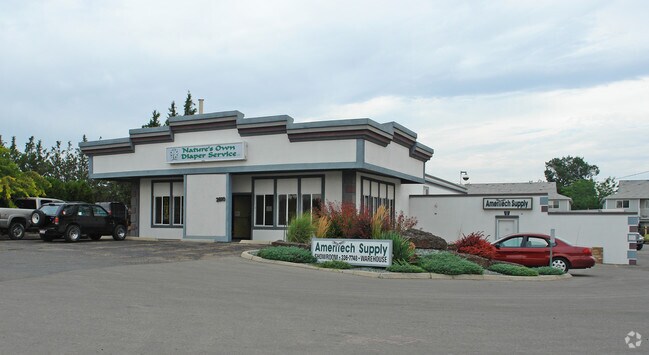
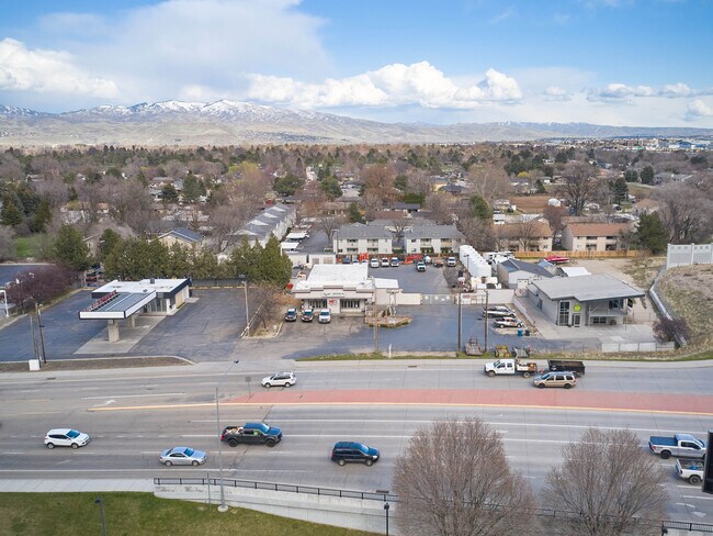
Property Record
2810 S Orchard St, Boise, ID 83705

Property Detail
2810 S Orchard St
R1580361080
PAR #1080 OF LOTS 2/3 BLK 2 COUNTRY CLUB SUB 12 #1075-B
Commercialbuilding
Ada
C-3D
Idaho
B and X Area of moderate flood hazard, usually the area between the limits of the 100-year and 500-year floods.
2
2025
1.48 AC
2025
Central Boise
001800
Boise City/Nampa
7,736 SF
Boise City, ID
NEARBY LISTINGS FOR SALE OR LEASE
DEMOGRAPHICS near 2810 S Orchard St
1 mile
3 mile
5 mile
2025 Total Population
7,092
75,752
209,600
2030 Population
7,350
79,470
219,598
Pop Growth 2025-2030
+ 3.64%
+ 4.91%
+ 4.77%
Average Age
40
38
40
2025 Total Households
3,029
31,803
87,908
HH Growth 2025-2030
+ 4.09%
+ 5.45%
+ 5.27%
Median Household Inc
$67,989
$67,159
$79,263
Avg Household Size
2.20
2.20
2.30
2025 Avg HH Vehicles
2.00
2.00
2.00
Median Home Value
$458,420
$453,520
$482,836
Median Year Built
1974
1981
1987
Nearby Places
Map Layers
Map Styles
 Street
 Aerial
Transit
 Traffic
 Biking
Places
Listings with unknown addresses are not visible on the map
- Restaurants
- Banks
- Shops
- Fitness
- Groceries
PUBLIC TRANSPORTATION
AIRPORT
Boise Air Trml/Gowen Field
Drive
Walk
Distance
Boise Air Trml/Gowen Field
19 min
6.0 mi
Freight Ports
Port of Portland
Drive
Walk
Distance
Port of Portland
475 min
430.9 mi
SALE & LEASE HISTORY
LISTING DATE
SALE/LEASE

Jun 19, 2023
For Lease
Apr 25, 2023
For Sale
Nearby Properties
Address
Land Use
TOTAL SIZE
Lot Size
Zoning
Address
Land Use
TOTAL SIZE
Lot Size
Zoning
646,787 SF
27.37 AC
C-2D
Address
Land Use
TOTAL SIZE
Lot Size
Zoning
279,694 SF
2.09 AC
R-ODD/DA
Address
Land Use
TOTAL SIZE
Lot Size
Zoning
258,747 SF
3.30 AC
R-OD/DA
Address
Land Use
TOTAL SIZE
Lot Size
Zoning
334,334 SF
3.21 AC
R-OD
Address
Land Use
TOTAL SIZE
Lot Size
Zoning
203,503 SF
7.93 AC
L-OD
Address
Land Use
TOTAL SIZE
Lot Size
Zoning
225,032 SF
12.75 AC
R-3D
Address
Land Use
TOTAL SIZE
Lot Size
Zoning
319,052 SF
24.33 AC
C-2D
Address
Land Use
TOTAL SIZE
Lot Size
Zoning
211,039 SF
12.21 AC
C-3D
Address
Land Use
TOTAL SIZE
Lot Size
Zoning
247,435 SF
2.90 AC
C-2DC
Address
Land Use
TOTAL SIZE
Lot Size
Zoning
246,944 SF
2.29 AC
R-OD
Address
Land Use
TOTAL SIZE
Lot Size
Zoning
125,305 SF
1.08 AC
R-OD
Address
Land Use
TOTAL SIZE
Lot Size
Zoning
290,239 SF
4.73 AC
ZC-243
Address
Land Use
TOTAL SIZE
Lot Size
Zoning
161,421 SF
10.05 AC
R-1C
Address
Land Use
TOTAL SIZE
Lot Size
Zoning
173,766 SF
9.53 AC
L-OD
Address
Land Use
TOTAL SIZE
Lot Size
Zoning
91,740 SF
3.63 AC
C-4D
Address
Land Use
TOTAL SIZE
Lot Size
Zoning
164,141 SF
24.32 AC
M-1D
Address
Land Use
TOTAL SIZE
Lot Size
Zoning
93,112 SF
2.73 AC
C-2D
Address
Land Use
TOTAL SIZE
Lot Size
Zoning
218,215 SF
17.11 AC
C-4D
Address
Land Use
TOTAL SIZE
Lot Size
Zoning
70,705 SF
0.63 AC
H-SD
Address
Land Use
TOTAL SIZE
Lot Size
Zoning
130,560 SF
7.72 AC
R-2
Address
Land Use
TOTAL SIZE
Lot Size
Zoning
49,821 SF
5.45 AC
C-1D/DA
Address
Land Use
TOTAL SIZE
Lot Size
Zoning
196,326 SF
M-1
Address
Land Use
TOTAL SIZE
Lot Size
Zoning
135,679 SF
3.11 AC
R-2D
Address
Land Use
TOTAL SIZE
Lot Size
Zoning
72,837 SF
2.42 AC
C-2DC
Address
Land Use
TOTAL SIZE
Lot Size
Zoning
131,328 SF
8.63 AC
R-3D
Address
Land Use
TOTAL SIZE
Lot Size
Zoning
83,700 SF
6.48 AC
R-2
Address
Land Use
TOTAL SIZE
Lot Size
Zoning
224,614 SF
9.89 AC
C-2D
Address
Land Use
TOTAL SIZE
Lot Size
Zoning
116,821 SF
6.19 AC
R-3D
Address
Land Use
TOTAL SIZE
Lot Size
Zoning
135,400 SF
1.29 AC
R-OD
Address
Land Use
TOTAL SIZE
Lot Size
Zoning
174,290 SF
14.12 AC
C-3D
The World's #1 Commercial Real Estate Marketplace
Connect with us
© 2026 CoStar Group
The information above has been obtained from sources believed reliable. While we do not doubt its accuracy we have not verified it and make no guarantee, warranty or representation about it. It is your responsibility to independently confirm its accuracy and completeness. Any projections, opinions, assumptions, or estimates used are for example only and do not represent the current or future performance of the property. The value of this transaction to you depends on tax and other factors which should be evaluated by your tax, financial, and legal advisors. You and your advisors should conduct a careful, independent investigation of the property to determine to your satisfaction the suitability of the property for your needs.