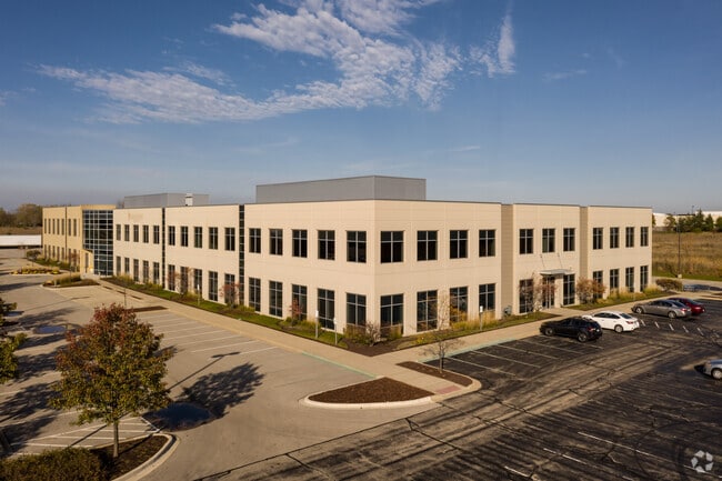
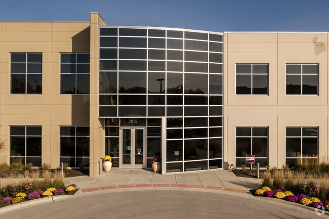
Property Record
2815 Forbs Ave, Hoffman Estates, IL 60192


Current Lease Availabilities
Property Detail
2815 Forbs Ave
01-33-300-008-0000
Cook
Storebuilding
Illinois
B and X Area of moderate flood hazard, usually the area between the limits of the 100-year and 500-year floods.
9.01 AC
2023
Schaumburg Area
2025
Chicago
804204
Chicago-Naperville-Elgin, IL-IN
98,728 SF
NEARBY LISTINGS FOR SALE OR LEASE
DEMOGRAPHICS near 2815 Forbs Ave
1 mile
3 mile
5 mile
2025 Total Population
1,104
20,120
169,702
2030 Population
1,117
20,273
170,373
Pop Growth 2025-2030
+ 1.18%
+ 0.76%
+ 0.40%
Average Age
43
43
40
2025 Total Households
345
6,933
57,663
HH Growth 2025-2030
+ 1.16%
+ 0.66%
+ 0.27%
Median Household Inc
$191,405
$132,682
$94,160
Avg Household Size
3.20
2.80
2.80
2025 Avg HH Vehicles
2.00
2.00
2.00
Median Home Value
$688,461
$411,011
$286,481
Median Year Built
1999
1994
1978
Nearby Places
Map Layers
Map Styles
 Street
 Aerial
Layers
 Traffic
 Biking
Places
Listings with unknown addresses are not visible on the map
- Restaurants
- Banks
- Shops
- Fitness
- Groceries
PUBLIC TRANSPORTATION
COMMUTER RAIL
Elgin Station (Milwaukee District West Line - Northeast Illinois Regional Commuter Railroad (Metra))
Drive
Walk
Distance
Elgin Station (Milwaukee District West Line - Northeast Illinois Regional Commuter Railroad (Metra))
14 min
7.3 mi
National Street Station (Milwaukee District West Line - Northeast Illinois Regional Commuter Railroad (Metra))
Drive
Walk
Distance
National Street Station (Milwaukee District West Line - Northeast Illinois Regional Commuter Railroad (Metra))
16 min
8.0 mi
AIRPORT
Chicago O'Hare International
Drive
Walk
Distance
Chicago O'Hare International
29 min
22.0 mi
Freight Ports
Port Milwaukee
Drive
Walk
Distance
Port Milwaukee
104 min
77.0 mi
Nearby Properties
Address
Land Use
TOTAL SIZE
Lot Size
Zoning
Address
Land Use
TOTAL SIZE
Lot Size
Zoning
51,091 SF
3.52 AC
Address
Land Use
TOTAL SIZE
Lot Size
Zoning
258,989 SF
27.84 AC
Address
Land Use
TOTAL SIZE
Lot Size
Zoning
Address
Land Use
TOTAL SIZE
Lot Size
Zoning
Address
Land Use
TOTAL SIZE
Lot Size
Zoning
110,940 SF
25.28 AC
Address
Land Use
TOTAL SIZE
Lot Size
Zoning
71,725 SF
49.30 AC
Address
Land Use
TOTAL SIZE
Lot Size
Zoning
Address
Land Use
TOTAL SIZE
Lot Size
Zoning
201,539 SF
15.66 AC
Address
Land Use
TOTAL SIZE
Lot Size
Zoning
240,352 SF
9.65 AC
Address
Land Use
TOTAL SIZE
Lot Size
Zoning
Address
Land Use
TOTAL SIZE
Lot Size
Zoning
227,125 SF
2.79 AC
Address
Land Use
TOTAL SIZE
Lot Size
Zoning
1.30 AC
Address
Land Use
TOTAL SIZE
Lot Size
Zoning
7,200 SF
16.86 AC
Address
Land Use
TOTAL SIZE
Lot Size
Zoning
2,415,708 SF
124.06 AC
Address
Land Use
TOTAL SIZE
Lot Size
Zoning
123,875 SF
10.91 AC
Address
Land Use
TOTAL SIZE
Lot Size
Zoning
272,944 SF
4.74 AC
Address
Land Use
TOTAL SIZE
Lot Size
Zoning
109,316 SF
4.73 AC
Address
Land Use
TOTAL SIZE
Lot Size
Zoning
161,280 SF
5.50 AC
Address
Land Use
TOTAL SIZE
Lot Size
Zoning
44.10 AC
Address
Land Use
TOTAL SIZE
Lot Size
Zoning
90,640 SF
18.99 AC
Address
Land Use
TOTAL SIZE
Lot Size
Zoning
1,352 SF
1.27 AC
Address
Land Use
TOTAL SIZE
Lot Size
Zoning
69,221 SF
3.22 AC
Address
Land Use
TOTAL SIZE
Lot Size
Zoning
49,476 SF
4.70 AC
Address
Land Use
TOTAL SIZE
Lot Size
Zoning
108,115 SF
3.74 AC
Address
Land Use
TOTAL SIZE
Lot Size
Zoning
11,200 SF
50.39 AC
Address
Land Use
TOTAL SIZE
Lot Size
Zoning
75,970 SF
5 AC
Address
Land Use
TOTAL SIZE
Lot Size
Zoning
62,840 SF
9.25 AC
Address
Land Use
TOTAL SIZE
Lot Size
Zoning
Address
Land Use
TOTAL SIZE
Lot Size
Zoning
121,751 SF
9.02 AC
The World's #1 Commercial Real Estate Marketplace
Connect with us
© 2026 CoStar Group
The information above has been obtained from sources believed reliable. While we do not doubt its accuracy we have not verified it and make no guarantee, warranty or representation about it. It is your responsibility to independently confirm its accuracy and completeness. Any projections, opinions, assumptions, or estimates used are for example only and do not represent the current or future performance of the property. The value of this transaction to you depends on tax and other factors which should be evaluated by your tax, financial, and legal advisors. You and your advisors should conduct a careful, independent investigation of the property to determine to your satisfaction the suitability of the property for your needs.