Property Record
2820 46Th Ave, Rock Island, IL 61201
NEARBY LISTINGS FOR SALE OR LEASE
-
-
View all Rock Island listings for sale on LoopNet.com
Property Detail
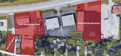
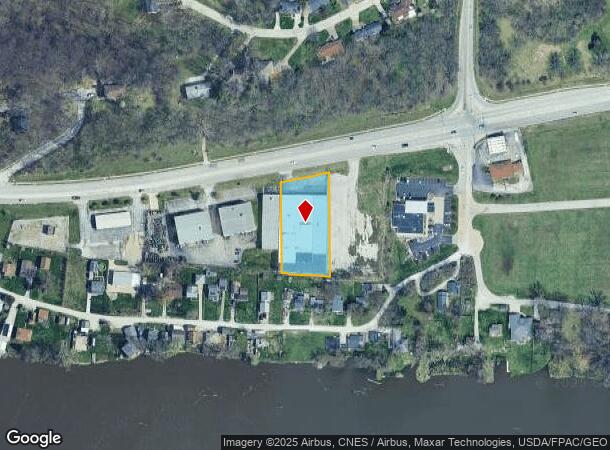
2820 46Th Ave
Davenport-Moline-Rock Island, IA-IL
Edgewater
16-13-301-017
E 100 FT OF OL D & W 40 FT OF OL E EDGEWATER PLACE EXC N PT R-O-W
Commercialnec
Rock Island
AE
Illinois
19163C0500F
o.l. x
2024
0.92 AC
2024
Greater Rock Island
023100
Davenport/Moline/Rock Island
39,426 SF
DEMOGRAPHICS near 2820 46Th Ave
1 Mile
3 Mile
5 Mile
2024 Total Population
3,385
50,908
104,889
2029 Population
3,282
49,825
103,261
Pop Growth 2024-2029
(3.04%)
(2.13%)
(1.55%)
Average Age
45
40
40
2024 Total Households
1,530
21,360
44,668
HH Growth 2024-2029
(3.07%)
(2.22%)
(1.54%)
Median Household Inc
$66,206
$54,334
$50,428
Avg Household Size
2.20
2.20
2.20
2024 Avg HH Vehicles
2.00
2.00
2.00
Median Home Value
$142,669
$116,073
$117,258
Median Year Built
1957
1951
1950
Nearby Places
Map Layers
Map Styles
 Street
 Aerial
- Restaurants
- Banks
- Shops
- Fitness
- Groceries
PUBLIC TRANSPORTATION
AIRPORT
Quad Cities International
DRIVE
WALK
Distance
Quad Cities International
12 min
4.7 mi
Freight Ports
Port Milwaukee
DRIVE
WALK
Distance
Port Milwaukee
241 min
209.8 mi
SALE & LEASE HISTORY
LISTING DATE
SALE/LEASE

Mar 01, 2018
For Sale
Nearby Properties
Address
Land Use
TOTAL SIZE
Lot Size
Zoning
Address
Land Use
TOTAL SIZE
Lot Size
Zoning
227,249 SF
38.78 AC
RI
Address
Land Use
TOTAL SIZE
Lot Size
Zoning
2,595,576 SF
185.35 AC
MIL
Address
Land Use
TOTAL SIZE
Lot Size
Zoning
7.86 AC
Address
Land Use
TOTAL SIZE
Lot Size
Zoning
44,839 SF
10.86 AC
RI
Address
Land Use
TOTAL SIZE
Lot Size
Zoning
17.43 AC
RI
Address
Land Use
TOTAL SIZE
Lot Size
Zoning
20.35 AC
MIL
Address
Land Use
TOTAL SIZE
Lot Size
Zoning
47,060 SF
3.23 AC
MOL
Address
Land Use
TOTAL SIZE
Lot Size
Zoning
935,332 SF
41.69 AC
MIL
Address
Land Use
TOTAL SIZE
Lot Size
Zoning
66.76 AC
MOL
Address
Land Use
TOTAL SIZE
Lot Size
Zoning
73,065 SF
12.67 AC
I2
Address
Land Use
TOTAL SIZE
Lot Size
Zoning
116,800 SF
9.30 AC
MOL
Address
Land Use
TOTAL SIZE
Lot Size
Zoning
14.01 AC
Address
Land Use
TOTAL SIZE
Lot Size
Zoning
79,785 SF
5.61 AC
MIL
Address
Land Use
TOTAL SIZE
Lot Size
Zoning
96,352 SF
9.77 AC
MOL
Address
Land Use
TOTAL SIZE
Lot Size
Zoning
75,651 SF
7.29 AC
RI
Address
Land Use
TOTAL SIZE
Lot Size
Zoning
53,897 SF
3.13 AC
MOL
Address
Land Use
TOTAL SIZE
Lot Size
Zoning
33.09 AC
Address
Land Use
TOTAL SIZE
Lot Size
Zoning
3 AC
MOL
Address
Land Use
TOTAL SIZE
Lot Size
Zoning
231,974 SF
7.64 AC
RI
Address
Land Use
TOTAL SIZE
Lot Size
Zoning
81,500 SF
6.95 AC
MOL
Address
Land Use
TOTAL SIZE
Lot Size
Zoning
4.40 AC
Address
Land Use
TOTAL SIZE
Lot Size
Zoning
24,985 SF
3.36 AC
RI
Address
Land Use
TOTAL SIZE
Lot Size
Zoning
63,972 SF
2.66 AC
MOL
Address
Land Use
TOTAL SIZE
Lot Size
Zoning
20,685 SF
2.02 AC
RI
Address
Land Use
TOTAL SIZE
Lot Size
Zoning
7.02 AC
MIL
Address
Land Use
TOTAL SIZE
Lot Size
Zoning
110,400 SF
2.35 AC
RI
Address
Land Use
TOTAL SIZE
Lot Size
Zoning
111,114 SF
8.38 AC
MOL
Address
Land Use
TOTAL SIZE
Lot Size
Zoning
170,666 SF
4.79 AC
MIL
Address
Land Use
TOTAL SIZE
Lot Size
Zoning
49,877 SF
2.39 AC
RI
Address
Land Use
TOTAL SIZE
Lot Size
Zoning
62,229 SF
6.94 AC
MIL
The World's #1 Commercial Real Estate Marketplace
Connect with us
© 2025 CoStar Group
The information above has been obtained from sources believed reliable. While we do not doubt its accuracy we have not verified it and make no guarantee, warranty or representation about it. It is your responsibility to independently confirm its accuracy and completeness. Any projections, opinions, assumptions, or estimates used are for example only and do not represent the current or future performance of the property. The value of this transaction to you depends on tax and other factors which should be evaluated by your tax, financial, and legal advisors. You and your advisors should conduct a careful, independent investigation of the property to determine to your satisfaction the suitability of the property for your needs.