Property Record
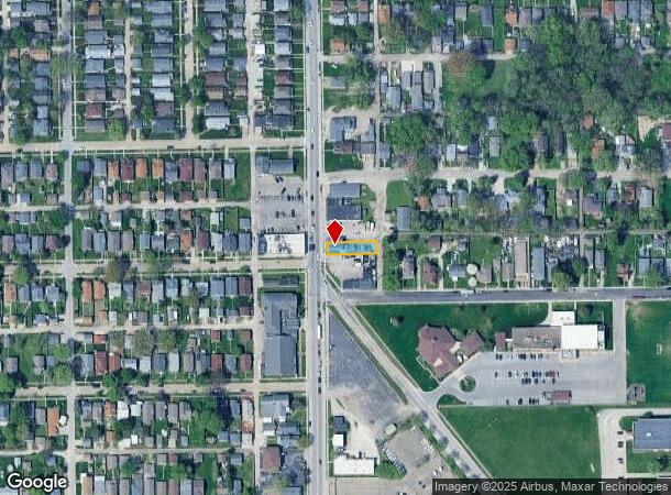
2849 Shelby St, Indianapolis, IN 46203


NEARBY LISTINGS FOR SALE OR LEASE
Property Detail
2849 Shelby St
Indianapolis-Carmel-Greenwood, IN
Mc Cord & Wheatleys S East Add
49-10-19-136-011.000-101
MC CORD & WHEATLEYS S EAST ADD L4
Restaurantbuilding
Marion
X
Indiana
18097C0232F
4
2023
0.10 AC
2024
Edgewood/South County
357900
Indianapolis
2,448 SF
DEMOGRAPHICS near 2849 Shelby St
1 Mile
3 Mile
5 Mile
2024 Total Population
14,713
85,334
237,227
2029 Population
14,721
85,433
237,927
Pop Growth 2024-2029
+ 0.05%
+ 0.12%
+ 0.30%
Average Age
36
36
36
2024 Total Households
5,746
34,420
99,482
HH Growth 2024-2029
(0.09%)
+ 0.15%
+ 0.35%
Median Household Inc
$43,796
$52,415
$56,063
Avg Household Size
2.40
2.30
2.30
2024 Avg HH Vehicles
2.00
2.00
2.00
Median Home Value
$120,492
$154,384
$169,031
Median Year Built
1951
1957
1958
Nearby Places
Map Layers
Map Styles
 Street
 Aerial
- Restaurants
- Banks
- Shops
- Fitness
- Groceries
PUBLIC TRANSPORTATION
COMMUTER RAIL
DRIVE
WALK
Distance
6 min
3.7 mi
AIRPORT
Indianapolis International
DRIVE
WALK
Distance
Indianapolis International
26 min
13.9 mi
Nearby Properties
Address
Land Use
TOTAL SIZE
Lot Size
Zoning
Address
Land Use
TOTAL SIZE
Lot Size
Zoning
33.61 AC
ZO01
Address
Land Use
TOTAL SIZE
Lot Size
Zoning
1,381,492 SF
15.08 AC
ZO01
Address
Land Use
TOTAL SIZE
Lot Size
Zoning
5.59 AC
ZO01
Address
Land Use
TOTAL SIZE
Lot Size
Zoning
41.83 AC
ZO01
Address
Land Use
TOTAL SIZE
Lot Size
Zoning
500,908 SF
10.36 AC
ZO01
Address
Land Use
TOTAL SIZE
Lot Size
Zoning
19,896 SF
32.59 AC
ZO01
Address
Land Use
TOTAL SIZE
Lot Size
Zoning
12.63 AC
ZO01
Address
Land Use
TOTAL SIZE
Lot Size
Zoning
6,000 SF
0.47 AC
ZO01
Address
Land Use
TOTAL SIZE
Lot Size
Zoning
217,895 SF
3.43 AC
ZO01
Address
Land Use
TOTAL SIZE
Lot Size
Zoning
45,971 SF
0.78 AC
Address
Land Use
TOTAL SIZE
Lot Size
Zoning
12,900 SF
2 AC
ZO01
Address
Land Use
TOTAL SIZE
Lot Size
Zoning
414,000 SF
1.64 AC
ZO01
Address
Land Use
TOTAL SIZE
Lot Size
Zoning
111,238 SF
0.06 AC
ZO01
Address
Land Use
TOTAL SIZE
Lot Size
Zoning
31,413 SF
3.91 AC
ZO01
Address
Land Use
TOTAL SIZE
Lot Size
Zoning
67,783 SF
44.97 AC
ZO01
Address
Land Use
TOTAL SIZE
Lot Size
Zoning
3.32 AC
ZO01
Address
Land Use
TOTAL SIZE
Lot Size
Zoning
194,488 SF
2.02 AC
ZO01
Address
Land Use
TOTAL SIZE
Lot Size
Zoning
531,996 SF
9.09 AC
ZO01
Address
Land Use
TOTAL SIZE
Lot Size
Zoning
1,281 SF
2.44 AC
ZO01
Address
Land Use
TOTAL SIZE
Lot Size
Zoning
25,918 SF
2.69 AC
ZO01
Address
Land Use
TOTAL SIZE
Lot Size
Zoning
19,927 SF
28.82 AC
ZO01
Address
Land Use
TOTAL SIZE
Lot Size
Zoning
405,888 SF
19.56 AC
ZO01
Address
Land Use
TOTAL SIZE
Lot Size
Zoning
51,801 SF
0.06 AC
ZO01
Address
Land Use
TOTAL SIZE
Lot Size
Zoning
121,309 SF
1.37 AC
ZO01
Address
Land Use
TOTAL SIZE
Lot Size
Zoning
197,386 SF
2.02 AC
Address
Land Use
TOTAL SIZE
Lot Size
Zoning
94,971 SF
5.04 AC
ZO01
Address
Land Use
TOTAL SIZE
Lot Size
Zoning
80,348 SF
2.95 AC
ZO01
Address
Land Use
TOTAL SIZE
Lot Size
Zoning
18,232 SF
4.16 AC
ZO01
Address
Land Use
TOTAL SIZE
Lot Size
Zoning
2.12 AC
ZO01
Address
Land Use
TOTAL SIZE
Lot Size
Zoning
1,812 SF
11.08 AC
ZO01
The World's #1 Commercial Real Estate Marketplace
Connect with us
© 2026 CoStar Group
The information above has been obtained from sources believed reliable. While we do not doubt its accuracy we have not verified it and make no guarantee, warranty or representation about it. It is your responsibility to independently confirm its accuracy and completeness. Any projections, opinions, assumptions, or estimates used are for example only and do not represent the current or future performance of the property. The value of this transaction to you depends on tax and other factors which should be evaluated by your tax, financial, and legal advisors. You and your advisors should conduct a careful, independent investigation of the property to determine to your satisfaction the suitability of the property for your needs.