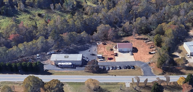
Property Record
285 Gap Creek Rd, Duncan, SC 29334


Property Detail
285 Gap Creek Rd
5-14-00-055.00
W SIDE GAP CREEK RD & N SIDE CSX RAILROAD
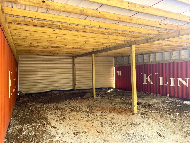
Commercialnec
Spartanburg
B and X Area of moderate flood hazard, usually the area between the limits of the 100-year and 500-year floods.
South Carolina
2024
2.01 AC
2025
Upper Spartanburg Cty
023101
Greenville/Spartanburg
3,574 SF
Spartanburg, SC
NEARBY LISTINGS FOR SALE OR LEASE
DEMOGRAPHICS near 285 Gap Creek Rd
1 mile
3 mile
5 mile
2025 Total Population
2,216
22,774
62,842
2030 Population
2,476
25,417
69,732
Pop Growth 2025-2030
+ 11.73%
+ 11.61%
+ 10.96%
Average Age
37
38
38
2025 Total Households
878
8,541
24,162
HH Growth 2025-2030
+ 11.73%
+ 11.65%
+ 10.98%
Median Household Inc
$49,727
$62,481
$63,742
Avg Household Size
2.50
2.60
2.60
2025 Avg HH Vehicles
2.00
2.00
2.00
Median Home Value
$188,653
$243,195
$247,845
Median Year Built
1993
1995
1993
Nearby Places
Map Layers
Map Styles
 Street
 Aerial
Layers
 Traffic
 Biking
Places
Listings with unknown addresses are not visible on the map
- Restaurants
- Banks
- Shops
- Fitness
- Groceries
PUBLIC TRANSPORTATION
AIRPORT
Greenville Spartanburg International
Drive
Walk
Distance
Greenville Spartanburg International
11 min
6.6 mi
SALE & LEASE HISTORY
LISTING DATE
SALE/LEASE

Feb 04, 2025
For Sale
Nearby Properties
Address
Land Use
TOTAL SIZE
Lot Size
Zoning
Address
Land Use
TOTAL SIZE
Lot Size
Zoning
227,627 SF
21.37 AC
Address
Land Use
TOTAL SIZE
Lot Size
Zoning
241,696 SF
15.12 AC
Address
Land Use
TOTAL SIZE
Lot Size
Zoning
1,320,000 SF
130.98 AC
Address
Land Use
TOTAL SIZE
Lot Size
Zoning
Address
Land Use
TOTAL SIZE
Lot Size
Zoning
2,528 SF
14.74 AC
Address
Land Use
TOTAL SIZE
Lot Size
Zoning
111.08 AC
Address
Land Use
TOTAL SIZE
Lot Size
Zoning
66.99 AC
Address
Land Use
TOTAL SIZE
Lot Size
Zoning
1,281 SF
41.23 AC
Address
Land Use
TOTAL SIZE
Lot Size
Zoning
710,705 SF
34.03 AC
Address
Land Use
TOTAL SIZE
Lot Size
Zoning
42.27 AC
Address
Land Use
TOTAL SIZE
Lot Size
Zoning
2,497 SF
12.36 AC
Address
Land Use
TOTAL SIZE
Lot Size
Zoning
26,472 SF
3.90 AC
Address
Land Use
TOTAL SIZE
Lot Size
Zoning
1,111,000 SF
Address
Land Use
TOTAL SIZE
Lot Size
Zoning
2,088 SF
40.12 AC
Address
Land Use
TOTAL SIZE
Lot Size
Zoning
736,169 SF
24.99 AC
Address
Land Use
TOTAL SIZE
Lot Size
Zoning
15.17 AC
Address
Land Use
TOTAL SIZE
Lot Size
Zoning
33.34 AC
Address
Land Use
TOTAL SIZE
Lot Size
Zoning
33.40 AC
Address
Land Use
TOTAL SIZE
Lot Size
Zoning
1,798 SF
9.63 AC
Address
Land Use
TOTAL SIZE
Lot Size
Zoning
28.26 AC
Address
Land Use
TOTAL SIZE
Lot Size
Zoning
67,938 SF
8.02 AC
Address
Land Use
TOTAL SIZE
Lot Size
Zoning
274,050 SF
Address
Land Use
TOTAL SIZE
Lot Size
Zoning
234,220 SF
Address
Land Use
TOTAL SIZE
Lot Size
Zoning
1,176 SF
20.13 AC
Address
Land Use
TOTAL SIZE
Lot Size
Zoning
107.32 AC
Address
Land Use
TOTAL SIZE
Lot Size
Zoning
217,788 SF
23.50 AC
Address
Land Use
TOTAL SIZE
Lot Size
Zoning
297,700 SF
23.64 AC
Address
Land Use
TOTAL SIZE
Lot Size
Zoning
20,621 SF
8.01 AC
Address
Land Use
TOTAL SIZE
Lot Size
Zoning
7,002 SF
6.66 AC
Address
Land Use
TOTAL SIZE
Lot Size
Zoning
3,105 SF
6.12 AC
The World's #1 Commercial Real Estate Marketplace
Connect with us
© 2026 CoStar Group
The information above has been obtained from sources believed reliable. While we do not doubt its accuracy we have not verified it and make no guarantee, warranty or representation about it. It is your responsibility to independently confirm its accuracy and completeness. Any projections, opinions, assumptions, or estimates used are for example only and do not represent the current or future performance of the property. The value of this transaction to you depends on tax and other factors which should be evaluated by your tax, financial, and legal advisors. You and your advisors should conduct a careful, independent investigation of the property to determine to your satisfaction the suitability of the property for your needs.