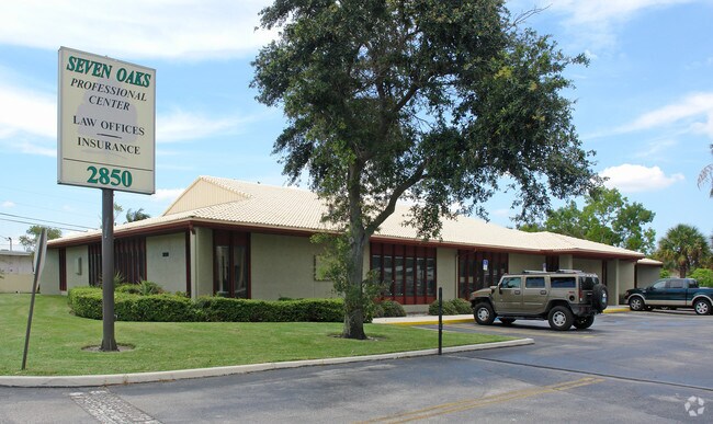
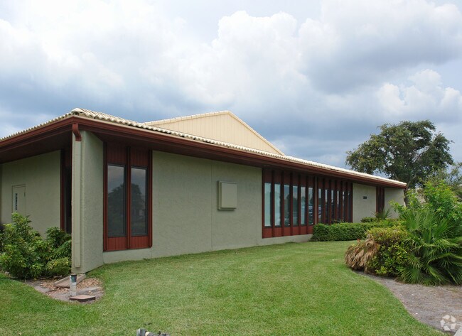
Property Record
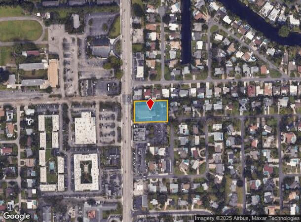
2850 N Andrews Ave, Wilton Manors, FL 33311

NEARBY LISTINGS FOR SALE OR LEASE
Property Detail
2850 N Andrews Ave
Fort Lauderdale-Pompano Beach-Deerfield Beach, FL
Wilton Manors Service
49-42-27-51-0010
WILTON MANORS SERVICE CENTER 125-21 B PARCEL A
Officebuilding
Broward
AE
Florida
12011C0367J
a
2024
0.82 AC
2025
Fort Lauderdale
050900
South Florida
9,010 SF
DEMOGRAPHICS near 2850 N Andrews Ave
1 Mile
3 Mile
5 Mile
2024 Total Population
20,181
174,008
416,610
2029 Population
20,327
175,802
422,900
Pop Growth 2024-2029
+ 0.72%
+ 1.03%
+ 1.51%
Average Age
45
43
43
2024 Total Households
9,585
78,823
182,018
HH Growth 2024-2029
+ 0.30%
+ 1.00%
+ 1.59%
Median Household Inc
$66,123
$63,796
$61,304
Avg Household Size
2.00
2.10
2.20
2024 Avg HH Vehicles
1.00
1.00
1.00
Median Home Value
$407,003
$417,411
$375,281
Median Year Built
1972
1974
1974
Nearby Places
Map Layers
Map Styles
 Street
 Aerial
- Restaurants
- Banks
- Shops
- Fitness
- Groceries
PUBLIC TRANSPORTATION
COMMUTER RAIL
Cypress Creek (Tri-County Commuter - South Florida Regional Transportation Authority (Tri-Rail))
DRIVE
WALK
Distance
Cypress Creek (Tri-County Commuter - South Florida Regional Transportation Authority (Tri-Rail))
7 min
2.9 mi
DRIVE
WALK
Distance
7 min
3.0 mi
AIRPORT
Fort Lauderdale/Hollywood International
DRIVE
WALK
Distance
Fort Lauderdale/Hollywood International
18 min
10.4 mi
Miami International
DRIVE
WALK
Distance
Miami International
55 min
35.6 mi
Freight Ports
Port Everglades
DRIVE
WALK
Distance
Port Everglades
12 min
5.6 mi
Nearby Properties
Address
Land Use
TOTAL SIZE
Lot Size
Zoning
Address
Land Use
TOTAL SIZE
Lot Size
Zoning
202,260 SF
443 AC
GAA
Address
Land Use
TOTAL SIZE
Lot Size
Zoning
725,898 SF
2.43 AC
RAC-CC
Address
Land Use
TOTAL SIZE
Lot Size
Zoning
730,297 SF
4.02 AC
B-1
Address
Land Use
TOTAL SIZE
Lot Size
Zoning
642,003 SF
1.55 AC
RAC-CC
Address
Land Use
TOTAL SIZE
Lot Size
Zoning
987,590 SF
1.38 AC
RAC-CC
Address
Land Use
TOTAL SIZE
Lot Size
Zoning
616,235 SF
1.91 AC
RAC-EMU
Address
Land Use
TOTAL SIZE
Lot Size
Zoning
606,213 SF
3.75 AC
RAC-UV
Address
Land Use
TOTAL SIZE
Lot Size
Zoning
383,964 SF
2.06 AC
RAC-EMU
Address
Land Use
TOTAL SIZE
Lot Size
Zoning
734,444 SF
5.26 AC
RAC-CC
Address
Land Use
TOTAL SIZE
Lot Size
Zoning
453,314 SF
2.01 AC
RAC-UV
Address
Land Use
TOTAL SIZE
Lot Size
Zoning
678,634 SF
0.36 AC
RAC-CC
Address
Land Use
TOTAL SIZE
Lot Size
Zoning
478,587 SF
1.36 AC
RAC-CC
Address
Land Use
TOTAL SIZE
Lot Size
Zoning
578,515 SF
1.36 AC
RAC-CC
Address
Land Use
TOTAL SIZE
Lot Size
Zoning
414,522 SF
5.76 AC
RAC-AS
Address
Land Use
TOTAL SIZE
Lot Size
Zoning
717,552 SF
3.01 AC
RAC-CC
Address
Land Use
TOTAL SIZE
Lot Size
Zoning
732,617 SF
2.60 AC
RAC-CC
Address
Land Use
TOTAL SIZE
Lot Size
Zoning
479,072 SF
2.02 AC
RAC-UV
Address
Land Use
TOTAL SIZE
Lot Size
Zoning
551,121 SF
3.35 AC
RAC-CC
Address
Land Use
TOTAL SIZE
Lot Size
Zoning
559,897 SF
2.04 AC
RAC-CC
Address
Land Use
TOTAL SIZE
Lot Size
Zoning
1,080,487 SF
27.58 AC
CF
Address
Land Use
TOTAL SIZE
Lot Size
Zoning
481,895 SF
1.86 AC
RAC-UV
Address
Land Use
TOTAL SIZE
Lot Size
Zoning
460,248 SF
2.26 AC
RAC-CC
Address
Land Use
TOTAL SIZE
Lot Size
Zoning
424,412 SF
2.39 AC
RAC-UV
Address
Land Use
TOTAL SIZE
Lot Size
Zoning
354,759 SF
0.73 AC
RAC-CC
Address
Land Use
TOTAL SIZE
Lot Size
Zoning
302,696 SF
42.40 AC
Address
Land Use
TOTAL SIZE
Lot Size
Zoning
287,591 SF
9.23 AC
MR
Address
Land Use
TOTAL SIZE
Lot Size
Zoning
377,156 SF
1.71 AC
RAC-UV
Address
Land Use
TOTAL SIZE
Lot Size
Zoning
426,792 SF
0.97 AC
RAC-CC
Address
Land Use
TOTAL SIZE
Lot Size
Zoning
435,442 SF
0.96 AC
RAC-CC
Address
Land Use
TOTAL SIZE
Lot Size
Zoning
447,253 SF
0.81 AC
RAC-CC
The World's #1 Commercial Real Estate Marketplace
Connect with us
© 2025 CoStar Group
The information above has been obtained from sources believed reliable. While we do not doubt its accuracy we have not verified it and make no guarantee, warranty or representation about it. It is your responsibility to independently confirm its accuracy and completeness. Any projections, opinions, assumptions, or estimates used are for example only and do not represent the current or future performance of the property. The value of this transaction to you depends on tax and other factors which should be evaluated by your tax, financial, and legal advisors. You and your advisors should conduct a careful, independent investigation of the property to determine to your satisfaction the suitability of the property for your needs.