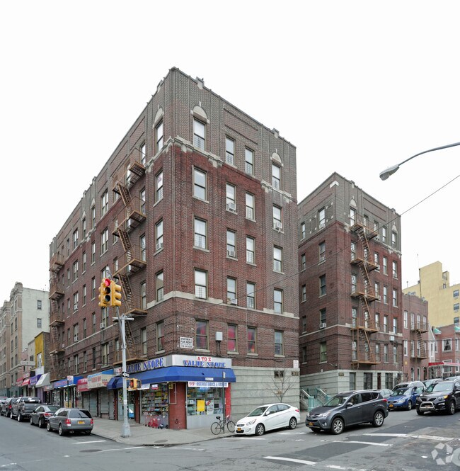
Property Record
2851 Valentine Ave, Bronx, NY 10458

NEARBY LISTINGS FOR SALE OR LEASE
Property Detail
2851 Valentine Ave
03305-0001
Bronx
Apartment
New York
X
1
3604970082F
0.28 AC
2024
Bedford Park
2025
Westchester/So Connecticut
040702
New York-Jersey City-White Plains, NY-NJ
53,000 SF
DEMOGRAPHICS near 2851 Valentine Ave
1 mile
3 mile
5 mile
2024 Total Population
186,806
1,043,570
1,892,041
2029 Population
176,290
967,848
1,763,776
Pop Growth 2024-2029
(5.63%)
(7.26%)
(6.78%)
Average Age
37
38
39
2024 Total Households
63,566
371,055
692,653
HH Growth 2024-2029
(6.35%)
(7.89%)
(7.25%)
Median Household Inc
$41,317
$46,122
$47,106
Avg Household Size
2.70
2.60
2.60
2024 Avg HH Vehicles
.00
.00
1.00
Median Home Value
$288,260
$522,994
$496,325
Median Year Built
1947
1949
1952
Nearby Places
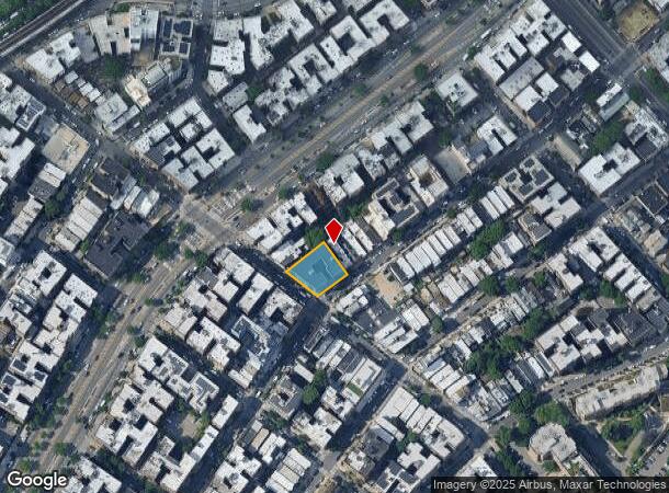
Map Layers
Map Styles
 Street
 Aerial
Transit
 Traffic
 Biking
Places
Listings with unknown addresses are not visible on the map
- Restaurants
- Banks
- Shops
- Fitness
- Groceries
PUBLIC TRANSPORTATION
TRANSIT/SUBWAY
Kingsbridge Road (B,D Line) (B - New York MTA Subway (The Subway), D - New York MTA Subway (The Subway))
Drive
Walk
Distance
Kingsbridge Road (B,D Line) (B - New York MTA Subway (The Subway), D - New York MTA Subway (The Subway))
1 min
6 min
0.3 mi
Bedford Park Boulevard (B - New York MTA Subway (The Subway), D - New York MTA Subway (The Subway))
Drive
Walk
Distance
Bedford Park Boulevard (B - New York MTA Subway (The Subway), D - New York MTA Subway (The Subway))
1 min
7 min
0.4 mi
Bedford Park Boulevard-Lehman College (4 - New York MTA Subway (The Subway))
Drive
Walk
Distance
Bedford Park Boulevard-Lehman College (4 - New York MTA Subway (The Subway))
2 min
7 min
0.4 mi
Kingsbridge Road (4 Line) (4 - New York MTA Subway (The Subway))
Drive
Walk
Distance
Kingsbridge Road (4 Line) (4 - New York MTA Subway (The Subway))
1 min
11 min
0.6 mi
Botanical Garden Station (Harlem Line - Metro-North Commuter Railroad Company (Metro-North))
Drive
Walk
Distance
Botanical Garden Station (Harlem Line - Metro-North Commuter Railroad Company (Metro-North))
3 min
12 min
0.6 mi
COMMUTER RAIL
Botanical Garden Station (Harlem Line - Metro-North Commuter Railroad Company (Metro-North))
Drive
Walk
Distance
Botanical Garden Station (Harlem Line - Metro-North Commuter Railroad Company (Metro-North))
3 min
13 min
0.7 mi
Fordham Station (Harlem Line - Metro-North Commuter Railroad Company (Metro-North), New Haven Line - Metro-North Commuter Railroad Company (Metro-North))
Drive
Walk
Distance
Fordham Station (Harlem Line - Metro-North Commuter Railroad Company (Metro-North), New Haven Line - Metro-North Commuter Railroad Company (Metro-North))
2 min
15 min
0.8 mi
AIRPORT
LaGuardia
Drive
Walk
Distance
LaGuardia
23 min
11.7 mi
John F Kennedy International
Drive
Walk
Distance
John F Kennedy International
32 min
20.7 mi
Westchester County
Drive
Walk
Distance
Westchester County
35 min
22.5 mi
Freight Ports
NY - Red Hook Container Terminal
Drive
Walk
Distance
NY - Red Hook Container Terminal
35 min
19.9 mi
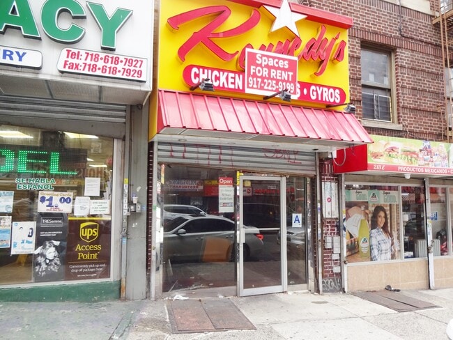
SALE & LEASE HISTORY
LISTING DATE
SALE/LEASE

May 18, 2017
For Lease
Jul 30, 2024
For Lease
Jul 19, 2021
For Lease
Aug 18, 2020
For Lease
Nearby Properties
Address
Land Use
TOTAL SIZE
Lot Size
Zoning
Address
Land Use
TOTAL SIZE
Lot Size
Zoning
1,299,700 SF
29.82 AC
R6
Address
Land Use
TOTAL SIZE
Lot Size
Zoning
550,000 SF
8.75 AC
M1-1
Address
Land Use
TOTAL SIZE
Lot Size
Zoning
1,743,584 SF
77.87 AC
R6
Address
Land Use
TOTAL SIZE
Lot Size
Zoning
1,427,393 SF
39.94 AC
R4
Address
Land Use
TOTAL SIZE
Lot Size
Zoning
481,172 SF
205.58 AC
PARK
Address
Land Use
TOTAL SIZE
Lot Size
Zoning
895,256 SF
8.32 AC
R7-1
Address
Land Use
TOTAL SIZE
Lot Size
Zoning
1,237,424 SF
21.25 AC
R6
Address
Land Use
TOTAL SIZE
Lot Size
Zoning
485,484 SF
39.63 AC
R5
Address
Land Use
TOTAL SIZE
Lot Size
Zoning
204,200 SF
1.68 AC
R7-1
Address
Land Use
TOTAL SIZE
Lot Size
Zoning
667,405 SF
5.51 AC
R6
Address
Land Use
TOTAL SIZE
Lot Size
Zoning
39 AC
P1
Address
Land Use
TOTAL SIZE
Lot Size
Zoning
390,750 SF
265 AC
PARK
Address
Land Use
TOTAL SIZE
Lot Size
Zoning
617,567 SF
3.19 AC
R7-1
Address
Land Use
TOTAL SIZE
Lot Size
Zoning
890,134 SF
8.79 AC
R7-2
Address
Land Use
TOTAL SIZE
Lot Size
Zoning
43.65 AC
PARK
Address
Land Use
TOTAL SIZE
Lot Size
Zoning
890,134 SF
8.79 AC
R7-2
Address
Land Use
TOTAL SIZE
Lot Size
Zoning
890,134 SF
8.79 AC
R7-2
Address
Land Use
TOTAL SIZE
Lot Size
Zoning
890,134 SF
8.79 AC
R7-2
Address
Land Use
TOTAL SIZE
Lot Size
Zoning
890,134 SF
0.54 AC
R7-2
Address
Land Use
TOTAL SIZE
Lot Size
Zoning
890,134 SF
8.79 AC
R7-2
Address
Land Use
TOTAL SIZE
Lot Size
Zoning
890,134 SF
0.54 AC
R7-2
Address
Land Use
TOTAL SIZE
Lot Size
Zoning
890,134 SF
8.79 AC
R7-2
Address
Land Use
TOTAL SIZE
Lot Size
Zoning
890,134 SF
8.79 AC
R7-2
Address
Land Use
TOTAL SIZE
Lot Size
Zoning
890,134 SF
0.54 AC
R7-2
Address
Land Use
TOTAL SIZE
Lot Size
Zoning
890,134 SF
8.79 AC
R7-2
Address
Land Use
TOTAL SIZE
Lot Size
Zoning
631,237 SF
30.93 AC
R5
Address
Land Use
TOTAL SIZE
Lot Size
Zoning
707,353 SF
29.34 AC
R6
Address
Land Use
TOTAL SIZE
Lot Size
Zoning
480,769 SF
1.21 AC
R8
Address
Land Use
TOTAL SIZE
Lot Size
Zoning
547,512 SF
3.93 AC
R7-2
Address
Land Use
TOTAL SIZE
Lot Size
Zoning
547,512 SF
3.93 AC
R7-2
The World's #1 Commercial Real Estate Marketplace
Connect with us
© 2026 CoStar Group
The information above has been obtained from sources believed reliable. While we do not doubt its accuracy we have not verified it and make no guarantee, warranty or representation about it. It is your responsibility to independently confirm its accuracy and completeness. Any projections, opinions, assumptions, or estimates used are for example only and do not represent the current or future performance of the property. The value of this transaction to you depends on tax and other factors which should be evaluated by your tax, financial, and legal advisors. You and your advisors should conduct a careful, independent investigation of the property to determine to your satisfaction the suitability of the property for your needs.