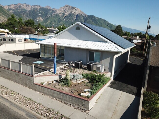
Property Record
2870 E 3300 S, Salt Lake City, UT 84109


NEARBY LISTINGS FOR SALE OR LEASE
Property Detail
2870 E 3300 S
Salt Lake City, UT
Capson Sub
16-26-351-041-0000
LOT 3, CAPSON SUB. 5403-1176 6423-2075 8280-5144 09679-4369 10637-1101 10746-2124
Officebuilding
Salt Lake
X
Utah
49035C0308H
3
0
0.22 AC
2025
Central Valley East
110500
Salt Lake City
4,812 SF
DEMOGRAPHICS near 2870 E 3300 S
1 Mile
3 Mile
5 Mile
2024 Total Population
13,586
93,566
227,560
2029 Population
13,626
94,356
229,607
Pop Growth 2024-2029
+ 0.29%
+ 0.84%
+ 0.90%
Average Age
39
39
39
2024 Total Households
4,702
35,697
92,963
HH Growth 2024-2029
+ 0.17%
+ 0.85%
+ 0.91%
Median Household Inc
$115,033
$100,543
$76,773
Avg Household Size
2.80
2.50
2.30
2024 Avg HH Vehicles
2.00
2.00
2.00
Median Home Value
$658,963
$663,131
$590,953
Median Year Built
1958
1962
1968
Nearby Places
Map Layers
Map Styles
 Street
 Aerial
- Restaurants
- Banks
- Shops
- Fitness
- Groceries
PUBLIC TRANSPORTATION
AIRPORT
Salt Lake City International
DRIVE
WALK
Distance
Salt Lake City International
20 min
14.4 mi
Freight Ports
Port of Stockton
DRIVE
WALK
Distance
Port of Stockton
720 min
704.8 mi
SALE & LEASE HISTORY
LISTING DATE
SALE/LEASE

Jun 21, 2021
For Sale
Jun 06, 2017
For Sale
Dec 11, 2018
For Lease
Aug 07, 2019
For Sale
Nearby Properties
Address
Land Use
TOTAL SIZE
Lot Size
Zoning
Address
Land Use
TOTAL SIZE
Lot Size
Zoning
207,140 SF
23.06 AC
P
Address
Land Use
TOTAL SIZE
Lot Size
Zoning
257,003 SF
25.87 AC
1108
Address
Land Use
TOTAL SIZE
Lot Size
Zoning
691,463 SF
17.80 AC
RM
Address
Land Use
TOTAL SIZE
Lot Size
Zoning
183,600 SF
10.70 AC
RMF-35
Address
Land Use
TOTAL SIZE
Lot Size
Zoning
297,476 SF
1.62 AC
CSHBD2
Address
Land Use
TOTAL SIZE
Lot Size
Zoning
369,717 SF
2.50 AC
RO
Address
Land Use
TOTAL SIZE
Lot Size
Zoning
412,006 SF
1.70 AC
C3
Address
Land Use
TOTAL SIZE
Lot Size
Zoning
369,377 SF
1.65 AC
Address
Land Use
TOTAL SIZE
Lot Size
Zoning
426,600 SF
1.61 AC
CSHBD1
Address
Land Use
TOTAL SIZE
Lot Size
Zoning
903,167 SF
1.90 AC
CSHBD1
Address
Land Use
TOTAL SIZE
Lot Size
Zoning
125,518 SF
11.03 AC
RMZC
Address
Land Use
TOTAL SIZE
Lot Size
Zoning
303,240 SF
29.21 AC
1205
Address
Land Use
TOTAL SIZE
Lot Size
Zoning
299,673 SF
2.16 AC
C3
Address
Land Use
TOTAL SIZE
Lot Size
Zoning
266,380 SF
2.09 AC
CSHBD1
Address
Land Use
TOTAL SIZE
Lot Size
Zoning
295,307 SF
2.46 AC
C-B
Address
Land Use
TOTAL SIZE
Lot Size
Zoning
386,512 SF
9.66 AC
C-SHDB
Address
Land Use
TOTAL SIZE
Lot Size
Zoning
621,969 SF
10.17 AC
CS
Address
Land Use
TOTAL SIZE
Lot Size
Zoning
433,385 SF
3.64 AC
R/M-U
Address
Land Use
TOTAL SIZE
Lot Size
Zoning
132,942 SF
18 AC
1108
Address
Land Use
TOTAL SIZE
Lot Size
Zoning
517,619 SF
4.20 AC
CSHBD1
Address
Land Use
TOTAL SIZE
Lot Size
Zoning
130,948 SF
18.95 AC
1107
Address
Land Use
TOTAL SIZE
Lot Size
Zoning
106,467 SF
4.41 AC
2000
Address
Land Use
TOTAL SIZE
Lot Size
Zoning
345,554 SF
3.21 AC
RO
Address
Land Use
TOTAL SIZE
Lot Size
Zoning
40,414 SF
3.81 AC
C-2
Address
Land Use
TOTAL SIZE
Lot Size
Zoning
479,027 SF
1.98 AC
C3
Address
Land Use
TOTAL SIZE
Lot Size
Zoning
89,546 SF
5.03 AC
1110
Address
Land Use
TOTAL SIZE
Lot Size
Zoning
136,849 SF
7.33 AC
CSHBD1
Address
Land Use
TOTAL SIZE
Lot Size
Zoning
104,648 SF
0.87 AC
RMF-45
Address
Land Use
TOTAL SIZE
Lot Size
Zoning
5,300 SF
56.12 AC
1205
Address
Land Use
TOTAL SIZE
Lot Size
Zoning
127,748 SF
8.87 AC
1210
The World's #1 Commercial Real Estate Marketplace
Connect with us
© 2026 CoStar Group
The information above has been obtained from sources believed reliable. While we do not doubt its accuracy we have not verified it and make no guarantee, warranty or representation about it. It is your responsibility to independently confirm its accuracy and completeness. Any projections, opinions, assumptions, or estimates used are for example only and do not represent the current or future performance of the property. The value of this transaction to you depends on tax and other factors which should be evaluated by your tax, financial, and legal advisors. You and your advisors should conduct a careful, independent investigation of the property to determine to your satisfaction the suitability of the property for your needs.