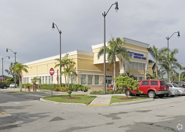
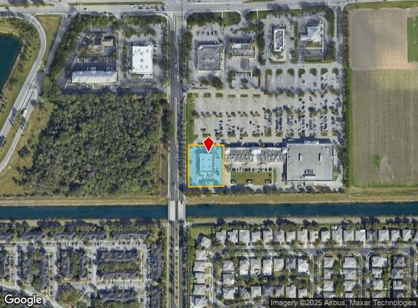
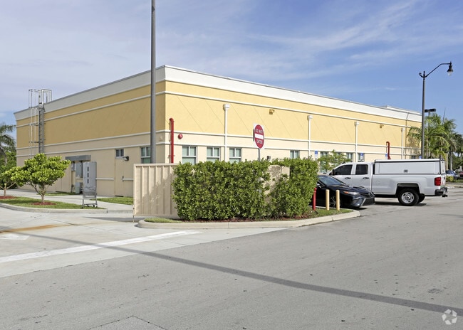
Property Record
2876 Ne 8Th St, Homestead, FL 33033
NEARBY LISTINGS FOR SALE OR LEASE
Property Detail
2876 Ne 8Th St
Miami-Miami Beach-Kendall, FL
Miami Land & Dev Cos Sub
10-7916-001-0093
16 57 39 MIAMI LAND & DEV COS SUB PB 5-10 PORT OF LOTS 11 & 12 BLK 1 DESC COMM N1/4 COR OF SEC TH S 00 DEG E 1011.55FT N 89 DEG E 70.01FT N 00 DEG W 48.67FT FOR POB CONT N 00 DEG W 212.02FT N 89 DEG E 182.58FT S 00 DEG E 212.02FT S 89 DEG W 182.58FT
Medicalbuilding
Miami/Dade
AH
Florida
12086C0731L
11,12
2024
0.89 AC
2025
South Dade
011015
South Florida
7,043 SF
DEMOGRAPHICS near 2876 Ne 8Th St
1 Mile
3 Mile
5 Mile
2024 Total Population
20,979
109,656
176,074
2029 Population
20,356
107,535
172,939
Pop Growth 2024-2029
(2.97%)
(1.93%)
(1.78%)
Average Age
36
36
36
2024 Total Households
6,161
33,200
52,560
HH Growth 2024-2029
(3.38%)
(2.39%)
(2.21%)
Median Household Inc
$74,493
$56,377
$54,370
Avg Household Size
3.30
3.20
3.20
2024 Avg HH Vehicles
2.00
2.00
2.00
Median Home Value
$314,244
$303,528
$302,409
Median Year Built
2004
2000
1998
Nearby Places
Map Layers
Map Styles
 Street
 Aerial
- Restaurants
- Banks
- Shops
- Fitness
- Groceries
PUBLIC TRANSPORTATION
AIRPORT
Miami International
DRIVE
WALK
Distance
Miami International
41 min
28.8 mi
Freight Ports
Port of Miami
DRIVE
WALK
Distance
Port of Miami
50 min
35.7 mi
Nearby Properties
Address
Land Use
TOTAL SIZE
Lot Size
Zoning
Address
Land Use
TOTAL SIZE
Lot Size
Zoning
487,531 SF
60 AC
9300
Address
Land Use
TOTAL SIZE
Lot Size
Zoning
289,905 SF
29.74 AC
6500
Address
Land Use
TOTAL SIZE
Lot Size
Zoning
321,122 SF
7.31 AC
3161
Address
Land Use
TOTAL SIZE
Lot Size
Zoning
313,656 SF
10.71 AC
3900
Address
Land Use
TOTAL SIZE
Lot Size
Zoning
1 SF
20.93 AC
9000
Address
Land Use
TOTAL SIZE
Lot Size
Zoning
149,022 SF
34.85 AC
9300
Address
Land Use
TOTAL SIZE
Lot Size
Zoning
253,088 SF
2.90 AC
6072
Address
Land Use
TOTAL SIZE
Lot Size
Zoning
225,691 SF
8.22 AC
3900
Address
Land Use
TOTAL SIZE
Lot Size
Zoning
228,908 SF
65.07 AC
3050
Address
Land Use
TOTAL SIZE
Lot Size
Zoning
216,282 SF
20.04 AC
6300
Address
Land Use
TOTAL SIZE
Lot Size
Zoning
183,244 SF
4 AC
6500
Address
Land Use
TOTAL SIZE
Lot Size
Zoning
304,629 SF
36.34 AC
0100
Address
Land Use
TOTAL SIZE
Lot Size
Zoning
252,526 SF
29.86 AC
6000
Address
Land Use
TOTAL SIZE
Lot Size
Zoning
302,948 SF
142.64 AC
9300
Address
Land Use
TOTAL SIZE
Lot Size
Zoning
169,474 SF
5.76 AC
6300
Address
Land Use
TOTAL SIZE
Lot Size
Zoning
213,133 SF
138.20 AC
9300
Address
Land Use
TOTAL SIZE
Lot Size
Zoning
208,951 SF
20 AC
6300
Address
Land Use
TOTAL SIZE
Lot Size
Zoning
237,527 SF
34.14 AC
9300
Address
Land Use
TOTAL SIZE
Lot Size
Zoning
409,347 SF
33.88 AC
3000
Address
Land Use
TOTAL SIZE
Lot Size
Zoning
179,608 SF
8.06 AC
9300
Address
Land Use
TOTAL SIZE
Lot Size
Zoning
322,425 SF
16.40 AC
5700
Address
Land Use
TOTAL SIZE
Lot Size
Zoning
144,931 SF
10.69 AC
6200
Address
Land Use
TOTAL SIZE
Lot Size
Zoning
119,534 SF
8.55 AC
6200
Address
Land Use
TOTAL SIZE
Lot Size
Zoning
203,528 SF
3.73 AC
6000
Address
Land Use
TOTAL SIZE
Lot Size
Zoning
234,124 SF
23.35 AC
6000
Address
Land Use
TOTAL SIZE
Lot Size
Zoning
374,632 SF
23.28 AC
3000
Address
Land Use
TOTAL SIZE
Lot Size
Zoning
172,811 SF
22.02 AC
9300
Address
Land Use
TOTAL SIZE
Lot Size
Zoning
1 SF
365.68 AC
9000
Address
Land Use
TOTAL SIZE
Lot Size
Zoning
159,298 SF
4.93 AC
5300
The World's #1 Commercial Real Estate Marketplace
Connect with us
© 2025 CoStar Group
The information above has been obtained from sources believed reliable. While we do not doubt its accuracy we have not verified it and make no guarantee, warranty or representation about it. It is your responsibility to independently confirm its accuracy and completeness. Any projections, opinions, assumptions, or estimates used are for example only and do not represent the current or future performance of the property. The value of this transaction to you depends on tax and other factors which should be evaluated by your tax, financial, and legal advisors. You and your advisors should conduct a careful, independent investigation of the property to determine to your satisfaction the suitability of the property for your needs.