Property Record
29199 Livingston Dr, Punta Gorda, FL 33982


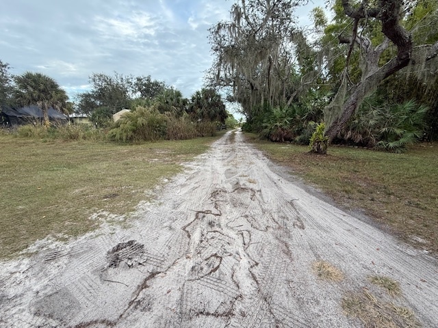
This Property Is For Sale
NEARBY LISTINGS FOR SALE OR LEASE
-
-
View all Punta Gorda listings for sale on LoopNet.com
Property Detail
29199 Livingston Dr
Punta Gorda, FL
Sas 00A 0002 0001 San Souci
402324328001
Charlotte
Sfr
Florida
AE
0.57 AC
12015C0251G
Outlying Punta Gorda
1,607 SF
Southwest Florida
DEMOGRAPHICS near 29199 Livingston Dr
1 Mile
3 Mile
5 Mile
2024 Total Population
882
8,339
30,481
2029 Population
995
9,192
33,680
Pop Growth 2024-2029
+ 12.81%
+ 10.23%
+ 10.50%
Average Age
53
50
52
2024 Total Households
433
3,734
13,971
HH Growth 2024-2029
+ 12.70%
+ 10.07%
+ 10.50%
Median Household Inc
$29,845
$61,698
$65,259
Avg Household Size
2.00
2.20
2.10
2024 Avg HH Vehicles
2.00
2.00
2.00
Median Home Value
$188,234
$373,203
$327,395
Median Year Built
1988
1990
1995
Nearby Places
Map Layers
Map Styles
 Street
 Aerial
- Restaurants
- Banks
- Shops
- Fitness
- Groceries
PUBLIC TRANSPORTATION
AIRPORT
Punta Gorda
DRIVE
WALK
Distance
Punta Gorda
15 min
8.2 mi
Freight Ports
Port Manatee
DRIVE
WALK
Distance
Port Manatee
92 min
76.4 mi
Nearby Properties
Address
Land Use
TOTAL SIZE
Lot Size
Zoning
Address
Land Use
TOTAL SIZE
Lot Size
Zoning
254.31 AC
PD
Address
Land Use
TOTAL SIZE
Lot Size
Zoning
116,186 SF
20.02 AC
RMF10
Address
Land Use
TOTAL SIZE
Lot Size
Zoning
2,148 SF
121.95 AC
PD
Address
Land Use
TOTAL SIZE
Lot Size
Zoning
1,556 SF
23.08 AC
CG
Address
Land Use
TOTAL SIZE
Lot Size
Zoning
31,194 SF
7.93 AC
CG
Address
Land Use
TOTAL SIZE
Lot Size
Zoning
8,750 SF
21.19 AC
CG
Address
Land Use
TOTAL SIZE
Lot Size
Zoning
2,400 SF
1.65 AC
IG
Address
Land Use
TOTAL SIZE
Lot Size
Zoning
16,969 SF
81.30 AC
EM
Address
Land Use
TOTAL SIZE
Lot Size
Zoning
24,234 SF
3.25 AC
CG
Address
Land Use
TOTAL SIZE
Lot Size
Zoning
18,256 SF
5.20 AC
RE1
Address
Land Use
TOTAL SIZE
Lot Size
Zoning
21,609 SF
20 AC
AG
Address
Land Use
TOTAL SIZE
Lot Size
Zoning
13.53 AC
CG
Address
Land Use
TOTAL SIZE
Lot Size
Zoning
18,144 SF
2.73 AC
IG
Address
Land Use
TOTAL SIZE
Lot Size
Zoning
1,960 SF
2.03 AC
IG
Address
Land Use
TOTAL SIZE
Lot Size
Zoning
6,606 SF
0.92 AC
RMF15
Address
Land Use
TOTAL SIZE
Lot Size
Zoning
1,416 SF
3.85 AC
RMF5
Address
Land Use
TOTAL SIZE
Lot Size
Zoning
4,926 SF
8.10 AC
PKR
Address
Land Use
TOTAL SIZE
Lot Size
Zoning
15,000 SF
1.50 AC
IG
Address
Land Use
TOTAL SIZE
Lot Size
Zoning
8,823 SF
73.60 AC
RE1
Address
Land Use
TOTAL SIZE
Lot Size
Zoning
4,767 SF
0.31 AC
CG
Address
Land Use
TOTAL SIZE
Lot Size
Zoning
10,500 SF
3.43 AC
CG
Address
Land Use
TOTAL SIZE
Lot Size
Zoning
4,426 SF
8.51 AC
CG
Address
Land Use
TOTAL SIZE
Lot Size
Zoning
10,500 SF
0.97 AC
CG
Address
Land Use
TOTAL SIZE
Lot Size
Zoning
9,991 SF
5.25 AC
CG
Address
Land Use
TOTAL SIZE
Lot Size
Zoning
7,538 SF
1 AC
CG
Address
Land Use
TOTAL SIZE
Lot Size
Zoning
12,360 SF
1.59 AC
CG
Address
Land Use
TOTAL SIZE
Lot Size
Zoning
5,400 SF
7.09 AC
CG
Address
Land Use
TOTAL SIZE
Lot Size
Zoning
11,776 SF
0.90 AC
IG
Address
Land Use
TOTAL SIZE
Lot Size
Zoning
6,960 SF
0.86 AC
CG
Address
Land Use
TOTAL SIZE
Lot Size
Zoning
8,500 SF
0.76 AC
IG
The World's #1 Commercial Real Estate Marketplace
Connect with us
© 2026 CoStar Group
The information above has been obtained from sources believed reliable. While we do not doubt its accuracy we have not verified it and make no guarantee, warranty or representation about it. It is your responsibility to independently confirm its accuracy and completeness. Any projections, opinions, assumptions, or estimates used are for example only and do not represent the current or future performance of the property. The value of this transaction to you depends on tax and other factors which should be evaluated by your tax, financial, and legal advisors. You and your advisors should conduct a careful, independent investigation of the property to determine to your satisfaction the suitability of the property for your needs.