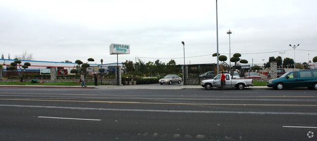
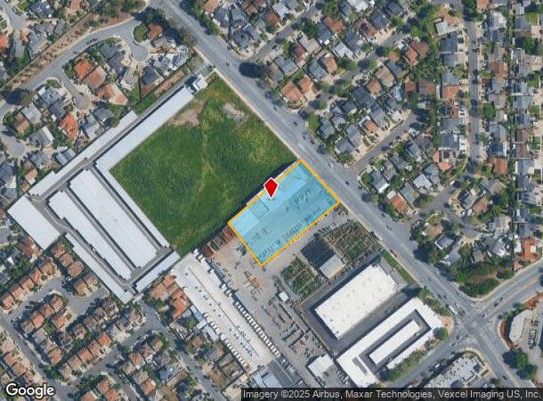
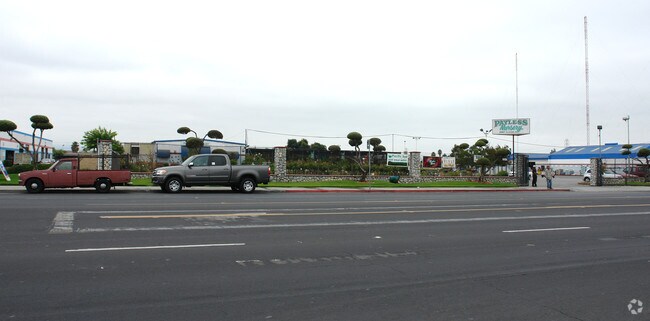
Property Record
2927 S King Rd, San Jose, CA 95122
NEARBY LISTINGS FOR SALE OR LEASE
Property Detail
2927 S King Rd
San Jose-Sunnyvale-Santa Clara, CA
Laurelwood Farm
670-13-024
LOT 1
Storebuilding
Santa Clara
D
California
06085C0262H
1
2024
1.51 AC
2025
East San Jose-Willow Glen
503304
South Bay/San Jose
17,205 SF
DEMOGRAPHICS near 2927 S King Rd
1 Mile
3 Mile
5 Mile
2024 Total Population
31,358
217,410
516,586
2029 Population
30,036
207,804
494,931
Pop Growth 2024-2029
(4.22%)
(4.42%)
(4.19%)
Average Age
41
39
39
2024 Total Households
7,870
55,642
153,453
HH Growth 2024-2029
(4.55%)
(4.65%)
(4.31%)
Median Household Inc
$106,468
$111,451
$110,334
Avg Household Size
3.70
3.60
3.20
2024 Avg HH Vehicles
3.00
2.00
2.00
Median Home Value
$738,689
$859,084
$926,722
Median Year Built
1975
1977
1976
Nearby Places
Map Layers
Map Styles
 Street
 Aerial
- Restaurants
- Banks
- Shops
- Fitness
- Groceries
PUBLIC TRANSPORTATION
COMMUTER RAIL
Capitol (Caltrain - Caltrain (Caltrain))
DRIVE
WALK
Distance
Capitol (Caltrain - Caltrain (Caltrain))
7 min
3.7 mi
Blossom Hill (Caltrain - Caltrain (Caltrain))
DRIVE
WALK
Distance
Blossom Hill (Caltrain - Caltrain (Caltrain))
9 min
5.2 mi
AIRPORT
Norman Y Mineta San Jose International
DRIVE
WALK
Distance
Norman Y Mineta San Jose International
16 min
9.6 mi
Nearby Properties
Address
Land Use
TOTAL SIZE
Lot Size
Zoning
Address
Land Use
TOTAL SIZE
Lot Size
Zoning
11.96 AC
M4
Address
Land Use
TOTAL SIZE
Lot Size
Zoning
8.72 AC
A-PD
Address
Land Use
TOTAL SIZE
Lot Size
Zoning
358,320 SF
4.97 AC
R1-20
Address
Land Use
TOTAL SIZE
Lot Size
Zoning
155,286 SF
9.50 AC
R3
Address
Land Use
TOTAL SIZE
Lot Size
Zoning
120,816 SF
5.45 AC
C3PD
Address
Land Use
TOTAL SIZE
Lot Size
Zoning
113.46 AC
M4
Address
Land Use
TOTAL SIZE
Lot Size
Zoning
21.67 AC
R3B
Address
Land Use
TOTAL SIZE
Lot Size
Zoning
163,904 SF
9.48 AC
R3APD
Address
Land Use
TOTAL SIZE
Lot Size
Zoning
5.05 AC
APD
Address
Land Use
TOTAL SIZE
Lot Size
Zoning
549,100 SF
51.91 AC
CG
Address
Land Use
TOTAL SIZE
Lot Size
Zoning
355,728 SF
20.95 AC
IP
Address
Land Use
TOTAL SIZE
Lot Size
Zoning
189,598 SF
2.20 AC
APD
Address
Land Use
TOTAL SIZE
Lot Size
Zoning
10.42 AC
PD
Address
Land Use
TOTAL SIZE
Lot Size
Zoning
124,000 SF
13.12 AC
C1
Address
Land Use
TOTAL SIZE
Lot Size
Zoning
450,000 SF
13.53 AC
HI
Address
Land Use
TOTAL SIZE
Lot Size
Zoning
142,100 SF
10.69 AC
IP
Address
Land Use
TOTAL SIZE
Lot Size
Zoning
159,300 SF
8.91 AC
RM
Address
Land Use
TOTAL SIZE
Lot Size
Zoning
159,300 SF
8.55 AC
RM
Address
Land Use
TOTAL SIZE
Lot Size
Zoning
433,139 SF
22 AC
R3A
Address
Land Use
TOTAL SIZE
Lot Size
Zoning
20,160.11 AC
SJ
Address
Land Use
TOTAL SIZE
Lot Size
Zoning
0.86 AC
R1AB
Address
Land Use
TOTAL SIZE
Lot Size
Zoning
3.98 AC
CG
Address
Land Use
TOTAL SIZE
Lot Size
Zoning
137,755 SF
10.04 AC
M4
Address
Land Use
TOTAL SIZE
Lot Size
Zoning
276,762 SF
11.29 AC
RM-PD
Address
Land Use
TOTAL SIZE
Lot Size
Zoning
105,490 SF
9.48 AC
C3
Address
Land Use
TOTAL SIZE
Lot Size
Zoning
287,782 SF
10.87 AC
R3B
Address
Land Use
TOTAL SIZE
Lot Size
Zoning
116,144 SF
6.32 AC
APD
Address
Land Use
TOTAL SIZE
Lot Size
Zoning
1.72 AC
APD
Address
Land Use
TOTAL SIZE
Lot Size
Zoning
143,328 SF
11 AC
A(PD)
Address
Land Use
TOTAL SIZE
Lot Size
Zoning
11,892 SF
49.23 AC
TM
The World's #1 Commercial Real Estate Marketplace
Connect with us
© 2025 CoStar Group
The information above has been obtained from sources believed reliable. While we do not doubt its accuracy we have not verified it and make no guarantee, warranty or representation about it. It is your responsibility to independently confirm its accuracy and completeness. Any projections, opinions, assumptions, or estimates used are for example only and do not represent the current or future performance of the property. The value of this transaction to you depends on tax and other factors which should be evaluated by your tax, financial, and legal advisors. You and your advisors should conduct a careful, independent investigation of the property to determine to your satisfaction the suitability of the property for your needs.