Property Record
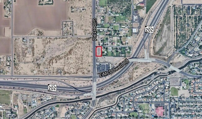
2929 N Gilbert Rd, Mesa, AZ 85213


NEARBY LISTINGS FOR SALE OR LEASE
Property Detail
2929 N Gilbert Rd
Phoenix-Mesa-Chandler, AZ
POR LOT 4 SEC 31 DAF COM SW COR SEC 31 TH N 660.18F TH E 110F POB TH N 280.11F TH N 44D 55M E 35.35F TH E 151.45F TH S 305.14F TH W 176.45F TO POB
141-03-035
Maricopa
Countyproperty
Arizona
X
4
04013C2260L
1.23 AC
0
Mesa East
2025
Phoenix
420705
DEMOGRAPHICS near 2929 N Gilbert Rd
1 Mile
3 Mile
5 Mile
2024 Total Population
4,816
53,322
191,479
2029 Population
5,100
56,583
206,319
Pop Growth 2024-2029
+ 5.90%
+ 6.12%
+ 7.75%
Average Age
38
38
39
2024 Total Households
1,434
17,342
70,998
HH Growth 2024-2029
+ 5.79%
+ 6.01%
+ 8.25%
Median Household Inc
$141,107
$93,288
$60,764
Avg Household Size
3.20
2.90
2.60
2024 Avg HH Vehicles
3.00
2.00
2.00
Median Home Value
$553,006
$431,838
$329,110
Median Year Built
1992
1984
1983
Nearby Places
Map Layers
Map Styles
 Street
 Aerial
- Restaurants
- Banks
- Shops
- Fitness
- Groceries
PUBLIC TRANSPORTATION
AIRPORT
Phoenix Sky Harbor International
DRIVE
WALK
Distance
Phoenix Sky Harbor International
20 min
14.0 mi
Phoenix-Mesa Gateway
DRIVE
WALK
Distance
Phoenix-Mesa Gateway
32 min
18.6 mi
Nearby Properties
Address
Land Use
TOTAL SIZE
Lot Size
Zoning
Address
Land Use
TOTAL SIZE
Lot Size
Zoning
181.80 AC
Address
Land Use
TOTAL SIZE
Lot Size
Zoning
125,356 SF
21.63 AC
R-9
Address
Land Use
TOTAL SIZE
Lot Size
Zoning
400,798 SF
55.94 AC
PF
Address
Land Use
TOTAL SIZE
Lot Size
Zoning
20.08 AC
Address
Land Use
TOTAL SIZE
Lot Size
Zoning
161,388 SF
32.52 AC
R-35
Address
Land Use
TOTAL SIZE
Lot Size
Zoning
66,350 SF
22.32 AC
I-1
Address
Land Use
TOTAL SIZE
Lot Size
Zoning
147,408 SF
34.58 AC
PF
Address
Land Use
TOTAL SIZE
Lot Size
Zoning
536,470 SF
28.81 AC
M-H
Address
Land Use
TOTAL SIZE
Lot Size
Zoning
81,000 SF
15.70 AC
AG
Address
Land Use
TOTAL SIZE
Lot Size
Zoning
113,207 SF
6.87 AC
C-G
Address
Land Use
TOTAL SIZE
Lot Size
Zoning
72,598 SF
38.83 AC
AG
Address
Land Use
TOTAL SIZE
Lot Size
Zoning
133,219 SF
8.65 AC
I-1
Address
Land Use
TOTAL SIZE
Lot Size
Zoning
10 SF
0.91 AC
AG
Address
Land Use
TOTAL SIZE
Lot Size
Zoning
191,871 SF
9.51 AC
M-H
Address
Land Use
TOTAL SIZE
Lot Size
Zoning
80,320 SF
11.11 AC
R-9
Address
Land Use
TOTAL SIZE
Lot Size
Zoning
110,396 SF
8.40 AC
C-G
Address
Land Use
TOTAL SIZE
Lot Size
Zoning
97,536 SF
7.82 AC
I-1
Address
Land Use
TOTAL SIZE
Lot Size
Zoning
60,000 SF
12.48 AC
RS-9
Address
Land Use
TOTAL SIZE
Lot Size
Zoning
60,421 SF
9.32 AC
R-9
Address
Land Use
TOTAL SIZE
Lot Size
Zoning
108,725 SF
5.78 AC
M-H
Address
Land Use
TOTAL SIZE
Lot Size
Zoning
76,344 SF
4.70 AC
PF
Address
Land Use
TOTAL SIZE
Lot Size
Zoning
65,084 SF
7.74 AC
R-43
Address
Land Use
TOTAL SIZE
Lot Size
Zoning
68,944 SF
3.23 AC
ID2
Address
Land Use
TOTAL SIZE
Lot Size
Zoning
24,610 SF
19.15 AC
AG
Address
Land Use
TOTAL SIZE
Lot Size
Zoning
96,839 SF
6.58 AC
I-1
Address
Land Use
TOTAL SIZE
Lot Size
Zoning
54,736 SF
3.94 AC
LC
Address
Land Use
TOTAL SIZE
Lot Size
Zoning
41,152 SF
4.51 AC
Address
Land Use
TOTAL SIZE
Lot Size
Zoning
9,776 SF
19.42 AC
PF
Address
Land Use
TOTAL SIZE
Lot Size
Zoning
40,589 SF
6.70 AC
C-G
Address
Land Use
TOTAL SIZE
Lot Size
Zoning
122,544 SF
7.51 AC
M-H
The World's #1 Commercial Real Estate Marketplace
Connect with us
© 2026 CoStar Group
The information above has been obtained from sources believed reliable. While we do not doubt its accuracy we have not verified it and make no guarantee, warranty or representation about it. It is your responsibility to independently confirm its accuracy and completeness. Any projections, opinions, assumptions, or estimates used are for example only and do not represent the current or future performance of the property. The value of this transaction to you depends on tax and other factors which should be evaluated by your tax, financial, and legal advisors. You and your advisors should conduct a careful, independent investigation of the property to determine to your satisfaction the suitability of the property for your needs.