Property Record
2933 105Th St, Sturtevant, WI 53177


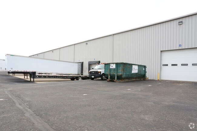
Property Detail
2933 105Th St
181-032221036010
PT SW1/4 CSM #2076 V6 P363 PCL 1 EXC #2501093 FROM 181032221036000 & 037010 IN 98 FOR 99 ROLL PT TO 181032221600000 & 1810322
Commercialnec
Racine
002
Wisconsin
B and X Area of moderate flood hazard, usually the area between the limits of the 100-year and 500-year floods.
6.52 AC
2025
Racine East
2025
Milwaukee/Madison
001702
Racine-Mount Pleasant, WI
32,560 SF
NEARBY LISTINGS FOR SALE OR LEASE
DEMOGRAPHICS near 2933 105Th St
1 mile
3 mile
5 mile
2025 Total Population
2,490
14,005
59,885
2030 Population
2,501
14,251
60,361
Pop Growth 2025-2030
+ 0.44%
+ 1.76%
+ 0.79%
Average Age
41
42
42
2025 Total Households
730
5,102
24,204
HH Growth 2025-2030
+ 0.27%
+ 1.86%
+ 0.78%
Median Household Inc
$79,615
$80,350
$79,407
Avg Household Size
2.50
2.30
2.30
2025 Avg HH Vehicles
2.00
2.00
2.00
Median Home Value
$221,261
$252,064
$252,463
Median Year Built
1968
1979
1974
Nearby Places
Map Layers
Map Styles
 Street
 Aerial
Layers
 Traffic
 Biking
Places
Listings with unknown addresses are not visible on the map
- Restaurants
- Banks
- Shops
- Fitness
- Groceries
PUBLIC TRANSPORTATION
COMMUTER RAIL
Sturtevant Amtrak Station (Hiawatha Service - Amtrak)
Drive
Walk
Distance
Sturtevant Amtrak Station (Hiawatha Service - Amtrak)
4 min
1.7 mi
AIRPORT
General Mitchell International
Drive
Walk
Distance
General Mitchell International
28 min
21.5 mi
Freight Ports
Port Milwaukee
Drive
Walk
Distance
Port Milwaukee
32 min
25.4 mi
SALE & LEASE HISTORY
LISTING DATE
SALE/LEASE

Apr 26, 2018
For Lease
Apr 26, 2018
For Lease
Nearby Properties
Address
Land Use
TOTAL SIZE
Lot Size
Zoning
Address
Land Use
TOTAL SIZE
Lot Size
Zoning
318.64 AC
Address
Land Use
TOTAL SIZE
Lot Size
Zoning
241.29 AC
Address
Land Use
TOTAL SIZE
Lot Size
Zoning
22.34 AC
Address
Land Use
TOTAL SIZE
Lot Size
Zoning
Address
Land Use
TOTAL SIZE
Lot Size
Zoning
9.31 AC
Address
Land Use
TOTAL SIZE
Lot Size
Zoning
Address
Land Use
TOTAL SIZE
Lot Size
Zoning
32.55 AC
Address
Land Use
TOTAL SIZE
Lot Size
Zoning
23.10 AC
Address
Land Use
TOTAL SIZE
Lot Size
Zoning
47.01 AC
M-1
Address
Land Use
TOTAL SIZE
Lot Size
Zoning
9.40 AC
B-3
Address
Land Use
TOTAL SIZE
Lot Size
Zoning
37.55 AC
Address
Land Use
TOTAL SIZE
Lot Size
Zoning
26.79 AC
Address
Land Use
TOTAL SIZE
Lot Size
Zoning
23.21 AC
Address
Land Use
TOTAL SIZE
Lot Size
Zoning
57.80 AC
M1
Address
Land Use
TOTAL SIZE
Lot Size
Zoning
20.61 AC
Address
Land Use
TOTAL SIZE
Lot Size
Zoning
30.45 AC
002
Address
Land Use
TOTAL SIZE
Lot Size
Zoning
Address
Land Use
TOTAL SIZE
Lot Size
Zoning
Address
Land Use
TOTAL SIZE
Lot Size
Zoning
Address
Land Use
TOTAL SIZE
Lot Size
Zoning
13.04 AC
Address
Land Use
TOTAL SIZE
Lot Size
Zoning
19.33 AC
002
Address
Land Use
TOTAL SIZE
Lot Size
Zoning
31.50 AC
Address
Land Use
TOTAL SIZE
Lot Size
Zoning
22.93 AC
Address
Land Use
TOTAL SIZE
Lot Size
Zoning
18.33 AC
Address
Land Use
TOTAL SIZE
Lot Size
Zoning
32.99 AC
002
Address
Land Use
TOTAL SIZE
Lot Size
Zoning
Address
Land Use
TOTAL SIZE
Lot Size
Zoning
Address
Land Use
TOTAL SIZE
Lot Size
Zoning
Address
Land Use
TOTAL SIZE
Lot Size
Zoning
5.74 AC
Address
Land Use
TOTAL SIZE
Lot Size
Zoning
16.91 AC
The World's #1 Commercial Real Estate Marketplace
Connect with us
© 2026 CoStar Group
The information above has been obtained from sources believed reliable. While we do not doubt its accuracy we have not verified it and make no guarantee, warranty or representation about it. It is your responsibility to independently confirm its accuracy and completeness. Any projections, opinions, assumptions, or estimates used are for example only and do not represent the current or future performance of the property. The value of this transaction to you depends on tax and other factors which should be evaluated by your tax, financial, and legal advisors. You and your advisors should conduct a careful, independent investigation of the property to determine to your satisfaction the suitability of the property for your needs.