Property Record
2947 Madison Ave, Indianapolis, IN 46225


NEARBY LISTINGS FOR SALE OR LEASE
Property Detail
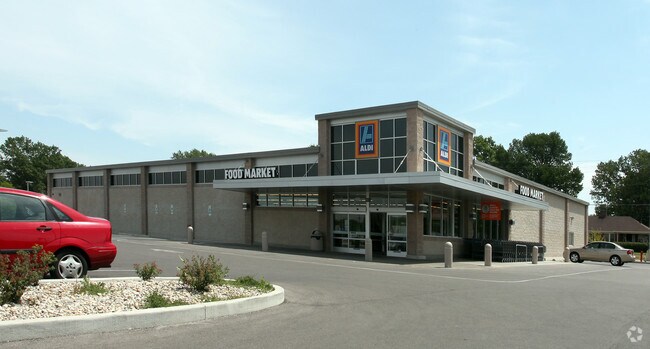
2947 Madison Ave
Indianapolis
Mckees Sub
Indianapolis-Carmel-Anderson, IN
MCKEES SUB L8 THROUGH L16 ALSO PARTS OF L6 L7 & L17 THROUGH L22 COMM SE COR L14 P.O.B. W208.34 NW37.73 NW192.44 BNE132.49 E146.64 N148.92 W57.89 N86.79 W7.00 N40.00 W62.99 N96.94 E175.00 S626.58 TO BEG 2.428 AC
49-11-24-151-009.000-101
Marion
Supermarket
Indiana
2023
8
2024
2.43 AC
356900
Edgewood/South County
17,682 SF
DEMOGRAPHICS near 2947 Madison Ave
1 Mile
3 Mile
5 Mile
2024 Total Population
10,212
77,879
235,653
2029 Population
10,224
78,086
236,277
Pop Growth 2024-2029
+ 0.12%
+ 0.27%
+ 0.26%
Average Age
37
36
36
2024 Total Households
4,213
30,870
97,917
HH Growth 2024-2029
(0.07%)
+ 0.32%
+ 0.35%
Median Household Inc
$47,295
$52,529
$55,982
Avg Household Size
2.30
2.30
2.30
2024 Avg HH Vehicles
1.00
2.00
2.00
Median Home Value
$148,191
$155,367
$167,055
Median Year Built
1949
1956
1959
Nearby Places
Map Layers
Map Styles
 Street
 Aerial
- Restaurants
- Banks
- Shops
- Fitness
- Groceries
PUBLIC TRANSPORTATION
COMMUTER RAIL
Indianapolis (Cardinal - Amtrak)
DRIVE
WALK
Distance
Indianapolis (Cardinal - Amtrak)
5 min
3.0 mi
AIRPORT
Indianapolis International
DRIVE
WALK
Distance
Indianapolis International
25 min
13.4 mi
Freight Ports
Port of Toledo
DRIVE
WALK
Distance
Port of Toledo
274 min
228.6 mi
Nearby Properties
Address
Land Use
TOTAL SIZE
Lot Size
Zoning
Address
Land Use
TOTAL SIZE
Lot Size
Zoning
33.61 AC
ZO01
Address
Land Use
TOTAL SIZE
Lot Size
Zoning
1,381,492 SF
15.08 AC
ZO01
Address
Land Use
TOTAL SIZE
Lot Size
Zoning
5.59 AC
ZO01
Address
Land Use
TOTAL SIZE
Lot Size
Zoning
41.83 AC
ZO01
Address
Land Use
TOTAL SIZE
Lot Size
Zoning
500,908 SF
10.36 AC
ZO01
Address
Land Use
TOTAL SIZE
Lot Size
Zoning
19,896 SF
32.59 AC
ZO01
Address
Land Use
TOTAL SIZE
Lot Size
Zoning
12.63 AC
ZO01
Address
Land Use
TOTAL SIZE
Lot Size
Zoning
6,000 SF
0.47 AC
ZO01
Address
Land Use
TOTAL SIZE
Lot Size
Zoning
217,895 SF
3.43 AC
ZO01
Address
Land Use
TOTAL SIZE
Lot Size
Zoning
45,971 SF
0.78 AC
Address
Land Use
TOTAL SIZE
Lot Size
Zoning
414,000 SF
1.64 AC
ZO01
Address
Land Use
TOTAL SIZE
Lot Size
Zoning
111,238 SF
0.06 AC
ZO01
Address
Land Use
TOTAL SIZE
Lot Size
Zoning
31,413 SF
3.91 AC
ZO01
Address
Land Use
TOTAL SIZE
Lot Size
Zoning
67,783 SF
44.97 AC
ZO01
Address
Land Use
TOTAL SIZE
Lot Size
Zoning
3.32 AC
ZO01
Address
Land Use
TOTAL SIZE
Lot Size
Zoning
531,996 SF
9.09 AC
ZO01
Address
Land Use
TOTAL SIZE
Lot Size
Zoning
1,281 SF
2.44 AC
ZO01
Address
Land Use
TOTAL SIZE
Lot Size
Zoning
25,918 SF
2.69 AC
ZO01
Address
Land Use
TOTAL SIZE
Lot Size
Zoning
19,927 SF
28.82 AC
ZO01
Address
Land Use
TOTAL SIZE
Lot Size
Zoning
405,888 SF
19.56 AC
ZO01
Address
Land Use
TOTAL SIZE
Lot Size
Zoning
51,801 SF
0.06 AC
ZO01
Address
Land Use
TOTAL SIZE
Lot Size
Zoning
121,309 SF
1.37 AC
ZO01
Address
Land Use
TOTAL SIZE
Lot Size
Zoning
197,386 SF
2.02 AC
Address
Land Use
TOTAL SIZE
Lot Size
Zoning
94,971 SF
5.04 AC
ZO01
Address
Land Use
TOTAL SIZE
Lot Size
Zoning
80,348 SF
2.95 AC
ZO01
Address
Land Use
TOTAL SIZE
Lot Size
Zoning
18,232 SF
4.16 AC
ZO01
Address
Land Use
TOTAL SIZE
Lot Size
Zoning
1,812 SF
11.08 AC
ZO01
Address
Land Use
TOTAL SIZE
Lot Size
Zoning
310,917 SF
2.16 AC
ZO01
Address
Land Use
TOTAL SIZE
Lot Size
Zoning
8,788 SF
13.94 AC
ZO01
Address
Land Use
TOTAL SIZE
Lot Size
Zoning
2,720 SF
1.33 AC
ZO01
The World's #1 Commercial Real Estate Marketplace
Connect with us
© 2025 CoStar Group
The information above has been obtained from sources believed reliable. While we do not doubt its accuracy we have not verified it and make no guarantee, warranty or representation about it. It is your responsibility to independently confirm its accuracy and completeness. Any projections, opinions, assumptions, or estimates used are for example only and do not represent the current or future performance of the property. The value of this transaction to you depends on tax and other factors which should be evaluated by your tax, financial, and legal advisors. You and your advisors should conduct a careful, independent investigation of the property to determine to your satisfaction the suitability of the property for your needs.