Property Record
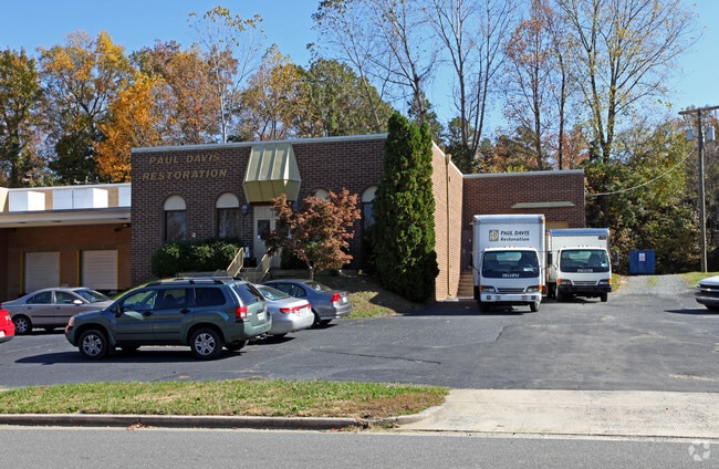
2939 Interstate St, Charlotte, NC 28208


Property Detail
2939 Interstate St
061-121-41
SEE 6112141
Industrialgeneral
Mecklenburg
I-1
North Carolina
B and X Area of moderate flood hazard, usually the area between the limits of the 100-year and 500-year floods.
41
2024
7.19 AC
2025
Airport/West
004000
Charlotte
5,200 SF
Charlotte-Concord-Gastonia, NC-SC
NEARBY LISTINGS FOR SALE OR LEASE
DEMOGRAPHICS near 2939 Interstate St
1 mile
3 mile
5 mile
2025 Total Population
8,250
60,690
188,366
2030 Population
9,154
66,793
206,960
Pop Growth 2025-2030
+ 10.96%
+ 10.06%
+ 9.87%
Average Age
37
37
36
2025 Total Households
3,230
24,069
84,893
HH Growth 2025-2030
+ 11.18%
+ 10.33%
+ 10.10%
Median Household Inc
$57,775
$53,811
$75,848
Avg Household Size
2.50
2.40
2.10
2025 Avg HH Vehicles
1.00
2.00
2.00
Median Home Value
$241,031
$307,827
$390,264
Median Year Built
1979
1978
2000
Nearby Places
Map Layers
Map Styles
 Street
 Aerial
Transit
 Traffic
 Biking
Places
Listings with unknown addresses are not visible on the map
- Restaurants
- Banks
- Shops
- Fitness
- Groceries
PUBLIC TRANSPORTATION
AIRPORT
Charlotte/Douglas International
Drive
Walk
Distance
Charlotte/Douglas International
14 min
5.8 mi
Concord-Padgett Regional
Drive
Walk
Distance
Concord-Padgett Regional
29 min
18.4 mi
SALE & LEASE HISTORY
LISTING DATE
SALE/LEASE

Dec 11, 2018
For Lease
Dec 04, 2019
For Lease
Nearby Properties
Address
Land Use
TOTAL SIZE
Lot Size
Zoning
Address
Land Use
TOTAL SIZE
Lot Size
Zoning
5,290,257 SF
502.52 AC
I2
Address
Land Use
TOTAL SIZE
Lot Size
Zoning
309.30 AC
I-2
Address
Land Use
TOTAL SIZE
Lot Size
Zoning
1,519,630 SF
235.59 AC
I2
Address
Land Use
TOTAL SIZE
Lot Size
Zoning
399,398 SF
35.02 AC
Address
Land Use
TOTAL SIZE
Lot Size
Zoning
621,107 SF
250.06 AC
I2
Address
Land Use
TOTAL SIZE
Lot Size
Zoning
100.51 AC
I-2
Address
Land Use
TOTAL SIZE
Lot Size
Zoning
24.40 AC
UR-2(CD)
Address
Land Use
TOTAL SIZE
Lot Size
Zoning
448,599 SF
3.16 AC
B1
Address
Land Use
TOTAL SIZE
Lot Size
Zoning
473,430 SF
3.35 AC
I1
Address
Land Use
TOTAL SIZE
Lot Size
Zoning
416,720 SF
81 AC
I2
Address
Land Use
TOTAL SIZE
Lot Size
Zoning
320,495 SF
10.03 AC
MUDDO
Address
Land Use
TOTAL SIZE
Lot Size
Zoning
382,514 SF
2.60 AC
TOD-NC
Address
Land Use
TOTAL SIZE
Lot Size
Zoning
350,120 SF
3.40 AC
MUDD-O
Address
Land Use
TOTAL SIZE
Lot Size
Zoning
661,612 SF
32.38 AC
I1CD
Address
Land Use
TOTAL SIZE
Lot Size
Zoning
375,318 SF
37.31 AC
B2
Address
Land Use
TOTAL SIZE
Lot Size
Zoning
201,056 SF
5.76 AC
MUDDO
Address
Land Use
TOTAL SIZE
Lot Size
Zoning
311,541 SF
40.41 AC
INST
Address
Land Use
TOTAL SIZE
Lot Size
Zoning
70.83 AC
I-2
Address
Land Use
TOTAL SIZE
Lot Size
Zoning
162,354 SF
6.97 AC
I-2
Address
Land Use
TOTAL SIZE
Lot Size
Zoning
306,012 SF
4.28 AC
Address
Land Use
TOTAL SIZE
Lot Size
Zoning
625,790 SF
89.50 AC
I-2(CD)
Address
Land Use
TOTAL SIZE
Lot Size
Zoning
215,624 SF
3.19 AC
MUDD-O
Address
Land Use
TOTAL SIZE
Lot Size
Zoning
58,666 SF
7.47 AC
Address
Land Use
TOTAL SIZE
Lot Size
Zoning
218,072 SF
1.94 AC
I2
Address
Land Use
TOTAL SIZE
Lot Size
Zoning
242,699 SF
20.50 AC
R17MF
Address
Land Use
TOTAL SIZE
Lot Size
Zoning
892,468 SF
14.48 AC
I2
Address
Land Use
TOTAL SIZE
Lot Size
Zoning
394,084 SF
29.35 AC
Address
Land Use
TOTAL SIZE
Lot Size
Zoning
238,075 SF
9.52 AC
Address
Land Use
TOTAL SIZE
Lot Size
Zoning
161,544 SF
20.23 AC
R17MF
Address
Land Use
TOTAL SIZE
Lot Size
Zoning
212,686 SF
25.20 AC
R17MF
The World's #1 Commercial Real Estate Marketplace
Connect with us
© 2026 CoStar Group
The information above has been obtained from sources believed reliable. While we do not doubt its accuracy we have not verified it and make no guarantee, warranty or representation about it. It is your responsibility to independently confirm its accuracy and completeness. Any projections, opinions, assumptions, or estimates used are for example only and do not represent the current or future performance of the property. The value of this transaction to you depends on tax and other factors which should be evaluated by your tax, financial, and legal advisors. You and your advisors should conduct a careful, independent investigation of the property to determine to your satisfaction the suitability of the property for your needs.