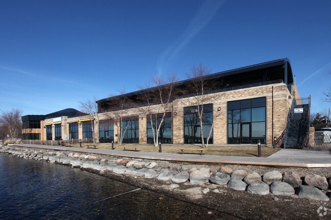
Property Record
294 Grove Ln E, Wayzata, MN 55391


Current Lease Availabilities
Property Detail
294 Grove Ln E
Minneapolis-St. Paul-Bloomington, MN-WI
T REG. LAND SURVEY NO. 0959 TRACT C AND THAT PART OF LOT 26 IN AUD SUBD NO 184 DESC AS FOL BEG AT MOST SLY COR OF TRACT D R L S NO 959 TH S ALONG E LINE OF SAID LOT 26 TO T IRREGULAR
06-117-22-32-0023
HENNEPIN
Commercialnec
Minnesota
AE The base floodplain where base flood elevations are provided. AE Zones are now used on new format FIRMs instead of A1-A30 Zones.
26
2025
3.08 AC
2025
I-394 Corridor
027300
Minneapolis/St Paul
NEARBY LISTINGS FOR SALE OR LEASE
DEMOGRAPHICS near 294 Grove Ln E
1 mile
3 mile
5 mile
2025 Total Population
4,016
30,644
94,445
2030 Population
4,104
30,785
94,824
Pop Growth 2025-2030
+ 2.19%
+ 0.46%
+ 0.40%
Average Age
49
44
43
2025 Total Households
2,000
12,611
38,120
HH Growth 2025-2030
+ 2.20%
+ 0.58%
+ 0.40%
Median Household Inc
$122,726
$139,405
$138,064
Avg Household Size
2.00
2.40
2.40
2025 Avg HH Vehicles
2.00
2.00
2.00
Median Home Value
$1,047,484
$633,552
$579,739
Median Year Built
1985
1977
1981
Nearby Places
Map Layers
Map Styles
 Street
 Aerial
Layers
 Traffic
 Biking
Places
Listings with unknown addresses are not visible on the map
- Restaurants
- Banks
- Shops
- Fitness
- Groceries
PUBLIC TRANSPORTATION
AIRPORT
Minneapolis-St Paul International/Wold-Chamberlain
Drive
Walk
Distance
Minneapolis-St Paul International/Wold-Chamberlain
33 min
22.4 mi
Freight Ports
Port Milwaukee
Drive
Walk
Distance
Port Milwaukee
392 min
351.4 mi
Nearby Properties
Address
Land Use
TOTAL SIZE
Lot Size
Zoning
Address
Land Use
TOTAL SIZE
Lot Size
Zoning
324,564 SF
32.54 AC
PID
Address
Land Use
TOTAL SIZE
Lot Size
Zoning
6.47 AC
Address
Land Use
TOTAL SIZE
Lot Size
Zoning
11.93 AC
PID
Address
Land Use
TOTAL SIZE
Lot Size
Zoning
20,710 SF
7.69 AC
PID
Address
Land Use
TOTAL SIZE
Lot Size
Zoning
20,710 SF
7.69 AC
PID
Address
Land Use
TOTAL SIZE
Lot Size
Zoning
2.18 AC
Address
Land Use
TOTAL SIZE
Lot Size
Zoning
2.12 AC
Address
Land Use
TOTAL SIZE
Lot Size
Zoning
171,900 SF
39.17 AC
B1
Address
Land Use
TOTAL SIZE
Lot Size
Zoning
81,834 SF
16.20 AC
PID
Address
Land Use
TOTAL SIZE
Lot Size
Zoning
0.07 AC
Address
Land Use
TOTAL SIZE
Lot Size
Zoning
7.51 AC
Address
Land Use
TOTAL SIZE
Lot Size
Zoning
0.88 AC
Address
Land Use
TOTAL SIZE
Lot Size
Zoning
0.44 AC
Address
Land Use
TOTAL SIZE
Lot Size
Zoning
43,180 SF
10.28 AC
PID
Address
Land Use
TOTAL SIZE
Lot Size
Zoning
0.99 AC
Address
Land Use
TOTAL SIZE
Lot Size
Zoning
43,180 SF
10.94 AC
PID
Address
Land Use
TOTAL SIZE
Lot Size
Zoning
0.57 AC
Address
Land Use
TOTAL SIZE
Lot Size
Zoning
1.37 AC
Address
Land Use
TOTAL SIZE
Lot Size
Zoning
0.48 AC
Address
Land Use
TOTAL SIZE
Lot Size
Zoning
1.87 AC
Address
Land Use
TOTAL SIZE
Lot Size
Zoning
0.41 AC
Address
Land Use
TOTAL SIZE
Lot Size
Zoning
37,453 SF
4.56 AC
PID
Address
Land Use
TOTAL SIZE
Lot Size
Zoning
0.34 AC
Address
Land Use
TOTAL SIZE
Lot Size
Zoning
Address
Land Use
TOTAL SIZE
Lot Size
Zoning
5.06 AC
Address
Land Use
TOTAL SIZE
Lot Size
Zoning
12.18 AC
Address
Land Use
TOTAL SIZE
Lot Size
Zoning
0.24 AC
Address
Land Use
TOTAL SIZE
Lot Size
Zoning
9.82 AC
Address
Land Use
TOTAL SIZE
Lot Size
Zoning
4.81 AC
The World's #1 Commercial Real Estate Marketplace
Connect with us
© 2026 CoStar Group
The information above has been obtained from sources believed reliable. While we do not doubt its accuracy we have not verified it and make no guarantee, warranty or representation about it. It is your responsibility to independently confirm its accuracy and completeness. Any projections, opinions, assumptions, or estimates used are for example only and do not represent the current or future performance of the property. The value of this transaction to you depends on tax and other factors which should be evaluated by your tax, financial, and legal advisors. You and your advisors should conduct a careful, independent investigation of the property to determine to your satisfaction the suitability of the property for your needs.