Property Record
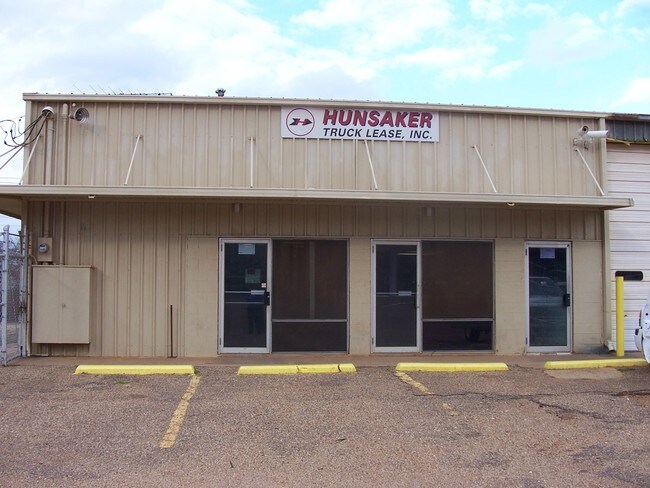
2942 N Industrial Ave, Tyler, TX 75708


Property Detail
2942 N Industrial Ave
1-00000-1062-00-014010
ABST A1062 H WALLTRACT 14A,14C
Warehouse
Smith
B and X Area of moderate flood hazard, usually the area between the limits of the 100-year and 500-year floods.
Texas
2025
7.76 AC
2025
Tyler
000300
Other Market Areas
11,680 SF
Tyler, TX
NEARBY LISTINGS FOR SALE OR LEASE
DEMOGRAPHICS near 2942 N Industrial Ave
1 mile
3 mile
5 mile
2025 Total Population
1,885
29,707
72,646
2030 Population
1,974
31,490
76,716
Pop Growth 2025-2030
+ 4.72%
+ 6.00%
+ 5.60%
Average Age
34
35
36
2025 Total Households
605
9,470
25,317
HH Growth 2025-2030
+ 4.30%
+ 5.65%
+ 5.21%
Median Household Inc
$71,326
$51,734
$55,835
Avg Household Size
3.00
2.80
2.60
2025 Avg HH Vehicles
2.00
2.00
2.00
Median Home Value
$94,766
$91,160
$149,167
Median Year Built
1966
1968
1966
Nearby Places
Map Layers
Map Styles
 Street
 Aerial
Layers
 Traffic
 Biking
Places
Listings with unknown addresses are not visible on the map
- Restaurants
- Banks
- Shops
- Fitness
- Groceries
PUBLIC TRANSPORTATION
AIRPORT
Tyler Pounds Regional
Drive
Walk
Distance
Tyler Pounds Regional
22 min
11.5 mi
SALE & LEASE HISTORY
LISTING DATE
SALE/LEASE

Feb 20, 2025
For Sale
Nearby Properties
Address
Land Use
TOTAL SIZE
Lot Size
Zoning
Address
Land Use
TOTAL SIZE
Lot Size
Zoning
14,000 SF
144.13 AC
M2
Address
Land Use
TOTAL SIZE
Lot Size
Zoning
12.64 AC
Address
Land Use
TOTAL SIZE
Lot Size
Zoning
Address
Land Use
TOTAL SIZE
Lot Size
Zoning
Address
Land Use
TOTAL SIZE
Lot Size
Zoning
Address
Land Use
TOTAL SIZE
Lot Size
Zoning
Address
Land Use
TOTAL SIZE
Lot Size
Zoning
1.78 AC
DBAC
Address
Land Use
TOTAL SIZE
Lot Size
Zoning
Address
Land Use
TOTAL SIZE
Lot Size
Zoning
238,658 SF
1.97 AC
INT
Address
Land Use
TOTAL SIZE
Lot Size
Zoning
2.40 AC
Address
Land Use
TOTAL SIZE
Lot Size
Zoning
Address
Land Use
TOTAL SIZE
Lot Size
Zoning
12,810 SF
12.07 AC
R1A
Address
Land Use
TOTAL SIZE
Lot Size
Zoning
111,750 SF
26 AC
Address
Land Use
TOTAL SIZE
Lot Size
Zoning
207,919 SF
1.90 AC
DBAC
Address
Land Use
TOTAL SIZE
Lot Size
Zoning
Address
Land Use
TOTAL SIZE
Lot Size
Zoning
83,450 SF
Address
Land Use
TOTAL SIZE
Lot Size
Zoning
1.54 AC
Address
Land Use
TOTAL SIZE
Lot Size
Zoning
25.54 AC
INT
Address
Land Use
TOTAL SIZE
Lot Size
Zoning
181,260 SF
2.06 AC
DBAC
Address
Land Use
TOTAL SIZE
Lot Size
Zoning
129,070 SF
3.75 AC
Address
Land Use
TOTAL SIZE
Lot Size
Zoning
8,800 SF
2.17 AC
DBAC
Address
Land Use
TOTAL SIZE
Lot Size
Zoning
47,996 SF
3.66 AC
Address
Land Use
TOTAL SIZE
Lot Size
Zoning
184,670 SF
18.22 AC
Address
Land Use
TOTAL SIZE
Lot Size
Zoning
Address
Land Use
TOTAL SIZE
Lot Size
Zoning
1,714 SF
13.36 AC
RMF
Address
Land Use
TOTAL SIZE
Lot Size
Zoning
520,081 SF
24.62 AC
M2
Address
Land Use
TOTAL SIZE
Lot Size
Zoning
2.38 AC
DBAC
Address
Land Use
TOTAL SIZE
Lot Size
Zoning
3,222 SF
7.43 AC
RMF
Address
Land Use
TOTAL SIZE
Lot Size
Zoning
Address
Land Use
TOTAL SIZE
Lot Size
Zoning
16,800 SF
12.99 AC
RMF
The World's #1 Commercial Real Estate Marketplace
Connect with us
© 2026 CoStar Group
The information above has been obtained from sources believed reliable. While we do not doubt its accuracy we have not verified it and make no guarantee, warranty or representation about it. It is your responsibility to independently confirm its accuracy and completeness. Any projections, opinions, assumptions, or estimates used are for example only and do not represent the current or future performance of the property. The value of this transaction to you depends on tax and other factors which should be evaluated by your tax, financial, and legal advisors. You and your advisors should conduct a careful, independent investigation of the property to determine to your satisfaction the suitability of the property for your needs.