Property Record
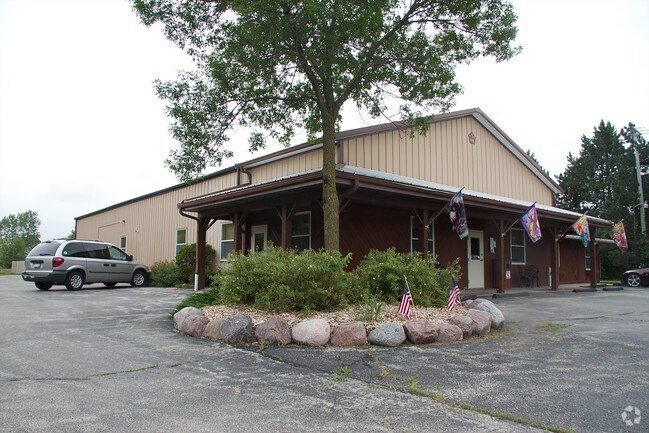
2962 State Road 83, Hartford, WI 53027


NEARBY LISTINGS FOR SALE OR LEASE
Property Detail
2962 State Road 83
T6-0718001
PT OF E1/2 SW SW DOC 1589189+1591315 (HWY V1256 P548)
Commercialnec
Washington
X
Wisconsin
55131C0217E
2.83 AC
2024
Washington West
2024
Milwaukee/Madison
440104
Milwaukee-Waukesha, WI
DEMOGRAPHICS near 2962 State Road 83
1 Mile
3 Mile
5 Mile
2024 Total Population
4,274
19,419
26,481
2029 Population
4,387
20,004
27,223
Pop Growth 2024-2029
+ 2.64%
+ 3.01%
+ 2.80%
Average Age
39
41
42
2024 Total Households
1,741
8,177
10,894
HH Growth 2024-2029
+ 2.64%
+ 3.03%
+ 2.79%
Median Household Inc
$66,392
$69,376
$73,790
Avg Household Size
2.40
2.30
2.40
2024 Avg HH Vehicles
2.00
2.00
2.00
Median Home Value
$225,641
$246,690
$266,402
Median Year Built
1985
1990
1990
Nearby Places
Map Layers
Map Styles
 Street
 Aerial
- Restaurants
- Banks
- Shops
- Fitness
- Groceries
PUBLIC TRANSPORTATION
AIRPORT
General Mitchell International
DRIVE
WALK
Distance
General Mitchell International
64 min
45.1 mi
Freight Ports
Port Milwaukee
DRIVE
WALK
Distance
Port Milwaukee
58 min
41.3 mi
SALE & LEASE HISTORY
LISTING DATE
SALE/LEASE

May 08, 2023
For Sale
Nearby Properties
Address
Land Use
TOTAL SIZE
Lot Size
Zoning
Address
Land Use
TOTAL SIZE
Lot Size
Zoning
49,735 SF
9.99 AC
Address
Land Use
TOTAL SIZE
Lot Size
Zoning
13,314 SF
16.91 AC
Address
Land Use
TOTAL SIZE
Lot Size
Zoning
70,221 SF
7.09 AC
Address
Land Use
TOTAL SIZE
Lot Size
Zoning
94,819 SF
0.18 AC
Address
Land Use
TOTAL SIZE
Lot Size
Zoning
22,814 SF
8.85 AC
Address
Land Use
TOTAL SIZE
Lot Size
Zoning
20.24 AC
Address
Land Use
TOTAL SIZE
Lot Size
Zoning
11.63 AC
Address
Land Use
TOTAL SIZE
Lot Size
Zoning
184,928 SF
22.37 AC
Address
Land Use
TOTAL SIZE
Lot Size
Zoning
15,408 SF
9.39 AC
Address
Land Use
TOTAL SIZE
Lot Size
Zoning
57,888 SF
2.45 AC
Address
Land Use
TOTAL SIZE
Lot Size
Zoning
37,038 SF
1.02 AC
Address
Land Use
TOTAL SIZE
Lot Size
Zoning
8.10 AC
Address
Land Use
TOTAL SIZE
Lot Size
Zoning
6,620 SF
1.26 AC
Address
Land Use
TOTAL SIZE
Lot Size
Zoning
13.14 AC
Address
Land Use
TOTAL SIZE
Lot Size
Zoning
26,340 SF
5.01 AC
Address
Land Use
TOTAL SIZE
Lot Size
Zoning
5.03 AC
Address
Land Use
TOTAL SIZE
Lot Size
Zoning
5.09 AC
Address
Land Use
TOTAL SIZE
Lot Size
Zoning
36,686 SF
1.86 AC
Address
Land Use
TOTAL SIZE
Lot Size
Zoning
63,705 SF
6.85 AC
Address
Land Use
TOTAL SIZE
Lot Size
Zoning
55,326 SF
1.37 AC
Address
Land Use
TOTAL SIZE
Lot Size
Zoning
25,300 SF
9.57 AC
Address
Land Use
TOTAL SIZE
Lot Size
Zoning
14,276 SF
9.02 AC
Address
Land Use
TOTAL SIZE
Lot Size
Zoning
14,015 SF
2.50 AC
Address
Land Use
TOTAL SIZE
Lot Size
Zoning
15,408 SF
5.25 AC
Address
Land Use
TOTAL SIZE
Lot Size
Zoning
11,676 SF
1.13 AC
Address
Land Use
TOTAL SIZE
Lot Size
Zoning
28,326 SF
3.27 AC
Address
Land Use
TOTAL SIZE
Lot Size
Zoning
Address
Land Use
TOTAL SIZE
Lot Size
Zoning
Address
Land Use
TOTAL SIZE
Lot Size
Zoning
10.85 AC
Address
Land Use
TOTAL SIZE
Lot Size
Zoning
7.96 AC
The World's #1 Commercial Real Estate Marketplace
Connect with us
© 2026 CoStar Group
The information above has been obtained from sources believed reliable. While we do not doubt its accuracy we have not verified it and make no guarantee, warranty or representation about it. It is your responsibility to independently confirm its accuracy and completeness. Any projections, opinions, assumptions, or estimates used are for example only and do not represent the current or future performance of the property. The value of this transaction to you depends on tax and other factors which should be evaluated by your tax, financial, and legal advisors. You and your advisors should conduct a careful, independent investigation of the property to determine to your satisfaction the suitability of the property for your needs.