Property Record
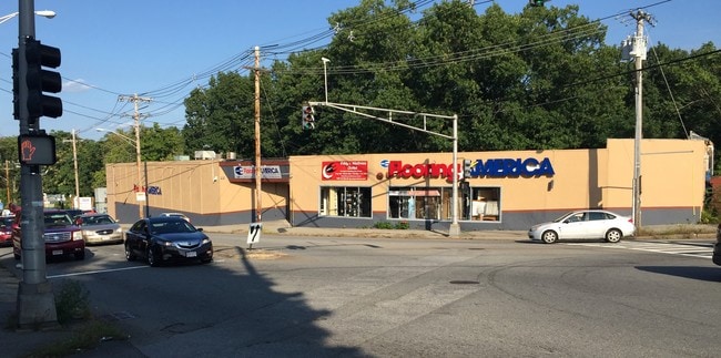
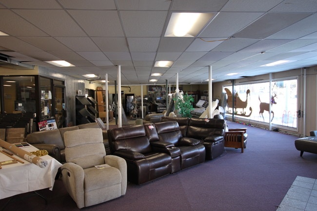
3 James St, Worcester, MA 01603

Property Detail
3 James St
WORC-000028-000004-000003-000003A
Worcester
Storebuilding
Massachusetts
BL-1
3+3a
B and X Area of moderate flood hazard, usually the area between the limits of the 100-year and 500-year floods.
0.38 AC
2025
Worcester Metro
2025
Boston
733102
Worcester, MA
18,248 SF
NEARBY LISTINGS FOR SALE OR LEASE
DEMOGRAPHICS near 3 James St
1 mile
3 mile
5 mile
2025 Total Population
10,339
93,198
193,203
2030 Population
10,430
93,987
195,544
Pop Growth 2025-2030
+ 0.88%
+ 0.85%
+ 1.21%
Average Age
41
39
39
2025 Total Households
3,982
36,289
75,018
HH Growth 2025-2030
+ 1.08%
+ 0.96%
+ 1.34%
Median Household Inc
$93,839
$66,020
$73,217
Avg Household Size
2.50
2.40
2.40
2025 Avg HH Vehicles
2.00
1.00
1.00
Median Home Value
$332,130
$371,338
$388,280
Median Year Built
1951
1948
1950
Nearby Places
Map Layers
Map Styles
 Street
 Aerial
Transit
 Traffic
 Biking
Places
Listings with unknown addresses are not visible on the map
- Restaurants
- Banks
- Shops
- Fitness
- Groceries
PUBLIC TRANSPORTATION
COMMUTER RAIL
Worcester Union Station (Lake Shore Limited - Amtrak)
Drive
Walk
Distance
Worcester Union Station (Lake Shore Limited - Amtrak)
6 min
3.5 mi
Worcester (Framingham/Worcester Line - Massachusetts Bay Transportation Authority Commuter Rail (Purple Line))
Drive
Walk
Distance
Worcester (Framingham/Worcester Line - Massachusetts Bay Transportation Authority Commuter Rail (Purple Line))
6 min
3.7 mi
AIRPORT
Worcester Regional
Drive
Walk
Distance
Worcester Regional
10 min
4.2 mi
Freight Ports
Port of Boston
Drive
Walk
Distance
Port of Boston
66 min
48.8 mi
SALE & LEASE HISTORY
LISTING DATE
SALE/LEASE

Sep 25, 2016
For Lease
Oct 05, 2017
For Lease
Oct 05, 2017
For Sale
Dec 11, 2019
For Lease
Dec 11, 2019
For Sale
Apr 30, 2019
For Sale
Nearby Properties
Address
Land Use
TOTAL SIZE
Lot Size
Zoning
Address
Land Use
TOTAL SIZE
Lot Size
Zoning
49.51 AC
IN-S
Address
Land Use
TOTAL SIZE
Lot Size
Zoning
244,486 SF
42.64 AC
RL-7
Address
Land Use
TOTAL SIZE
Lot Size
Zoning
142.98 AC
Address
Land Use
TOTAL SIZE
Lot Size
Zoning
311,604 SF
2.37 AC
MG-2
Address
Land Use
TOTAL SIZE
Lot Size
Zoning
1,760 SF
105.54 AC
ML10
Address
Land Use
TOTAL SIZE
Lot Size
Zoning
164,378 SF
21.40 AC
Address
Land Use
TOTAL SIZE
Lot Size
Zoning
177.12 AC
RL-7
Address
Land Use
TOTAL SIZE
Lot Size
Zoning
3.55 AC
RG-5
Address
Land Use
TOTAL SIZE
Lot Size
Zoning
69.46 AC
RS-7
Address
Land Use
TOTAL SIZE
Lot Size
Zoning
159,355 SF
207.62 AC
RL-7
Address
Land Use
TOTAL SIZE
Lot Size
Zoning
3.43 AC
ML10
Address
Land Use
TOTAL SIZE
Lot Size
Zoning
41.84 AC
Address
Land Use
TOTAL SIZE
Lot Size
Zoning
643,250 SF
35.17 AC
RL-7
Address
Land Use
TOTAL SIZE
Lot Size
Zoning
175,200 SF
2.26 AC
BL-1
Address
Land Use
TOTAL SIZE
Lot Size
Zoning
36.67 AC
Address
Land Use
TOTAL SIZE
Lot Size
Zoning
2.78 AC
MG-2
Address
Land Use
TOTAL SIZE
Lot Size
Zoning
188,980 SF
20 AC
RL-7
Address
Land Use
TOTAL SIZE
Lot Size
Zoning
222,474 SF
22.75 AC
MG-1
Address
Land Use
TOTAL SIZE
Lot Size
Zoning
279,977 SF
17.80 AC
Address
Land Use
TOTAL SIZE
Lot Size
Zoning
200 SF
50.14 AC
MG-2
Address
Land Use
TOTAL SIZE
Lot Size
Zoning
10.70 AC
RS-7
Address
Land Use
TOTAL SIZE
Lot Size
Zoning
14.66 AC
BG-2
Address
Land Use
TOTAL SIZE
Lot Size
Zoning
153,745 SF
10.99 AC
MG-2
Address
Land Use
TOTAL SIZE
Lot Size
Zoning
251,549 SF
0.27 AC
BG-3
Address
Land Use
TOTAL SIZE
Lot Size
Zoning
11 AC
RS-7
Address
Land Use
TOTAL SIZE
Lot Size
Zoning
92,604 SF
1 AC
Address
Land Use
TOTAL SIZE
Lot Size
Zoning
16.06 AC
RS-7
Address
Land Use
TOTAL SIZE
Lot Size
Zoning
210,001 SF
13.14 AC
Address
Land Use
TOTAL SIZE
Lot Size
Zoning
70,400 SF
17.10 AC
Address
Land Use
TOTAL SIZE
Lot Size
Zoning
8.77 AC
BL-1
The World's #1 Commercial Real Estate Marketplace
Connect with us
© 2026 CoStar Group
The information above has been obtained from sources believed reliable. While we do not doubt its accuracy we have not verified it and make no guarantee, warranty or representation about it. It is your responsibility to independently confirm its accuracy and completeness. Any projections, opinions, assumptions, or estimates used are for example only and do not represent the current or future performance of the property. The value of this transaction to you depends on tax and other factors which should be evaluated by your tax, financial, and legal advisors. You and your advisors should conduct a careful, independent investigation of the property to determine to your satisfaction the suitability of the property for your needs.