Property Record
3001 Menchaca Rd, Austin, TX 78704
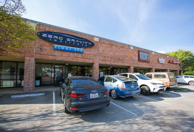


Property Detail
3001 Menchaca Rd
Austin-Round Rock-San Marcos, TX
LOT 1 CORNERS III LOT 1 CENISA ADDN
305363
TRAVIS
Stripcommercialcenter
Texas
B and X Area of moderate flood hazard, usually the area between the limits of the 100-year and 500-year floods.
1
2025
1.61 AC
2025
South
001307
Austin
18,096 SF
NEARBY LISTINGS FOR SALE OR LEASE
DEMOGRAPHICS near 3001 Menchaca Rd
1 mile
3 mile
5 mile
2025 Total Population
18,632
128,581
365,748
2030 Population
19,570
135,076
383,448
Pop Growth 2025-2030
+ 5.03%
+ 5.05%
+ 4.84%
Average Age
37
39
36
2025 Total Households
10,164
66,058
165,792
HH Growth 2025-2030
+ 5.63%
+ 5.75%
+ 5.71%
Median Household Inc
$89,513
$107,517
$90,592
Avg Household Size
1.80
1.80
2.00
2025 Avg HH Vehicles
1.00
2.00
2.00
Median Home Value
$841,174
$820,880
$720,565
Median Year Built
1988
1994
1995
Nearby Places
Map Layers
Map Styles
 Street
 Aerial
Transit
 Traffic
 Biking
Places
Listings with unknown addresses are not visible on the map
- Restaurants
- Banks
- Shops
- Fitness
- Groceries
PUBLIC TRANSPORTATION
COMMUTER RAIL
Drive
Walk
Distance
8 min
3.0 mi
AIRPORT
Austin-Bergstrom International
Drive
Walk
Distance
Austin-Bergstrom International
24 min
11.3 mi
SALE & LEASE HISTORY
LISTING DATE
SALE/LEASE

Jul 07, 2017
For Lease
Jan 23, 2018
For Lease
Nearby Properties
Address
Land Use
TOTAL SIZE
Lot Size
Zoning
Address
Land Use
TOTAL SIZE
Lot Size
Zoning
20,550 SF
14.15 AC
Address
Land Use
TOTAL SIZE
Lot Size
Zoning
262 SF
65.06 AC
Address
Land Use
TOTAL SIZE
Lot Size
Zoning
1,156,135 SF
1.74 AC
Address
Land Use
TOTAL SIZE
Lot Size
Zoning
1,003,475 SF
1.84 AC
Address
Land Use
TOTAL SIZE
Lot Size
Zoning
786,600 SF
1.27 AC
Address
Land Use
TOTAL SIZE
Lot Size
Zoning
9,034 SF
28.69 AC
Address
Land Use
TOTAL SIZE
Lot Size
Zoning
709,300 SF
0.94 AC
Address
Land Use
TOTAL SIZE
Lot Size
Zoning
498,684 SF
61.86 AC
Address
Land Use
TOTAL SIZE
Lot Size
Zoning
47.20 AC
Address
Land Use
TOTAL SIZE
Lot Size
Zoning
1,400,000 SF
3.07 AC
Address
Land Use
TOTAL SIZE
Lot Size
Zoning
35,041 SF
28.65 AC
Address
Land Use
TOTAL SIZE
Lot Size
Zoning
513,567 SF
1.78 AC
Address
Land Use
TOTAL SIZE
Lot Size
Zoning
500,511 SF
0.82 AC
Address
Land Use
TOTAL SIZE
Lot Size
Zoning
24.06 AC
Address
Land Use
TOTAL SIZE
Lot Size
Zoning
826,478 SF
1.75 AC
Address
Land Use
TOTAL SIZE
Lot Size
Zoning
341,096 SF
0.31 AC
Address
Land Use
TOTAL SIZE
Lot Size
Zoning
546,000 SF
1.27 AC
Address
Land Use
TOTAL SIZE
Lot Size
Zoning
533,917 SF
0.81 AC
Address
Land Use
TOTAL SIZE
Lot Size
Zoning
597,500 SF
0.99 AC
Address
Land Use
TOTAL SIZE
Lot Size
Zoning
337,855 SF
43.51 AC
Address
Land Use
TOTAL SIZE
Lot Size
Zoning
400,000 SF
0.27 AC
Address
Land Use
TOTAL SIZE
Lot Size
Zoning
Address
Land Use
TOTAL SIZE
Lot Size
Zoning
6.12 AC
Address
Land Use
TOTAL SIZE
Lot Size
Zoning
483,917 SF
1.60 AC
Address
Land Use
TOTAL SIZE
Lot Size
Zoning
27.45 AC
Address
Land Use
TOTAL SIZE
Lot Size
Zoning
627,984 SF
0.81 AC
Address
Land Use
TOTAL SIZE
Lot Size
Zoning
219,543 SF
0.22 AC
Address
Land Use
TOTAL SIZE
Lot Size
Zoning
357,080 SF
0.41 AC
Address
Land Use
TOTAL SIZE
Lot Size
Zoning
364,532 SF
0.41 AC
Address
Land Use
TOTAL SIZE
Lot Size
Zoning
530,102 SF
1.10 AC
The World's #1 Commercial Real Estate Marketplace
Connect with us
© 2026 CoStar Group
The information above has been obtained from sources believed reliable. While we do not doubt its accuracy we have not verified it and make no guarantee, warranty or representation about it. It is your responsibility to independently confirm its accuracy and completeness. Any projections, opinions, assumptions, or estimates used are for example only and do not represent the current or future performance of the property. The value of this transaction to you depends on tax and other factors which should be evaluated by your tax, financial, and legal advisors. You and your advisors should conduct a careful, independent investigation of the property to determine to your satisfaction the suitability of the property for your needs.