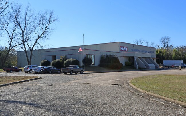
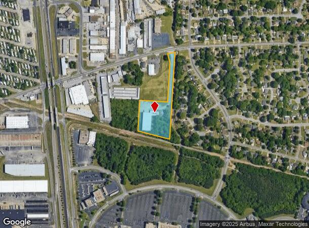
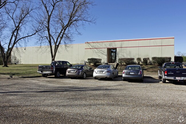
Property Record
301 Hawk Pl, Montgomery, AL 36117
NEARBY LISTINGS FOR SALE OR LEASE
Property Detail
301 Hawk Pl
Montgomery, AL
Alastar Food 2
10-01-01-4-005-003.002
1001014005003002
Publicstorage
Montgomery
X
Alabama
01101C0114J
2
2025
5.20 AC
2025
North Montgomery
005402
Montgomery
31,398 SF
DEMOGRAPHICS near 301 Hawk Pl
1 Mile
3 Mile
5 Mile
2024 Total Population
8,479
41,259
105,986
2029 Population
8,239
39,785
102,567
Pop Growth 2024-2029
(2.83%)
(3.57%)
(3.23%)
Average Age
36
38
38
2024 Total Households
3,591
17,931
45,544
HH Growth 2024-2029
(2.56%)
(3.60%)
(3.35%)
Median Household Inc
$47,695
$55,627
$53,990
Avg Household Size
2.30
2.20
2.30
2024 Avg HH Vehicles
2.00
2.00
2.00
Median Home Value
$108,819
$150,059
$159,434
Median Year Built
1978
1983
1981
Nearby Places
Map Layers
Map Styles
 Street
 Aerial
- Restaurants
- Banks
- Shops
- Fitness
- Groceries
PUBLIC TRANSPORTATION
AIRPORT
Montgomery Regional (Dannelly Field)
DRIVE
WALK
Distance
Montgomery Regional (Dannelly Field)
23 min
15.9 mi
Freight Ports
Port of Panama City
DRIVE
WALK
Distance
Port of Panama City
237 min
187.6 mi
Nearby Properties
Address
Land Use
TOTAL SIZE
Lot Size
Zoning
Address
Land Use
TOTAL SIZE
Lot Size
Zoning
117,161 SF
12.07 AC
INST
Address
Land Use
TOTAL SIZE
Lot Size
Zoning
4,836 SF
16.25 AC
R-75-M
Address
Land Use
TOTAL SIZE
Lot Size
Zoning
76,996 SF
15.51 AC
B-3
Address
Land Use
TOTAL SIZE
Lot Size
Zoning
385,644 SF
26.60 AC
B-2
Address
Land Use
TOTAL SIZE
Lot Size
Zoning
31,205 SF
59 AC
INST
Address
Land Use
TOTAL SIZE
Lot Size
Zoning
2,885 SF
14 AC
R-75-M
Address
Land Use
TOTAL SIZE
Lot Size
Zoning
92,200 SF
9.74 AC
O-1
Address
Land Use
TOTAL SIZE
Lot Size
Zoning
7,040 SF
11.70 AC
R-65-M
Address
Land Use
TOTAL SIZE
Lot Size
Zoning
24,360 SF
26.59 AC
R-65-M
Address
Land Use
TOTAL SIZE
Lot Size
Zoning
224,132 SF
26.57 AC
AGR-2
Address
Land Use
TOTAL SIZE
Lot Size
Zoning
223,000 SF
26 AC
O-1
Address
Land Use
TOTAL SIZE
Lot Size
Zoning
1,964 SF
13.40 AC
R-75-M
Address
Land Use
TOTAL SIZE
Lot Size
Zoning
5,606 SF
21 AC
R-75-M
Address
Land Use
TOTAL SIZE
Lot Size
Zoning
591,904 SF
26 AC
M-1
Address
Land Use
TOTAL SIZE
Lot Size
Zoning
108,176 SF
4.27 AC
B-1-B
Address
Land Use
TOTAL SIZE
Lot Size
Zoning
154,375 SF
21.19 AC
B-3
Address
Land Use
TOTAL SIZE
Lot Size
Zoning
75,510 SF
10.97 AC
B-2
Address
Land Use
TOTAL SIZE
Lot Size
Zoning
2,679 SF
10.77 AC
R-75-M
Address
Land Use
TOTAL SIZE
Lot Size
Zoning
82,638 SF
O-1
Address
Land Use
TOTAL SIZE
Lot Size
Zoning
84,764 SF
5.20 AC
B-2
Address
Land Use
TOTAL SIZE
Lot Size
Zoning
65,394 SF
13 AC
B-2
Address
Land Use
TOTAL SIZE
Lot Size
Zoning
8,697 SF
21.84 AC
R-20-T
Address
Land Use
TOTAL SIZE
Lot Size
Zoning
37,365 SF
8.64 AC
B-4
Address
Land Use
TOTAL SIZE
Lot Size
Zoning
2,397 SF
4.35 AC
R-75-M
Address
Land Use
TOTAL SIZE
Lot Size
Zoning
3,458 SF
15.34 AC
R-65-M
Address
Land Use
TOTAL SIZE
Lot Size
Zoning
2,200 SF
11.06 AC
R-75-M
Address
Land Use
TOTAL SIZE
Lot Size
Zoning
6,024 SF
17.30 AC
R-75-M
Address
Land Use
TOTAL SIZE
Lot Size
Zoning
25,809 SF
11.80 AC
B-3
Address
Land Use
TOTAL SIZE
Lot Size
Zoning
187,340 SF
22.80 AC
M-1
Address
Land Use
TOTAL SIZE
Lot Size
Zoning
5,624 SF
14.34 AC
R-75-M
The World's #1 Commercial Real Estate Marketplace
Connect with us
© 2025 CoStar Group
The information above has been obtained from sources believed reliable. While we do not doubt its accuracy we have not verified it and make no guarantee, warranty or representation about it. It is your responsibility to independently confirm its accuracy and completeness. Any projections, opinions, assumptions, or estimates used are for example only and do not represent the current or future performance of the property. The value of this transaction to you depends on tax and other factors which should be evaluated by your tax, financial, and legal advisors. You and your advisors should conduct a careful, independent investigation of the property to determine to your satisfaction the suitability of the property for your needs.