Property Record
301 Leora Ln, The Colony, TX 75056
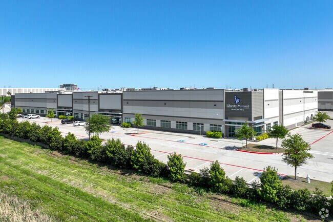

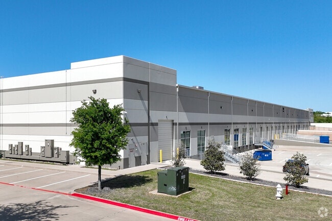
Property Detail
301 Leora Ln
Dallas-Fort Worth-Arlington, TX
CREEKVIEW 121 ADDITION BLK A LOT 1
R683489
DENTON
Commercialnec
Texas
AE The base floodplain where base flood elevations are provided. AE Zones are now used on new format FIRMs instead of A1-A30 Zones.
1
2024
28.10 AC
2025
Lewisville
021517
Dallas/Ft Worth
350,629 SF
NEARBY LISTINGS FOR SALE OR LEASE
DEMOGRAPHICS near 301 Leora Ln
1 mile
3 mile
5 mile
2024 Total Population
14,958
86,142
225,513
2029 Population
18,785
104,392
272,447
Pop Growth 2024-2029
+ 25.58%
+ 21.19%
+ 20.81%
Average Age
36
38
39
2024 Total Households
6,085
32,697
89,278
HH Growth 2024-2029
+ 25.70%
+ 21.71%
+ 21.42%
Median Household Inc
$108,510
$107,247
$100,638
Avg Household Size
2.50
2.60
2.50
2024 Avg HH Vehicles
2.00
2.00
2.00
Median Home Value
$456,815
$405,534
$401,636
Median Year Built
2011
2006
2000
Nearby Places
Map Layers
Map Styles
 Street
 Aerial
Transit
 Traffic
 Biking
Places
Listings with unknown addresses are not visible on the map
- Restaurants
- Banks
- Shops
- Fitness
- Groceries
PUBLIC TRANSPORTATION
COMMUTER RAIL
Old Town Station (A-train - Denton County Transportation Authority)
Drive
Walk
Distance
Old Town Station (A-train - Denton County Transportation Authority)
10 min
5.4 mi
Hebron Station (A-train - Denton County Transportation Authority)
Drive
Walk
Distance
Hebron Station (A-train - Denton County Transportation Authority)
11 min
6.2 mi
AIRPORT
Dallas-Fort Worth International
Drive
Walk
Distance
Dallas-Fort Worth International
21 min
16.5 mi
Dallas Love Field
Drive
Walk
Distance
Dallas Love Field
33 min
22.6 mi
Freight Ports
Port of Shreveport
Drive
Walk
Distance
Port of Shreveport
239 min
220.2 mi
SALE & LEASE HISTORY
LISTING DATE
SALE/LEASE

Sep 25, 2016
For Lease
Oct 09, 2018
For Lease
Nearby Properties
Address
Land Use
TOTAL SIZE
Lot Size
Zoning
Address
Land Use
TOTAL SIZE
Lot Size
Zoning
526,369 SF
45.84 AC
Address
Land Use
TOTAL SIZE
Lot Size
Zoning
598,569 SF
86.50 AC
Address
Land Use
TOTAL SIZE
Lot Size
Zoning
1,817,951 SF
82 AC
Address
Land Use
TOTAL SIZE
Lot Size
Zoning
578,457 SF
31.79 AC
Address
Land Use
TOTAL SIZE
Lot Size
Zoning
559,657 SF
30.49 AC
Address
Land Use
TOTAL SIZE
Lot Size
Zoning
554,780 SF
23.81 AC
Address
Land Use
TOTAL SIZE
Lot Size
Zoning
512,903 SF
18 AC
Address
Land Use
TOTAL SIZE
Lot Size
Zoning
460,403 SF
19.26 AC
Address
Land Use
TOTAL SIZE
Lot Size
Zoning
389,014 SF
20.91 AC
Address
Land Use
TOTAL SIZE
Lot Size
Zoning
448,915 SF
20.37 AC
Address
Land Use
TOTAL SIZE
Lot Size
Zoning
376,139 SF
3.58 AC
Address
Land Use
TOTAL SIZE
Lot Size
Zoning
346,269 SF
15.14 AC
Address
Land Use
TOTAL SIZE
Lot Size
Zoning
434,639 SF
16.20 AC
Address
Land Use
TOTAL SIZE
Lot Size
Zoning
343,234 SF
32.41 AC
Address
Land Use
TOTAL SIZE
Lot Size
Zoning
462,429 SF
5.70 AC
Address
Land Use
TOTAL SIZE
Lot Size
Zoning
291,446 SF
16.18 AC
Address
Land Use
TOTAL SIZE
Lot Size
Zoning
285,835 SF
15.61 AC
Address
Land Use
TOTAL SIZE
Lot Size
Zoning
424,064 SF
22.15 AC
2B
Address
Land Use
TOTAL SIZE
Lot Size
Zoning
364,000 SF
8.11 AC
Address
Land Use
TOTAL SIZE
Lot Size
Zoning
961,306 SF
44.52 AC
Address
Land Use
TOTAL SIZE
Lot Size
Zoning
97,750 SF
69.90 AC
Address
Land Use
TOTAL SIZE
Lot Size
Zoning
262,879 SF
11.97 AC
Address
Land Use
TOTAL SIZE
Lot Size
Zoning
267,413 SF
5.25 AC
Address
Land Use
TOTAL SIZE
Lot Size
Zoning
350,292 SF
7.75 AC
Address
Land Use
TOTAL SIZE
Lot Size
Zoning
303,962 SF
9.82 AC
Address
Land Use
TOTAL SIZE
Lot Size
Zoning
323,736 SF
14.98 AC
Address
Land Use
TOTAL SIZE
Lot Size
Zoning
335,257 SF
12.83 AC
Address
Land Use
TOTAL SIZE
Lot Size
Zoning
298,991 SF
15.72 AC
Address
Land Use
TOTAL SIZE
Lot Size
Zoning
270,969 SF
13.03 AC
Address
Land Use
TOTAL SIZE
Lot Size
Zoning
638,645 SF
47.87 AC
The World's #1 Commercial Real Estate Marketplace
Connect with us
© 2026 CoStar Group
The information above has been obtained from sources believed reliable. While we do not doubt its accuracy we have not verified it and make no guarantee, warranty or representation about it. It is your responsibility to independently confirm its accuracy and completeness. Any projections, opinions, assumptions, or estimates used are for example only and do not represent the current or future performance of the property. The value of this transaction to you depends on tax and other factors which should be evaluated by your tax, financial, and legal advisors. You and your advisors should conduct a careful, independent investigation of the property to determine to your satisfaction the suitability of the property for your needs.