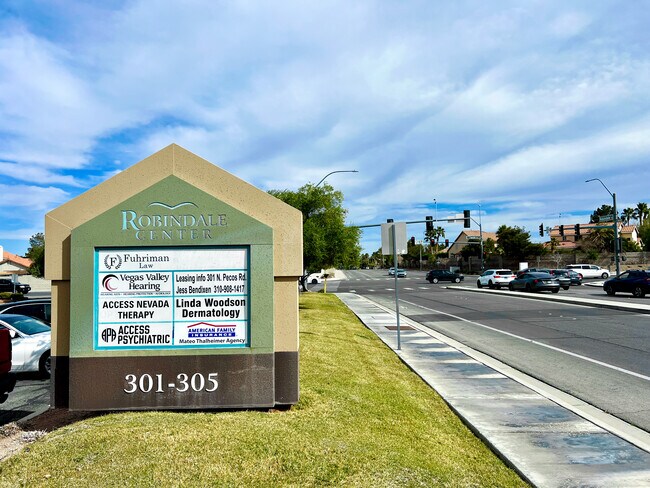
Property Record
301 N Pecos Rd, Henderson, NV 89074


Save to a Folder
{{folder.Name}}
{{folder.ListingIds.length}} Properties
{{folder.ListingIds.length}} Property
Create a New Folder
Property Detail
301 N Pecos Rd
177-12-620-005
PECOS ROAD COML CENTER PLAT BOOK 84 PAGE 32 PT LOT 1
Commercialnec
Clark
CN
Nevada
B and X Area of moderate flood hazard, usually the area between the limits of the 100-year and 500-year floods.
1
2026
0.28 AC
2026
South Las Vegas
005312
Las Vegas
8,774 SF
Las Vegas-Henderson-North Las Vegas, NV
NEARBY LISTINGS FOR SALE OR LEASE
DEMOGRAPHICS near 301 N Pecos Rd
1 mile
3 mile
5 mile
2025 Total Population
18,372
136,566
394,195
2030 Population
19,197
142,480
412,077
Pop Growth 2025-2030
+ 4.49%
+ 4.33%
+ 4.54%
Average Age
43
43
41
2025 Total Households
6,986
55,307
159,825
HH Growth 2025-2030
+ 4.52%
+ 4.34%
+ 4.59%
Median Household Inc
$93,876
$87,357
$76,856
Avg Household Size
2.60
2.40
2.40
2025 Avg HH Vehicles
2.00
2.00
2.00
Median Home Value
$486,700
$471,903
$450,477
Median Year Built
1993
1993
1995
Nearby Places
Map Layers
Map Styles
 Street
 Aerial
Layers
 Traffic
 Biking
Places
Listings with unknown addresses are not visible on the map
- Restaurants
- Banks
- Shops
- Fitness
- Groceries
PUBLIC TRANSPORTATION
AIRPORT
Harry Reid International
Drive
Walk
Distance
Harry Reid International
11 min
5.2 mi
Boulder City Municipal
Drive
Walk
Distance
Boulder City Municipal
28 min
19.1 mi
SALE & LEASE HISTORY
LISTING DATE
SALE/LEASE

Sep 24, 2016
For Lease
Sep 24, 2016
For Lease
Sep 24, 2016
For Lease
Oct 04, 2022
For Lease
Mar 26, 2018
For Lease
Jul 12, 2018
For Lease
Aug 05, 2025
For Lease
Apr 22, 2022
For Lease
Nearby Properties
Address
Land Use
TOTAL SIZE
Lot Size
Zoning
Address
Land Use
TOTAL SIZE
Lot Size
Zoning
630,906 SF
39.87 AC
CT
Address
Land Use
TOTAL SIZE
Lot Size
Zoning
44.69 AC
PF
Address
Land Use
TOTAL SIZE
Lot Size
Zoning
7,177 SF
15.88 AC
Address
Land Use
TOTAL SIZE
Lot Size
Zoning
18.08 AC
RE
Address
Land Use
TOTAL SIZE
Lot Size
Zoning
399,206 SF
22.06 AC
MD
Address
Land Use
TOTAL SIZE
Lot Size
Zoning
402,610 SF
15.51 AC
R3
Address
Land Use
TOTAL SIZE
Lot Size
Zoning
9,164 SF
22.81 AC
R3
Address
Land Use
TOTAL SIZE
Lot Size
Zoning
213,957 SF
19.68 AC
Address
Land Use
TOTAL SIZE
Lot Size
Zoning
148.64 AC
PF
Address
Land Use
TOTAL SIZE
Lot Size
Zoning
8,891 SF
11.59 AC
Address
Land Use
TOTAL SIZE
Lot Size
Zoning
61,157 SF
2.54 AC
Address
Land Use
TOTAL SIZE
Lot Size
Zoning
198.15 AC
PF
Address
Land Use
TOTAL SIZE
Lot Size
Zoning
59,421 SF
14 AC
Address
Land Use
TOTAL SIZE
Lot Size
Zoning
18.75 AC
PF
Address
Land Use
TOTAL SIZE
Lot Size
Zoning
6,295 SF
13.58 AC
R3
Address
Land Use
TOTAL SIZE
Lot Size
Zoning
17.18 AC
PS
Address
Land Use
TOTAL SIZE
Lot Size
Zoning
152.76 AC
PF
Address
Land Use
TOTAL SIZE
Lot Size
Zoning
216,315 SF
4.52 AC
Address
Land Use
TOTAL SIZE
Lot Size
Zoning
229,860 SF
25.59 AC
C2
Address
Land Use
TOTAL SIZE
Lot Size
Zoning
15.17 AC
PS
Address
Land Use
TOTAL SIZE
Lot Size
Zoning
229,309 SF
4.85 AC
Address
Land Use
TOTAL SIZE
Lot Size
Zoning
100.43 AC
PF
Address
Land Use
TOTAL SIZE
Lot Size
Zoning
266,782 SF
8.83 AC
Address
Land Use
TOTAL SIZE
Lot Size
Zoning
520 SF
3.99 AC
RE
Address
Land Use
TOTAL SIZE
Lot Size
Zoning
303,540 SF
4.99 AC
Address
Land Use
TOTAL SIZE
Lot Size
Zoning
213,048 SF
13.60 AC
Address
Land Use
TOTAL SIZE
Lot Size
Zoning
23.76 AC
PS
Address
Land Use
TOTAL SIZE
Lot Size
Zoning
Address
Land Use
TOTAL SIZE
Lot Size
Zoning
334,698 SF
18.44 AC
MD
Address
Land Use
TOTAL SIZE
Lot Size
Zoning
3,040 SF
16.76 AC
R4
The World's #1 Commercial Real Estate Marketplace
Connect with us
© 2026 CoStar Group
The information above has been obtained from sources believed reliable. While we do not doubt its accuracy we have not verified it and make no guarantee, warranty or representation about it. It is your responsibility to independently confirm its accuracy and completeness. Any projections, opinions, assumptions, or estimates used are for example only and do not represent the current or future performance of the property. The value of this transaction to you depends on tax and other factors which should be evaluated by your tax, financial, and legal advisors. You and your advisors should conduct a careful, independent investigation of the property to determine to your satisfaction the suitability of the property for your needs.