Property Record
3010 Latrobe Dr, Charlotte, NC 28211


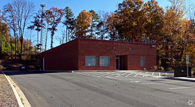
Property Detail
3010 Latrobe Dr
157-063-84
L1B M26-78
Industrialgeneral
Mecklenburg
I-2
North Carolina
B and X Area of moderate flood hazard, usually the area between the limits of the 100-year and 500-year floods.
1b
2024
1 AC
2025
East
002300
Charlotte
7,270 SF
Charlotte-Concord-Gastonia, NC-SC
NEARBY LISTINGS FOR SALE OR LEASE
DEMOGRAPHICS near 3010 Latrobe Dr
1 mile
3 mile
5 mile
2025 Total Population
13,164
120,655
333,327
2030 Population
14,306
130,960
363,256
Pop Growth 2025-2030
+ 8.68%
+ 8.54%
+ 8.98%
Average Age
36
37
37
2025 Total Households
5,995
55,171
151,643
HH Growth 2025-2030
+ 8.76%
+ 8.79%
+ 9.23%
Median Household Inc
$64,970
$95,710
$83,263
Avg Household Size
2.10
2.10
2.10
2025 Avg HH Vehicles
1.00
2.00
2.00
Median Home Value
$631,579
$747,566
$570,272
Median Year Built
1975
1979
1986
Nearby Places
Map Layers
Map Styles
 Street
 Aerial
Layers
 Traffic
 Biking
Places
Listings with unknown addresses are not visible on the map
- Restaurants
- Banks
- Shops
- Fitness
- Groceries
PUBLIC TRANSPORTATION
COMMUTER RAIL
Drive
Walk
Distance
12 min
6.3 mi
AIRPORT
Charlotte/Douglas International
Drive
Walk
Distance
Charlotte/Douglas International
26 min
13.5 mi
Concord-Padgett Regional
Drive
Walk
Distance
Concord-Padgett Regional
29 min
17.5 mi
Nearby Properties
Address
Land Use
TOTAL SIZE
Lot Size
Zoning
Address
Land Use
TOTAL SIZE
Lot Size
Zoning
3,286,640 SF
55.70 AC
O6CD
Address
Land Use
TOTAL SIZE
Lot Size
Zoning
780,000 SF
7.69 AC
UMUD-O
Address
Land Use
TOTAL SIZE
Lot Size
Zoning
1,250,218 SF
17.75 AC
O2
Address
Land Use
TOTAL SIZE
Lot Size
Zoning
852,355 SF
16.72 AC
MUDDO
Address
Land Use
TOTAL SIZE
Lot Size
Zoning
1,017,564 SF
13.91 AC
O2
Address
Land Use
TOTAL SIZE
Lot Size
Zoning
894,108 SF
4.52 AC
UMUDO
Address
Land Use
TOTAL SIZE
Lot Size
Zoning
944,863 SF
3.58 AC
UMUD
Address
Land Use
TOTAL SIZE
Lot Size
Zoning
864,694 SF
11.07 AC
MUDDO
Address
Land Use
TOTAL SIZE
Lot Size
Zoning
645,212 SF
3.76 AC
UMUD
Address
Land Use
TOTAL SIZE
Lot Size
Zoning
588,300 SF
1.45 AC
Address
Land Use
TOTAL SIZE
Lot Size
Zoning
768,780 SF
6.84 AC
UMUDO
Address
Land Use
TOTAL SIZE
Lot Size
Zoning
729,709 SF
10.67 AC
B2
Address
Land Use
TOTAL SIZE
Lot Size
Zoning
690,862 SF
136.80 AC
R17MF
Address
Land Use
TOTAL SIZE
Lot Size
Zoning
447,803 SF
0.27 AC
Address
Land Use
TOTAL SIZE
Lot Size
Zoning
603,986 SF
1.47 AC
B1
Address
Land Use
TOTAL SIZE
Lot Size
Zoning
831,732 SF
24.50 AC
R3
Address
Land Use
TOTAL SIZE
Lot Size
Zoning
606,594 SF
3.45 AC
MUDDO
Address
Land Use
TOTAL SIZE
Lot Size
Zoning
410,964 SF
0.58 AC
UMUDO
Address
Land Use
TOTAL SIZE
Lot Size
Zoning
534,085 SF
0.85 AC
MUDDO
Address
Land Use
TOTAL SIZE
Lot Size
Zoning
429,728 SF
1.08 AC
MUDDO
Address
Land Use
TOTAL SIZE
Lot Size
Zoning
533,477 SF
3.15 AC
I2
Address
Land Use
TOTAL SIZE
Lot Size
Zoning
590,973 SF
6.59 AC
MUDDCD
Address
Land Use
TOTAL SIZE
Lot Size
Zoning
501,350 SF
6.82 AC
Address
Land Use
TOTAL SIZE
Lot Size
Zoning
586,989 SF
6.50 AC
Address
Land Use
TOTAL SIZE
Lot Size
Zoning
499,729 SF
3.90 AC
I2
Address
Land Use
TOTAL SIZE
Lot Size
Zoning
504,845 SF
2.64 AC
UMUD
Address
Land Use
TOTAL SIZE
Lot Size
Zoning
678,293 SF
1.47 AC
UMUD
Address
Land Use
TOTAL SIZE
Lot Size
Zoning
411,129 SF
2.44 AC
B2
Address
Land Use
TOTAL SIZE
Lot Size
Zoning
386,012 SF
2.67 AC
UMUD
Address
Land Use
TOTAL SIZE
Lot Size
Zoning
440,772 SF
3.47 AC
The World's #1 Commercial Real Estate Marketplace
Connect with us
© 2026 CoStar Group
The information above has been obtained from sources believed reliable. While we do not doubt its accuracy we have not verified it and make no guarantee, warranty or representation about it. It is your responsibility to independently confirm its accuracy and completeness. Any projections, opinions, assumptions, or estimates used are for example only and do not represent the current or future performance of the property. The value of this transaction to you depends on tax and other factors which should be evaluated by your tax, financial, and legal advisors. You and your advisors should conduct a careful, independent investigation of the property to determine to your satisfaction the suitability of the property for your needs.