Property Record
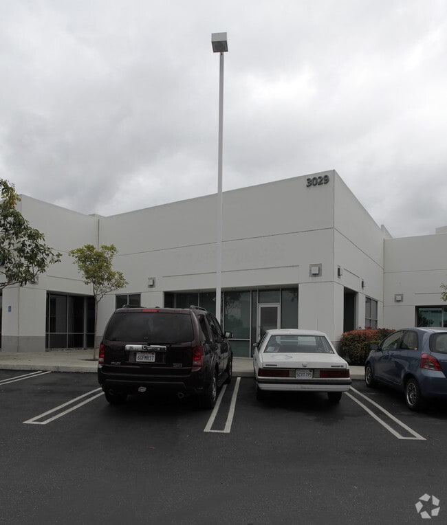
3029 Edinger Ave, Tustin, CA 92780


NEARBY LISTINGS FOR SALE OR LEASE
Property Detail
3029 Edinger Ave
Anaheim-Santa Ana-Irvine, CA
Map 97-164
434-341-08
P BK 306 PG 34 PAR 4
Industrialgeneral
Orange
X
California
06059C0283J
4
2024
0.06 AC
2025
Tustin
075518
Orange County (California)
DEMOGRAPHICS near 3029 Edinger Ave
1 mile
3 mile
5 mile
2024 Total Population
16,050
204,824
527,432
2029 Population
15,783
202,460
522,413
Pop Growth 2024-2029
(1.66%)
(1.15%)
(0.95%)
Average Age
38
38
37
2024 Total Households
5,192
72,997
175,027
HH Growth 2024-2029
(1.89%)
(1.26%)
(0.97%)
Median Household Inc
$145,485
$107,538
$103,713
Avg Household Size
3.00
2.70
2.90
2024 Avg HH Vehicles
2.00
2.00
2.00
Median Home Value
$916,946
$868,689
$884,264
Median Year Built
1994
1985
1986
Nearby Places
Map Layers
Map Styles
 Street
 Aerial
Transit
 Traffic
 Biking
Places
Listings with unknown addresses are not visible on the map
- Restaurants
- Banks
- Shops
- Fitness
- Groceries
PUBLIC TRANSPORTATION
TRANSIT/SUBWAY
Tustin (Inland Empire-Orange County Line - Southern California Regional Rail Authority (Metrolink), Orange County Line - Southern California Regional Rail Authority (Metrolink))
Drive
Walk
Distance
Tustin (Inland Empire-Orange County Line - Southern California Regional Rail Authority (Metrolink), Orange County Line - Southern California Regional Rail Authority (Metrolink))
1 min
2 min
0.1 mi
COMMUTER RAIL
Tustin (Inland Empire-Orange County Line - Southern California Regional Rail Authority (Metrolink), Orange County Line - Southern California Regional Rail Authority (Metrolink))
Drive
Walk
Distance
Tustin (Inland Empire-Orange County Line - Southern California Regional Rail Authority (Metrolink), Orange County Line - Southern California Regional Rail Authority (Metrolink))
1 min
2 min
0.1 mi
Santa Ana (Inland Empire-Orange County Line - Southern California Regional Rail Authority (Metrolink), Orange County Line - Southern California Regional Rail Authority (Metrolink))
Drive
Walk
Distance
Santa Ana (Inland Empire-Orange County Line - Southern California Regional Rail Authority (Metrolink), Orange County Line - Southern California Regional Rail Authority (Metrolink))
10 min
5.7 mi
AIRPORT
John Wayne/Orange County
Drive
Walk
Distance
John Wayne/Orange County
10 min
6.2 mi
Long Beach (Daugherty Field)
Drive
Walk
Distance
Long Beach (Daugherty Field)
33 min
26.3 mi
Ontario International
Drive
Walk
Distance
Ontario International
47 min
34.3 mi
Freight Ports
Port of Long Beach
Drive
Walk
Distance
Port of Long Beach
38 min
25.8 mi
Nearby Properties
Address
Land Use
TOTAL SIZE
Lot Size
Zoning
Address
Land Use
TOTAL SIZE
Lot Size
Zoning
28.01 AC
Address
Land Use
TOTAL SIZE
Lot Size
Zoning
15.99 AC
Address
Land Use
TOTAL SIZE
Lot Size
Zoning
5.11 AC
Address
Land Use
TOTAL SIZE
Lot Size
Zoning
21.56 AC
Address
Land Use
TOTAL SIZE
Lot Size
Zoning
9.44 AC
Address
Land Use
TOTAL SIZE
Lot Size
Zoning
24,680 SF
3.63 AC
Address
Land Use
TOTAL SIZE
Lot Size
Zoning
9.27 AC
Address
Land Use
TOTAL SIZE
Lot Size
Zoning
9.60 AC
Address
Land Use
TOTAL SIZE
Lot Size
Zoning
4.29 AC
Address
Land Use
TOTAL SIZE
Lot Size
Zoning
Address
Land Use
TOTAL SIZE
Lot Size
Zoning
7.42 AC
Address
Land Use
TOTAL SIZE
Lot Size
Zoning
8.95 AC
Address
Land Use
TOTAL SIZE
Lot Size
Zoning
4.05 AC
Address
Land Use
TOTAL SIZE
Lot Size
Zoning
4.69 AC
Address
Land Use
TOTAL SIZE
Lot Size
Zoning
Address
Land Use
TOTAL SIZE
Lot Size
Zoning
21.73 AC
Address
Land Use
TOTAL SIZE
Lot Size
Zoning
Address
Land Use
TOTAL SIZE
Lot Size
Zoning
1.62 AC
Address
Land Use
TOTAL SIZE
Lot Size
Zoning
Address
Land Use
TOTAL SIZE
Lot Size
Zoning
5.21 AC
Address
Land Use
TOTAL SIZE
Lot Size
Zoning
19,310 SF
3.94 AC
M
Address
Land Use
TOTAL SIZE
Lot Size
Zoning
16,092 SF
5.97 AC
IND
Address
Land Use
TOTAL SIZE
Lot Size
Zoning
3.61 AC
Address
Land Use
TOTAL SIZE
Lot Size
Zoning
6.67 AC
Address
Land Use
TOTAL SIZE
Lot Size
Zoning
3.16 AC
Address
Land Use
TOTAL SIZE
Lot Size
Zoning
3.15 AC
Address
Land Use
TOTAL SIZE
Lot Size
Zoning
3.34 AC
Address
Land Use
TOTAL SIZE
Lot Size
Zoning
5.72 AC
Address
Land Use
TOTAL SIZE
Lot Size
Zoning
3.56 AC
Address
Land Use
TOTAL SIZE
Lot Size
Zoning
4.85 AC
The World's #1 Commercial Real Estate Marketplace
Connect with us
© 2026 CoStar Group
The information above has been obtained from sources believed reliable. While we do not doubt its accuracy we have not verified it and make no guarantee, warranty or representation about it. It is your responsibility to independently confirm its accuracy and completeness. Any projections, opinions, assumptions, or estimates used are for example only and do not represent the current or future performance of the property. The value of this transaction to you depends on tax and other factors which should be evaluated by your tax, financial, and legal advisors. You and your advisors should conduct a careful, independent investigation of the property to determine to your satisfaction the suitability of the property for your needs.