Property Record
3049 N Post Rd, Indianapolis, IN 46226


Save to a Folder
{{folder.Name}}
{{folder.ListingIds.length}} Properties
{{folder.ListingIds.length}} Property
Create a New Folder
Property Detail
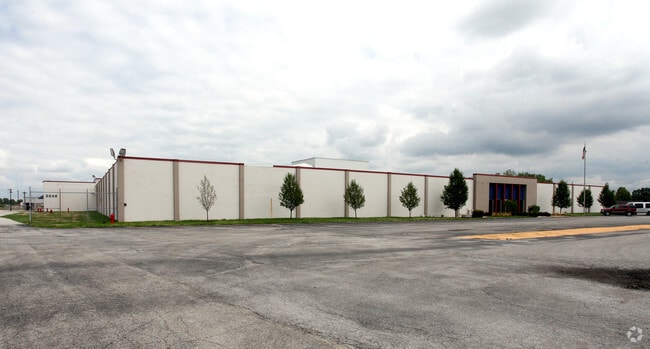
3049 N Post Rd
49-08-20-107-002.000-700
PT SW 1/4 SW 1/4 S20 T16 R5 BEG 674.7FT N & 55.38FT E OF SW COR NE 1303.12 FT S 969.10FT W 255FT N25FT W 899.4FT NW 630.27 FT TO BEG 22.768AC
Lightindustrial
MARION
ZO01
Indiana
B and X Area of moderate flood hazard, usually the area between the limits of the 100-year and 500-year floods.
22.77 AC
2024
Washington Square
2025
Indianapolis
360402
Indianapolis-Carmel-Greenwood, IN
250,372 SF
NEARBY LISTINGS FOR SALE OR LEASE
DEMOGRAPHICS near 3049 N Post Rd
1 mile
3 mile
5 mile
2025 Total Population
8,512
92,888
188,388
2030 Population
8,501
93,540
191,023
Pop Growth 2025-2030
(0.13%)
+ 0.70%
+ 1.40%
Average Age
35
36
37
2025 Total Households
3,128
35,206
74,186
HH Growth 2025-2030
(0.22%)
+ 0.68%
+ 1.42%
Median Household Inc
$53,726
$51,755
$60,258
Avg Household Size
2.60
2.60
2.50
2025 Avg HH Vehicles
2.00
1.00
2.00
Median Home Value
$148,003
$162,900
$200,193
Median Year Built
1967
1971
1969
Nearby Places
Map Layers
Map Styles
 Street
 Aerial
Layers
 Traffic
 Biking
Places
Listings with unknown addresses are not visible on the map
- Restaurants
- Banks
- Shops
- Fitness
- Groceries
PUBLIC TRANSPORTATION
AIRPORT
Indianapolis International
Drive
Walk
Distance
Indianapolis International
40 min
24.2 mi
Freight Ports
Port of Toledo
Drive
Walk
Distance
Port of Toledo
263 min
221.1 mi
SALE & LEASE HISTORY
LISTING DATE
SALE/LEASE

Sep 24, 2016
For Lease
Sep 04, 2018
For Lease
Nov 14, 2025
For Lease
Nov 01, 2017
For Sale
Feb 07, 2017
For Lease
Feb 03, 2017
For Lease
Nearby Properties
Address
Land Use
TOTAL SIZE
Lot Size
Zoning
Address
Land Use
TOTAL SIZE
Lot Size
Zoning
532,932 SF
61.88 AC
ZO03
Address
Land Use
TOTAL SIZE
Lot Size
Zoning
679,214 SF
16.70 AC
ZO01
Address
Land Use
TOTAL SIZE
Lot Size
Zoning
2,556 SF
35.56 AC
ZO01
Address
Land Use
TOTAL SIZE
Lot Size
Zoning
4,588 SF
24.33 AC
ZO01
Address
Land Use
TOTAL SIZE
Lot Size
Zoning
4,379 SF
11.48 AC
ZO01
Address
Land Use
TOTAL SIZE
Lot Size
Zoning
7,284 SF
17.31 AC
Address
Land Use
TOTAL SIZE
Lot Size
Zoning
6,000 SF
8.79 AC
ZO01
Address
Land Use
TOTAL SIZE
Lot Size
Zoning
5,560 SF
10.88 AC
ZO01
Address
Land Use
TOTAL SIZE
Lot Size
Zoning
536,804 SF
25.94 AC
ZO01
Address
Land Use
TOTAL SIZE
Lot Size
Zoning
118,126 SF
6.31 AC
ZO01
Address
Land Use
TOTAL SIZE
Lot Size
Zoning
170,000 SF
11.29 AC
ZO01
Address
Land Use
TOTAL SIZE
Lot Size
Zoning
150,929 SF
28.61 AC
ZO01
Address
Land Use
TOTAL SIZE
Lot Size
Zoning
268,930 SF
20.55 AC
ZO01
Address
Land Use
TOTAL SIZE
Lot Size
Zoning
925,384 SF
49.48 AC
ZO01
Address
Land Use
TOTAL SIZE
Lot Size
Zoning
167,808 SF
14.95 AC
ZO01
Address
Land Use
TOTAL SIZE
Lot Size
Zoning
5,620 SF
36.95 AC
ZO01
Address
Land Use
TOTAL SIZE
Lot Size
Zoning
1,768 SF
30.88 AC
ZO01
Address
Land Use
TOTAL SIZE
Lot Size
Zoning
329,180 SF
20.88 AC
Address
Land Use
TOTAL SIZE
Lot Size
Zoning
5,512 SF
19.05 AC
ZO01
Address
Land Use
TOTAL SIZE
Lot Size
Zoning
269,450 SF
5.85 AC
Address
Land Use
TOTAL SIZE
Lot Size
Zoning
1,865 SF
22.15 AC
ZO01
Address
Land Use
TOTAL SIZE
Lot Size
Zoning
1,490 SF
14.21 AC
ZO01
Address
Land Use
TOTAL SIZE
Lot Size
Zoning
206,080 SF
12.97 AC
ZO01
Address
Land Use
TOTAL SIZE
Lot Size
Zoning
128,126 SF
12.99 AC
ZO01
Address
Land Use
TOTAL SIZE
Lot Size
Zoning
4,878 SF
25.65 AC
Address
Land Use
TOTAL SIZE
Lot Size
Zoning
1,594 SF
6.47 AC
ZO01
Address
Land Use
TOTAL SIZE
Lot Size
Zoning
254,641 SF
29.53 AC
Address
Land Use
TOTAL SIZE
Lot Size
Zoning
278,338 SF
14.80 AC
Address
Land Use
TOTAL SIZE
Lot Size
Zoning
3,004 SF
13.79 AC
Address
Land Use
TOTAL SIZE
Lot Size
Zoning
4,754 SF
16.85 AC
ZO01
The World's #1 Commercial Real Estate Marketplace
Connect with us
© 2026 CoStar Group
The information above has been obtained from sources believed reliable. While we do not doubt its accuracy we have not verified it and make no guarantee, warranty or representation about it. It is your responsibility to independently confirm its accuracy and completeness. Any projections, opinions, assumptions, or estimates used are for example only and do not represent the current or future performance of the property. The value of this transaction to you depends on tax and other factors which should be evaluated by your tax, financial, and legal advisors. You and your advisors should conduct a careful, independent investigation of the property to determine to your satisfaction the suitability of the property for your needs.