Property Record
3032 N Roosevelt Blvd, Key West, FL 33040
NEARBY LISTINGS FOR SALE OR LEASE
Property Detail
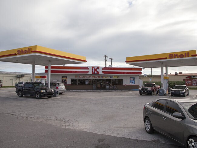
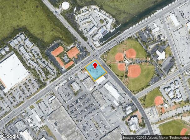
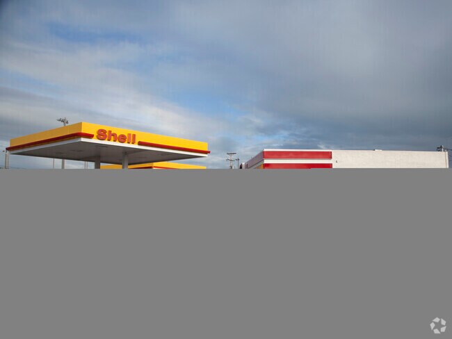
3032 N Roosevelt Blvd
00065670-000000
City Park
Servicestation
KW PLAT OF SURVEY OF LANDS ON ISLAND OF KEY WEST MONROE COUNTY FLA PT TR 9 PB 3-35 AND A PARCEL OF LAND BETWEEN TR 9 AND 13TH ST G72-414-415 OR66-209/10 OR203-232/33 OR865-691/693 OR976-1545/46 OR1030-1284/87E OR1390-1548/9 OR1390-1551/2 OR2420-2267/
AE
Monroe
12087C1509K
Florida
2024
0.72 AC
2025
Key West
972100
Other Market Areas
2,519 SF
Key West, FL
DEMOGRAPHICS near 3032 N Roosevelt Blvd
1 Mile
3 Mile
5 Mile
2024 Total Population
9,197
27,068
27,068
2029 Population
8,802
25,787
25,787
Pop Growth 2024-2029
(4.29%)
(4.73%)
(4.73%)
Average Age
39
43
43
2024 Total Households
3,449
11,363
11,363
HH Growth 2024-2029
(4.90%)
(4.95%)
(4.95%)
Median Household Inc
$66,777
$71,997
$71,997
Avg Household Size
2.50
2.20
2.20
2024 Avg HH Vehicles
1.00
1.00
1.00
Median Home Value
$669,126
$726,850
$726,850
Median Year Built
1974
1972
1972
Nearby Places
Map Layers
Map Styles
 Street
 Aerial
- Restaurants
- Banks
- Shops
- Fitness
- Groceries
PUBLIC TRANSPORTATION
AIRPORT
Key West International
DRIVE
WALK
Distance
Key West International
6 min
1.8 mi
Nearby Properties
Address
Land Use
TOTAL SIZE
Lot Size
Zoning
Address
Land Use
TOTAL SIZE
Lot Size
Zoning
98,815 SF
341.08 AC
M
Address
Land Use
TOTAL SIZE
Lot Size
Zoning
306.55 AC
M
Address
Land Use
TOTAL SIZE
Lot Size
Zoning
83.22 AC
HPRD
Address
Land Use
TOTAL SIZE
Lot Size
Zoning
105.78 AC
COW
Address
Land Use
TOTAL SIZE
Lot Size
Zoning
6.29 AC
HRCC2
Address
Land Use
TOTAL SIZE
Lot Size
Zoning
311,480 SF
8.57 AC
HCT
Address
Land Use
TOTAL SIZE
Lot Size
Zoning
291,300 SF
4.15 AC
HPRD
Address
Land Use
TOTAL SIZE
Lot Size
Zoning
58,091 SF
4.87 AC
CT
Address
Land Use
TOTAL SIZE
Lot Size
Zoning
106,800 SF
1.46 AC
HRCC1
Address
Land Use
TOTAL SIZE
Lot Size
Zoning
24,704 SF
2.42 AC
HRCC1
Address
Land Use
TOTAL SIZE
Lot Size
Zoning
53,173 SF
3.11 AC
HCT
Address
Land Use
TOTAL SIZE
Lot Size
Zoning
300,215 SF
13.94 AC
PS
Address
Land Use
TOTAL SIZE
Lot Size
Zoning
225,221 SF
17.11 AC
HDR
Address
Land Use
TOTAL SIZE
Lot Size
Zoning
963 SF
16.94 AC
HPS
Address
Land Use
TOTAL SIZE
Lot Size
Zoning
121,188 SF
4.75 AC
HRCC1
Address
Land Use
TOTAL SIZE
Lot Size
Zoning
83,684 SF
3.22 AC
HCT
Address
Land Use
TOTAL SIZE
Lot Size
Zoning
115,501 SF
96.47 AC
Address
Land Use
TOTAL SIZE
Lot Size
Zoning
126,563 SF
6.07 AC
HDR
Address
Land Use
TOTAL SIZE
Lot Size
Zoning
109,118 SF
7.80 AC
MU
Address
Land Use
TOTAL SIZE
Lot Size
Zoning
55,274 SF
2.87 AC
HCT
Address
Land Use
TOTAL SIZE
Lot Size
Zoning
22,387 SF
57.30 AC
M
Address
Land Use
TOTAL SIZE
Lot Size
Zoning
219,839 SF
7.52 AC
URM
Address
Land Use
TOTAL SIZE
Lot Size
Zoning
228,039 SF
18.85 AC
PS
Address
Land Use
TOTAL SIZE
Lot Size
Zoning
13,452 SF
4.38 AC
HPRD
Address
Land Use
TOTAL SIZE
Lot Size
Zoning
147,707 SF
6.24 AC
MDR
Address
Land Use
TOTAL SIZE
Lot Size
Zoning
90,585 SF
2 AC
CG
Address
Land Use
TOTAL SIZE
Lot Size
Zoning
222,433 SF
25.69 AC
PS
Address
Land Use
TOTAL SIZE
Lot Size
Zoning
13,174 SF
38.72 AC
HPRD
Address
Land Use
TOTAL SIZE
Lot Size
Zoning
232,414 SF
17.63 AC
CG
Address
Land Use
TOTAL SIZE
Lot Size
Zoning
37,890 SF
1.89 AC
HRCC1
The World's #1 Commercial Real Estate Marketplace
Connect with us
© 2025 CoStar Group
The information above has been obtained from sources believed reliable. While we do not doubt its accuracy we have not verified it and make no guarantee, warranty or representation about it. It is your responsibility to independently confirm its accuracy and completeness. Any projections, opinions, assumptions, or estimates used are for example only and do not represent the current or future performance of the property. The value of this transaction to you depends on tax and other factors which should be evaluated by your tax, financial, and legal advisors. You and your advisors should conduct a careful, independent investigation of the property to determine to your satisfaction the suitability of the property for your needs.