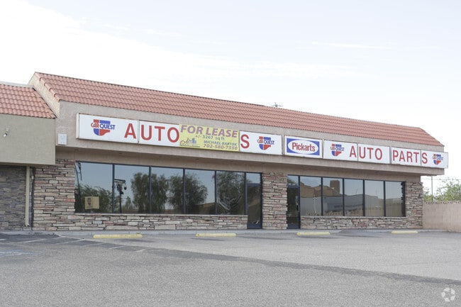
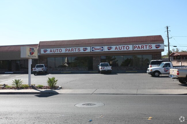
Property Record
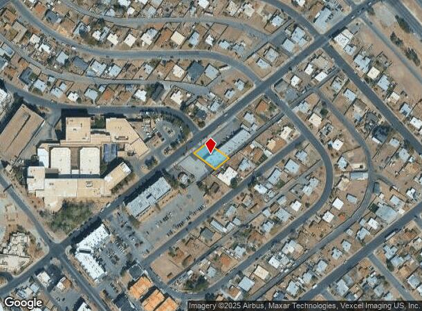
31 E Basic Rd, Henderson, NV 89015
Property Detail
31 E Basic Rd
Las Vegas-Henderson-North Las Vegas, NV
Henderson Townsite
179-18-710-204
HENDERSON TOWNSITE PLAT BOOK 3 PAGE 42 LOT 19 BLOCK 12
Autorepair
Clark
X
Nevada
32003C2615F
19
2026
0.21 AC
2026
Southeast Las Vegas
005336
Las Vegas
2,910 SF
NEARBY LISTINGS FOR SALE OR LEASE
DEMOGRAPHICS near 31 E Basic Rd
1 mile
3 mile
5 mile
2024 Total Population
14,787
99,343
190,038
2029 Population
15,702
105,607
201,138
Pop Growth 2024-2029
+ 6.19%
+ 6.31%
+ 5.84%
Average Age
42
41
41
2024 Total Households
5,754
37,019
72,573
HH Growth 2024-2029
+ 6.20%
+ 6.40%
+ 5.92%
Median Household Inc
$65,812
$90,766
$89,594
Avg Household Size
2.40
2.60
2.50
2024 Avg HH Vehicles
2.00
2.00
2.00
Median Home Value
$381,116
$452,158
$459,560
Median Year Built
1985
1997
2000
Nearby Places
Map Layers
Map Styles
 Street
 Aerial
Transit
 Traffic
 Biking
Places
Listings with unknown addresses are not visible on the map
- Restaurants
- Banks
- Shops
- Fitness
- Groceries
PUBLIC TRANSPORTATION
AIRPORT
Boulder City Municipal
Drive
Walk
Distance
Boulder City Municipal
18 min
10.5 mi
Harry Reid International
Drive
Walk
Distance
Harry Reid International
19 min
13.6 mi
Freight Ports
Port of Long Beach
Drive
Walk
Distance
Port of Long Beach
317 min
282.2 mi
SALE & LEASE HISTORY
LISTING DATE
SALE/LEASE

Jul 20, 2017
For Lease
Nearby Properties
Address
Land Use
TOTAL SIZE
Lot Size
Zoning
Address
Land Use
TOTAL SIZE
Lot Size
Zoning
62,258 SF
59.95 AC
Address
Land Use
TOTAL SIZE
Lot Size
Zoning
Address
Land Use
TOTAL SIZE
Lot Size
Zoning
502,625 SF
45.92 AC
Address
Land Use
TOTAL SIZE
Lot Size
Zoning
9,493 SF
15.37 AC
Address
Land Use
TOTAL SIZE
Lot Size
Zoning
46.75 AC
PS
Address
Land Use
TOTAL SIZE
Lot Size
Zoning
10.50 AC
Address
Land Use
TOTAL SIZE
Lot Size
Zoning
81,485 SF
160.06 AC
PS
Address
Land Use
TOTAL SIZE
Lot Size
Zoning
387,990 SF
22.04 AC
Address
Land Use
TOTAL SIZE
Lot Size
Zoning
1,500 SF
25.08 AC
Address
Land Use
TOTAL SIZE
Lot Size
Zoning
26.83 AC
PS
Address
Land Use
TOTAL SIZE
Lot Size
Zoning
40,031 SF
21.25 AC
Address
Land Use
TOTAL SIZE
Lot Size
Zoning
78,760 SF
1.23 AC
Address
Land Use
TOTAL SIZE
Lot Size
Zoning
4,578 SF
13.23 AC
H:RH-24-MP
Address
Land Use
TOTAL SIZE
Lot Size
Zoning
23,087 SF
71.36 AC
PS
Address
Land Use
TOTAL SIZE
Lot Size
Zoning
239,288 SF
14.10 AC
Address
Land Use
TOTAL SIZE
Lot Size
Zoning
250,076 SF
24.61 AC
Address
Land Use
TOTAL SIZE
Lot Size
Zoning
295,238 SF
23.49 AC
IP
Address
Land Use
TOTAL SIZE
Lot Size
Zoning
4,280 SF
18.25 AC
H:RM-16-MP
Address
Land Use
TOTAL SIZE
Lot Size
Zoning
71,133 SF
7.56 AC
DP
Address
Land Use
TOTAL SIZE
Lot Size
Zoning
13.05 AC
PS
Address
Land Use
TOTAL SIZE
Lot Size
Zoning
19,753 SF
10.21 AC
DP
Address
Land Use
TOTAL SIZE
Lot Size
Zoning
2,860 SF
15.43 AC
RM16
Address
Land Use
TOTAL SIZE
Lot Size
Zoning
213,472 SF
7.46 AC
Address
Land Use
TOTAL SIZE
Lot Size
Zoning
3,664 SF
16.09 AC
RH20
Address
Land Use
TOTAL SIZE
Lot Size
Zoning
14,463 SF
19.48 AC
Address
Land Use
TOTAL SIZE
Lot Size
Zoning
136,465 SF
34.67 AC
Address
Land Use
TOTAL SIZE
Lot Size
Zoning
241,207 SF
13.42 AC
IG
Address
Land Use
TOTAL SIZE
Lot Size
Zoning
168,361 SF
10.84 AC
The World's #1 Commercial Real Estate Marketplace
Connect with us
© 2026 CoStar Group
The information above has been obtained from sources believed reliable. While we do not doubt its accuracy we have not verified it and make no guarantee, warranty or representation about it. It is your responsibility to independently confirm its accuracy and completeness. Any projections, opinions, assumptions, or estimates used are for example only and do not represent the current or future performance of the property. The value of this transaction to you depends on tax and other factors which should be evaluated by your tax, financial, and legal advisors. You and your advisors should conduct a careful, independent investigation of the property to determine to your satisfaction the suitability of the property for your needs.