Property Record
310 Genoble Rd, Greer, SC 29651


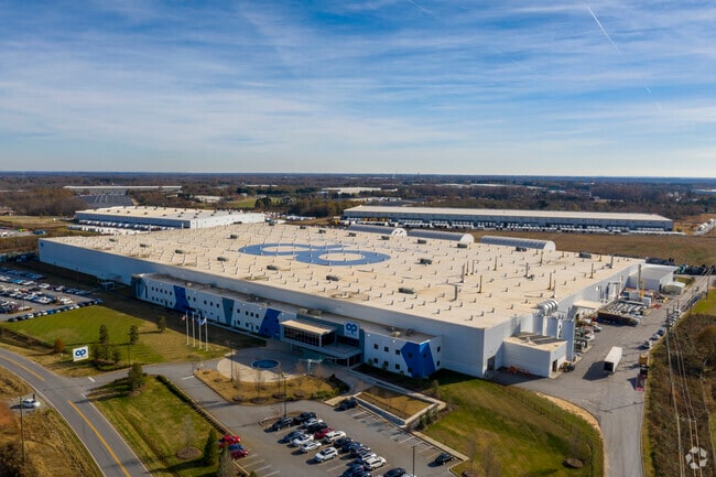

Property Detail
310 Genoble Rd
Spartanburg, SC
TR 2 & 3 CULLUM GSP 081 LP SURVEY PB 165-338 PB 168-964 PB 168-977 HWY R/W TAKEN TR 5
5-24-00-043.12
Spartanburg
Taxexempt
South Carolina
2024
66.99 AC
2025
Rt 101 Corridor
023202
Greenville/Spartanburg
NEARBY LISTINGS FOR SALE OR LEASE
DEMOGRAPHICS near 310 Genoble Rd
1 mile
3 mile
5 mile
2025 Total Population
595
15,718
72,118
2030 Population
667
17,557
79,798
Pop Growth 2025-2030
+ 12.10%
+ 11.70%
+ 10.65%
Average Age
38
37
38
2025 Total Households
222
5,894
27,619
HH Growth 2025-2030
+ 12.16%
+ 11.79%
+ 10.64%
Median Household Inc
$53,823
$62,309
$71,376
Avg Household Size
2.60
2.60
2.60
2025 Avg HH Vehicles
2.00
2.00
2.00
Median Home Value
$232,911
$235,015
$271,804
Median Year Built
1984
1993
1998
Nearby Places
Map Layers
Map Styles
 Street
 Aerial
Layers
 Traffic
 Biking
Places
Listings with unknown addresses are not visible on the map
- Restaurants
- Banks
- Shops
- Fitness
- Groceries
PUBLIC TRANSPORTATION
AIRPORT
Greenville Spartanburg International
Drive
Walk
Distance
Greenville Spartanburg International
12 min
4.6 mi
Freight Ports
North Charleston Terminal
Drive
Walk
Distance
North Charleston Terminal
232 min
201.4 mi
Nearby Properties
Address
Land Use
TOTAL SIZE
Lot Size
Zoning
Address
Land Use
TOTAL SIZE
Lot Size
Zoning
227,627 SF
21.37 AC
Address
Land Use
TOTAL SIZE
Lot Size
Zoning
241,696 SF
15.12 AC
Address
Land Use
TOTAL SIZE
Lot Size
Zoning
235,600 SF
14.48 AC
Address
Land Use
TOTAL SIZE
Lot Size
Zoning
1,320,000 SF
130.98 AC
Address
Land Use
TOTAL SIZE
Lot Size
Zoning
86,884 SF
5.31 AC
Address
Land Use
TOTAL SIZE
Lot Size
Zoning
Address
Land Use
TOTAL SIZE
Lot Size
Zoning
111.08 AC
Address
Land Use
TOTAL SIZE
Lot Size
Zoning
2,417 SF
115.88 AC
Address
Land Use
TOTAL SIZE
Lot Size
Zoning
1,281 SF
41.23 AC
Address
Land Use
TOTAL SIZE
Lot Size
Zoning
710,705 SF
34.03 AC
Address
Land Use
TOTAL SIZE
Lot Size
Zoning
16,592 SF
15.43 AC
Address
Land Use
TOTAL SIZE
Lot Size
Zoning
177,675 SF
39.88 AC
Address
Land Use
TOTAL SIZE
Lot Size
Zoning
42.27 AC
Address
Land Use
TOTAL SIZE
Lot Size
Zoning
2,497 SF
12.36 AC
Address
Land Use
TOTAL SIZE
Lot Size
Zoning
1,111,000 SF
Address
Land Use
TOTAL SIZE
Lot Size
Zoning
2,088 SF
40.12 AC
Address
Land Use
TOTAL SIZE
Lot Size
Zoning
736,169 SF
24.99 AC
Address
Land Use
TOTAL SIZE
Lot Size
Zoning
15.17 AC
Address
Land Use
TOTAL SIZE
Lot Size
Zoning
33.34 AC
Address
Land Use
TOTAL SIZE
Lot Size
Zoning
33.40 AC
Address
Land Use
TOTAL SIZE
Lot Size
Zoning
1,798 SF
9.63 AC
Address
Land Use
TOTAL SIZE
Lot Size
Zoning
7,990 SF
1.62 AC
Address
Land Use
TOTAL SIZE
Lot Size
Zoning
28.26 AC
Address
Land Use
TOTAL SIZE
Lot Size
Zoning
274,050 SF
Address
Land Use
TOTAL SIZE
Lot Size
Zoning
234,220 SF
Address
Land Use
TOTAL SIZE
Lot Size
Zoning
1,176 SF
20.13 AC
Address
Land Use
TOTAL SIZE
Lot Size
Zoning
107.32 AC
Address
Land Use
TOTAL SIZE
Lot Size
Zoning
217,788 SF
23.50 AC
Address
Land Use
TOTAL SIZE
Lot Size
Zoning
297,700 SF
23.64 AC
The World's #1 Commercial Real Estate Marketplace
Connect with us
© 2026 CoStar Group
The information above has been obtained from sources believed reliable. While we do not doubt its accuracy we have not verified it and make no guarantee, warranty or representation about it. It is your responsibility to independently confirm its accuracy and completeness. Any projections, opinions, assumptions, or estimates used are for example only and do not represent the current or future performance of the property. The value of this transaction to you depends on tax and other factors which should be evaluated by your tax, financial, and legal advisors. You and your advisors should conduct a careful, independent investigation of the property to determine to your satisfaction the suitability of the property for your needs.