Property Record
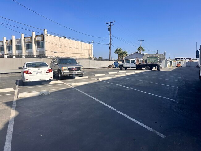
3117 E South St, Long Beach, CA 90805

Property Detail
3117 E South St
Los Angeles-Long Beach-Glendale, CA
CALIFORNIA COOPERATIVE COLONY TRACT LOT COM E ON N LINE OF LOT 17 BLK 28, 161.25 FT FROM NW COR OF SD LOT TH E ON SD N LINE 80.625 FT TH S ON E LINE OF W 241.875 FT OF SD LOT 70 FT TH W PARALLEL 280 FT TO BEG PART OF LOT 17 BLK 28
7121-009-001
Los Angeles
Lightindustrial
California
LBIL
17
2025
0.52 AC
2025
Long Beach
570100
Los Angeles
3,359 SF
NEARBY LISTINGS FOR SALE OR LEASE
DEMOGRAPHICS near 3117 E South St
1 mile
3 mile
5 mile
2025 Total Population
31,774
267,207
656,557
2030 Population
31,170
263,842
647,266
Pop Growth 2025-2030
(1.90%)
(1.26%)
(1.42%)
Average Age
39
39
39
2025 Total Households
9,778
83,524
194,939
HH Growth 2025-2030
(2.19%)
(1.50%)
(1.65%)
Median Household Inc
$87,387
$85,154
$89,995
Avg Household Size
3.10
3.10
3.20
2025 Avg HH Vehicles
2.00
2.00
2.00
Median Home Value
$717,520
$726,181
$733,443
Median Year Built
1957
1958
1958
Nearby Places
Map Layers
Map Styles
 Street
 Aerial
Layers
 Traffic
 Biking
Places
Listings with unknown addresses are not visible on the map
- Restaurants
- Banks
- Shops
- Fitness
- Groceries
PUBLIC TRANSPORTATION
COMMUTER RAIL
Norwalk/Santa Fe Springs (91 Line - Southern California Regional Rail Authority (Metrolink), Orange County Line - Southern California Regional Rail Authority (Metrolink))
Drive
Walk
Distance
Norwalk/Santa Fe Springs (91 Line - Southern California Regional Rail Authority (Metrolink), Orange County Line - Southern California Regional Rail Authority (Metrolink))
16 min
9.3 mi
AIRPORT
Long Beach (Daugherty Field)
Drive
Walk
Distance
Long Beach (Daugherty Field)
9 min
4.2 mi
Los Angeles International
Drive
Walk
Distance
Los Angeles International
30 min
20.2 mi
John Wayne/Orange County
Drive
Walk
Distance
John Wayne/Orange County
34 min
24.0 mi
Freight Ports
Port of Long Beach
Drive
Walk
Distance
Port of Long Beach
19 min
7.9 mi
SALE & LEASE HISTORY
LISTING DATE
SALE/LEASE

Aug 15, 2025
For Lease
Nearby Properties
Address
Land Use
TOTAL SIZE
Lot Size
Zoning
Address
Land Use
TOTAL SIZE
Lot Size
Zoning
202,924 SF
99.50 AC
LKC4*
Address
Land Use
TOTAL SIZE
Lot Size
Zoning
556,348 SF
26.38 AC
PAM2
Address
Land Use
TOTAL SIZE
Lot Size
Zoning
373,498 SF
5.20 AC
LBR4R
Address
Land Use
TOTAL SIZE
Lot Size
Zoning
395,436 SF
17.22 AC
LBMG
Address
Land Use
TOTAL SIZE
Lot Size
Zoning
160,112 SF
3.94 AC
LBPPD1
Address
Land Use
TOTAL SIZE
Lot Size
Zoning
108,931 SF
5.76 AC
LBPPD1
Address
Land Use
TOTAL SIZE
Lot Size
Zoning
97,250 SF
4.86 AC
LBPPD1
Address
Land Use
TOTAL SIZE
Lot Size
Zoning
454,860 SF
0.64 AC
LBIM
Address
Land Use
TOTAL SIZE
Lot Size
Zoning
1,097,606 SF
52.50 AC
LBPD
Address
Land Use
TOTAL SIZE
Lot Size
Zoning
91,545 SF
2.86 AC
LBPPD1
Address
Land Use
TOTAL SIZE
Lot Size
Zoning
292,696 SF
11.48 AC
LBR4
Address
Land Use
TOTAL SIZE
Lot Size
Zoning
132,404 SF
4.84 AC
LBIG
Address
Land Use
TOTAL SIZE
Lot Size
Zoning
233,030 SF
10.95 AC
LBR4
Address
Land Use
TOTAL SIZE
Lot Size
Zoning
108,564 SF
2.48 AC
LBR4N
Address
Land Use
TOTAL SIZE
Lot Size
Zoning
80,114 SF
1.27 AC
LKC4*
Address
Land Use
TOTAL SIZE
Lot Size
Zoning
299,406 SF
1.72 AC
LKC4*
Address
Land Use
TOTAL SIZE
Lot Size
Zoning
76,570 SF
6.46 AC
LBPPD1
Address
Land Use
TOTAL SIZE
Lot Size
Zoning
132,019 SF
5.22 AC
LKMFR*
Address
Land Use
TOTAL SIZE
Lot Size
Zoning
141,332 SF
7.13 AC
LBPPD1
Address
Land Use
TOTAL SIZE
Lot Size
Zoning
52,031 SF
3.65 AC
LBCCH/
Address
Land Use
TOTAL SIZE
Lot Size
Zoning
96,849 SF
7.56 AC
LKC3YY
Address
Land Use
TOTAL SIZE
Lot Size
Zoning
183,128 SF
10.77 AC
PAM2*
Address
Land Use
TOTAL SIZE
Lot Size
Zoning
160,769 SF
5.90 AC
LKC4*
Address
Land Use
TOTAL SIZE
Lot Size
Zoning
157,755 SF
9.90 AC
LBIG
Address
Land Use
TOTAL SIZE
Lot Size
Zoning
166,006 SF
1.59 AC
LKC4*
Address
Land Use
TOTAL SIZE
Lot Size
Zoning
86,790 SF
4.93 AC
LKM1-M2*
Address
Land Use
TOTAL SIZE
Lot Size
Zoning
126,905 SF
7.87 AC
LBCHW
Address
Land Use
TOTAL SIZE
Lot Size
Zoning
218,733 SF
12.39 AC
LBPD19
The World's #1 Commercial Real Estate Marketplace
Connect with us
© 2026 CoStar Group
The information above has been obtained from sources believed reliable. While we do not doubt its accuracy we have not verified it and make no guarantee, warranty or representation about it. It is your responsibility to independently confirm its accuracy and completeness. Any projections, opinions, assumptions, or estimates used are for example only and do not represent the current or future performance of the property. The value of this transaction to you depends on tax and other factors which should be evaluated by your tax, financial, and legal advisors. You and your advisors should conduct a careful, independent investigation of the property to determine to your satisfaction the suitability of the property for your needs.