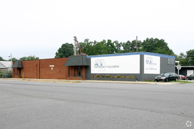
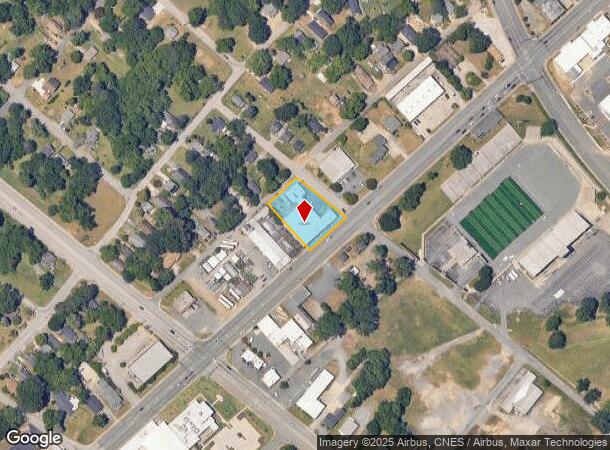
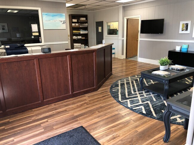
Property Record
312 Cherry Rd S, Rock Hill, SC 29732
NEARBY LISTINGS FOR SALE OR LEASE
Property Detail
312 Cherry Rd S
Charlotte-Concord-Gastonia, NC-SC
Ind
5980204003
LOTS 10,11,12 BLK F S CHERRY RD
Commercialnec
York
X
South Carolina
45091C0308E
10-12
2025
0.65 AC
2025
York County
060501
Charlotte
12,774 SF
DEMOGRAPHICS near 312 Cherry Rd S
1 Mile
3 Mile
5 Mile
2024 Total Population
9,763
55,413
97,726
2029 Population
10,901
62,169
109,681
Pop Growth 2024-2029
+ 11.66%
+ 12.19%
+ 12.23%
Average Age
34
39
39
2024 Total Households
3,494
22,341
39,471
HH Growth 2024-2029
+ 14.68%
+ 12.98%
+ 12.82%
Median Household Inc
$34,371
$51,286
$58,743
Avg Household Size
2.10
2.30
2.40
2024 Avg HH Vehicles
1.00
2.00
2.00
Median Home Value
$149,769
$191,864
$221,785
Median Year Built
1990
1985
1992
Nearby Places
Map Layers
Map Styles
 Street
 Aerial
- Restaurants
- Banks
- Shops
- Fitness
- Groceries
PUBLIC TRANSPORTATION
AIRPORT
Charlotte/Douglas International
DRIVE
WALK
Distance
Charlotte/Douglas International
39 min
23.3 mi
Concord-Padgett Regional
DRIVE
WALK
Distance
Concord-Padgett Regional
58 min
40.2 mi
SALE & LEASE HISTORY
LISTING DATE
SALE/LEASE

Mar 06, 2020
For Sale
Nearby Properties
Address
Land Use
TOTAL SIZE
Lot Size
Zoning
Address
Land Use
TOTAL SIZE
Lot Size
Zoning
13,556 SF
10.86 AC
MF15
Address
Land Use
TOTAL SIZE
Lot Size
Zoning
267,338 SF
Address
Land Use
TOTAL SIZE
Lot Size
Zoning
5,380 SF
5.62 AC
MF15
Address
Land Use
TOTAL SIZE
Lot Size
Zoning
8,512 SF
7.73 AC
MF15
Address
Land Use
TOTAL SIZE
Lot Size
Zoning
45,426 SF
6 AC
MF15
Address
Land Use
TOTAL SIZE
Lot Size
Zoning
28,848 SF
1.04 AC
PUD
Address
Land Use
TOTAL SIZE
Lot Size
Zoning
252,312 SF
1.25 AC
Address
Land Use
TOTAL SIZE
Lot Size
Zoning
10,232 SF
4.50 AC
MF15
Address
Land Use
TOTAL SIZE
Lot Size
Zoning
28,660 SF
19.95 AC
OI
Address
Land Use
TOTAL SIZE
Lot Size
Zoning
554,100 SF
21.58 AC
OI
Address
Land Use
TOTAL SIZE
Lot Size
Zoning
113,490 SF
7 AC
Address
Land Use
TOTAL SIZE
Lot Size
Zoning
84,995 SF
5.09 AC
DTWN
Address
Land Use
TOTAL SIZE
Lot Size
Zoning
225,936 SF
2.87 AC
Address
Land Use
TOTAL SIZE
Lot Size
Zoning
8,348 SF
1 AC
SF3
Address
Land Use
TOTAL SIZE
Lot Size
Zoning
98,813 SF
3.34 AC
Address
Land Use
TOTAL SIZE
Lot Size
Zoning
14,178 SF
1.81 AC
OI
Address
Land Use
TOTAL SIZE
Lot Size
Zoning
22 AC
OI
Address
Land Use
TOTAL SIZE
Lot Size
Zoning
127,028 SF
1.28 AC
Address
Land Use
TOTAL SIZE
Lot Size
Zoning
342,804 SF
23.99 AC
NMU
Address
Land Use
TOTAL SIZE
Lot Size
Zoning
38,000 SF
4.28 AC
LC
Address
Land Use
TOTAL SIZE
Lot Size
Zoning
23,898 SF
19.65 AC
OI
Address
Land Use
TOTAL SIZE
Lot Size
Zoning
207,492 SF
6.66 AC
IH
Address
Land Use
TOTAL SIZE
Lot Size
Zoning
162,641 SF
1.31 AC
Address
Land Use
TOTAL SIZE
Lot Size
Zoning
237,723 SF
15.89 AC
PUD
Address
Land Use
TOTAL SIZE
Lot Size
Zoning
Address
Land Use
TOTAL SIZE
Lot Size
Zoning
11,286 SF
1 AC
IH
Address
Land Use
TOTAL SIZE
Lot Size
Zoning
91.87 AC
UD
Address
Land Use
TOTAL SIZE
Lot Size
Zoning
Address
Land Use
TOTAL SIZE
Lot Size
Zoning
9,116 SF
0.74 AC
PUDO
The World's #1 Commercial Real Estate Marketplace
Connect with us
© 2025 CoStar Group
The information above has been obtained from sources believed reliable. While we do not doubt its accuracy we have not verified it and make no guarantee, warranty or representation about it. It is your responsibility to independently confirm its accuracy and completeness. Any projections, opinions, assumptions, or estimates used are for example only and do not represent the current or future performance of the property. The value of this transaction to you depends on tax and other factors which should be evaluated by your tax, financial, and legal advisors. You and your advisors should conduct a careful, independent investigation of the property to determine to your satisfaction the suitability of the property for your needs.