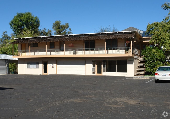
Property Record
312 E Matilija St, Ojai, CA 93023

NEARBY LISTINGS FOR SALE OR LEASE
Property Detail
312 E Matilija St
Oxnard-Thousand Oaks-Ventura, CA
Parcel Map No 07 02
021-0-113-300
LOT: 3 REF: 67 PM 84
Commercialofficeresidentialmixeduse
Ventura
X
California
06111C0578G
3
2024
0.20 AC
2025
Ojai/NW County
000903
Los Angeles
902 SF
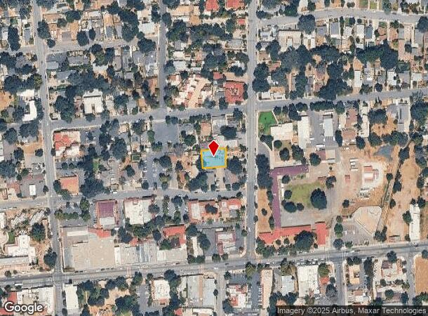
DEMOGRAPHICS near 312 E Matilija St
1 Mile
3 Mile
5 Mile
2024 Total Population
6,253
14,776
23,783
2029 Population
6,110
14,501
23,365
Pop Growth 2024-2029
(2.29%)
(1.86%)
(1.76%)
Average Age
46
46
46
2024 Total Households
2,586
5,893
9,331
HH Growth 2024-2029
(2.44%)
(2.02%)
(1.92%)
Median Household Inc
$74,965
$85,711
$89,015
Avg Household Size
2.30
2.40
2.50
2024 Avg HH Vehicles
2.00
2.00
2.00
Median Home Value
$875,886
$808,463
$801,462
Median Year Built
1962
1965
1966
Nearby Places
Map Layers
Map Styles
 Street
 Aerial
- Restaurants
- Banks
- Shops
- Fitness
- Groceries
PUBLIC TRANSPORTATION
AIRPORT
Santa Barbara Municipal
DRIVE
WALK
Distance
Santa Barbara Municipal
75 min
45.3 mi
SALE & LEASE HISTORY
LISTING DATE
SALE/LEASE

Nov 18, 2023
For Sale
Jun 14, 2024
For Sale
Nearby Properties
Address
Land Use
TOTAL SIZE
Lot Size
Zoning
Address
Land Use
TOTAL SIZE
Lot Size
Zoning
182.91 AC
Address
Land Use
TOTAL SIZE
Lot Size
Zoning
6.23 AC
Address
Land Use
TOTAL SIZE
Lot Size
Zoning
2.01 AC
C1
Address
Land Use
TOTAL SIZE
Lot Size
Zoning
25,301 SF
1.74 AC
BP
Address
Land Use
TOTAL SIZE
Lot Size
Zoning
28.32 AC
RE20
Address
Land Use
TOTAL SIZE
Lot Size
Zoning
5.05 AC
CR
Address
Land Use
TOTAL SIZE
Lot Size
Zoning
534.56 AC
OS40AC
Address
Land Use
TOTAL SIZE
Lot Size
Zoning
1.93 AC
CPD
Address
Land Use
TOTAL SIZE
Lot Size
Zoning
Address
Land Use
TOTAL SIZE
Lot Size
Zoning
126.17 AC
OS20AC
Address
Land Use
TOTAL SIZE
Lot Size
Zoning
12.68 AC
PL
Address
Land Use
TOTAL SIZE
Lot Size
Zoning
1,440 SF
98.32 AC
AE
Address
Land Use
TOTAL SIZE
Lot Size
Zoning
1,028 SF
4.87 AC
Address
Land Use
TOTAL SIZE
Lot Size
Zoning
54,259 SF
2.56 AC
M1
Address
Land Use
TOTAL SIZE
Lot Size
Zoning
2,690 SF
0.80 AC
Address
Land Use
TOTAL SIZE
Lot Size
Zoning
9.70 AC
Address
Land Use
TOTAL SIZE
Lot Size
Zoning
494 SF
8.72 AC
OS20AC
Address
Land Use
TOTAL SIZE
Lot Size
Zoning
35,318 SF
2.59 AC
BP
Address
Land Use
TOTAL SIZE
Lot Size
Zoning
29,708 SF
2.08 AC
M1
Address
Land Use
TOTAL SIZE
Lot Size
Zoning
3,779 SF
42.97 AC
AE
Address
Land Use
TOTAL SIZE
Lot Size
Zoning
3,452 SF
21.55 AC
AE
Address
Land Use
TOTAL SIZE
Lot Size
Zoning
100 SF
0.61 AC
C1
Address
Land Use
TOTAL SIZE
Lot Size
Zoning
36.30 AC
RA20AC
Address
Land Use
TOTAL SIZE
Lot Size
Zoning
4,701 SF
40 AC
AE80AC
Address
Land Use
TOTAL SIZE
Lot Size
Zoning
7.09 AC
Address
Land Use
TOTAL SIZE
Lot Size
Zoning
1,200 SF
51.18 AC
AE
Address
Land Use
TOTAL SIZE
Lot Size
Zoning
2,395 SF
44.63 AC
Address
Land Use
TOTAL SIZE
Lot Size
Zoning
5,506 SF
12.51 AC
OS20AC
Address
Land Use
TOTAL SIZE
Lot Size
Zoning
14,812 SF
1.86 AC
MULT
Address
Land Use
TOTAL SIZE
Lot Size
Zoning
0.67 AC
The World's #1 Commercial Real Estate Marketplace
Connect with us
© 2026 CoStar Group
The information above has been obtained from sources believed reliable. While we do not doubt its accuracy we have not verified it and make no guarantee, warranty or representation about it. It is your responsibility to independently confirm its accuracy and completeness. Any projections, opinions, assumptions, or estimates used are for example only and do not represent the current or future performance of the property. The value of this transaction to you depends on tax and other factors which should be evaluated by your tax, financial, and legal advisors. You and your advisors should conduct a careful, independent investigation of the property to determine to your satisfaction the suitability of the property for your needs.