Property Record
3130 N Clybourn Ave, Burbank, CA 91505


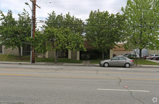

Property Detail
3130 N Clybourn Ave
2466-020-006
*TR=PARCEL MAP AS PER BK 126 P 51-52 OF P M LOT 2
Warehouse
Los Angeles
BUM2*
California
B and X Area of moderate flood hazard, usually the area between the limits of the 100-year and 500-year floods.
2
2025
0.39 AC
2025
Burbank
980001
Los Angeles
8,064 SF
Los Angeles-Long Beach-Glendale, CA
NEARBY LISTINGS FOR SALE OR LEASE
DEMOGRAPHICS near 3130 N Clybourn Ave
1 mile
3 mile
5 mile
2025 Total Population
22,534
206,091
538,345
2030 Population
22,345
205,247
534,822
Pop Growth 2025-2030
(0.84%)
(0.41%)
(0.65%)
Average Age
39
40
40
2025 Total Households
5,894
69,828
195,963
HH Growth 2025-2030
(1.00%)
(0.59%)
(0.80%)
Median Household Inc
$70,396
$78,197
$83,580
Avg Household Size
3.60
2.80
2.60
2025 Avg HH Vehicles
2.00
2.00
2.00
Median Home Value
$723,967
$858,085
$899,107
Median Year Built
1961
1962
1965
Nearby Places
Map Layers
Map Styles
 Street
 Aerial
Layers
 Traffic
 Biking
Places
Listings with unknown addresses are not visible on the map
- Restaurants
- Banks
- Shops
- Fitness
- Groceries
PUBLIC TRANSPORTATION
COMMUTER RAIL
Burbank Airport - North (Av Line) Metrolink Station (Metrolink Antelope Valley Line - Metrolink Trains)
Drive
Walk
Distance
Burbank Airport - North (Av Line) Metrolink Station (Metrolink Antelope Valley Line - Metrolink Trains)
2 min
1.8 mi
Burbank-Bob Hope Airport (Ventura County Line - Southern California Regional Rail Authority (Metrolink))
Drive
Walk
Distance
Burbank-Bob Hope Airport (Ventura County Line - Southern California Regional Rail Authority (Metrolink))
4 min
2.4 mi
AIRPORT
Bob Hope
Drive
Walk
Distance
Bob Hope
1 min
0.5 mi
Los Angeles International
Drive
Walk
Distance
Los Angeles International
39 min
26.9 mi
Long Beach (Daugherty Field)
Drive
Walk
Distance
Long Beach (Daugherty Field)
50 min
37.3 mi
Freight Ports
Port of Long Beach
Drive
Walk
Distance
Port of Long Beach
52 min
40.2 mi
Nearby Properties
Address
Land Use
TOTAL SIZE
Lot Size
Zoning
Address
Land Use
TOTAL SIZE
Lot Size
Zoning
518,067 SF
17.27 AC
LAC4
Address
Land Use
TOTAL SIZE
Lot Size
Zoning
690,600 SF
6.57 AC
LACM
Address
Land Use
TOTAL SIZE
Lot Size
Zoning
1,328,547 SF
39.36 AC
BUPD
Address
Land Use
TOTAL SIZE
Lot Size
Zoning
529,249 SF
5.42 AC
LAC4
Address
Land Use
TOTAL SIZE
Lot Size
Zoning
432,232 SF
7.17 AC
BUM2
Address
Land Use
TOTAL SIZE
Lot Size
Zoning
362,863 SF
1.82 AC
BUMZ
Address
Land Use
TOTAL SIZE
Lot Size
Zoning
346,186 SF
11.72 AC
BUM2*
Address
Land Use
TOTAL SIZE
Lot Size
Zoning
232,965 SF
3.78 AC
LAC4
Address
Land Use
TOTAL SIZE
Lot Size
Zoning
388,171 SF
2.42 AC
LAC4
Address
Land Use
TOTAL SIZE
Lot Size
Zoning
182,061 SF
1.99 AC
LAC4
Address
Land Use
TOTAL SIZE
Lot Size
Zoning
227,746 SF
4.03 AC
LAC4
Address
Land Use
TOTAL SIZE
Lot Size
Zoning
BURAILROAD
Address
Land Use
TOTAL SIZE
Lot Size
Zoning
152,445 SF
1.05 AC
LAC4
Address
Land Use
TOTAL SIZE
Lot Size
Zoning
279,574 SF
4.01 AC
BUM2*
Address
Land Use
TOTAL SIZE
Lot Size
Zoning
201,944 SF
1.14 AC
LAC4
Address
Land Use
TOTAL SIZE
Lot Size
Zoning
132,652 SF
0.76 AC
LAC2
Address
Land Use
TOTAL SIZE
Lot Size
Zoning
221,276 SF
1.37 AC
LAC4
Address
Land Use
TOTAL SIZE
Lot Size
Zoning
162,506 SF
2.28 AC
LAC2
Address
Land Use
TOTAL SIZE
Lot Size
Zoning
222,004 SF
2.29 AC
LAC4
Address
Land Use
TOTAL SIZE
Lot Size
Zoning
108,649 SF
3.33 AC
BUPD
Address
Land Use
TOTAL SIZE
Lot Size
Zoning
86,190 SF
3.07 AC
BUM2
Address
Land Use
TOTAL SIZE
Lot Size
Zoning
116,297 SF
1.60 AC
LAC4
Address
Land Use
TOTAL SIZE
Lot Size
Zoning
169,740 SF
1.74 AC
BUM2*
Address
Land Use
TOTAL SIZE
Lot Size
Zoning
151,207 SF
1.20 AC
LAR4
Address
Land Use
TOTAL SIZE
Lot Size
Zoning
474,155 SF
8.45 AC
LAM2
Address
Land Use
TOTAL SIZE
Lot Size
Zoning
229,983 SF
7.90 AC
BUM2YY*
Address
Land Use
TOTAL SIZE
Lot Size
Zoning
214,664 SF
2.23 AC
BUM2*
Address
Land Use
TOTAL SIZE
Lot Size
Zoning
65,224 SF
1.86 AC
LAC4
Address
Land Use
TOTAL SIZE
Lot Size
Zoning
172,303 SF
1.14 AC
LAC4
The World's #1 Commercial Real Estate Marketplace
Connect with us
© 2026 CoStar Group
The information above has been obtained from sources believed reliable. While we do not doubt its accuracy we have not verified it and make no guarantee, warranty or representation about it. It is your responsibility to independently confirm its accuracy and completeness. Any projections, opinions, assumptions, or estimates used are for example only and do not represent the current or future performance of the property. The value of this transaction to you depends on tax and other factors which should be evaluated by your tax, financial, and legal advisors. You and your advisors should conduct a careful, independent investigation of the property to determine to your satisfaction the suitability of the property for your needs.