Property Record
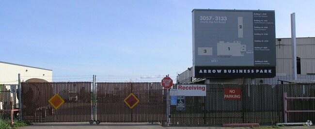
3133 N Ad Art Rd, Stockton, CA 95215


NEARBY LISTINGS FOR SALE OR LEASE
Property Detail
3133 N Ad Art Rd
Stockton-Lodi, CA
Sunny Valley Gardens 03
087-100-73
DEL LOS FRANCESES EL RHO MAP E1 43
Lightindustrial
San Joaquin
AH
California
06077C0460F
11.05 AC
2025
NE Stockton
2025
Stockton/Modesto
003601
DEMOGRAPHICS near 3133 N Ad Art Rd
1 Mile
3 Mile
5 Mile
2024 Total Population
3,810
100,525
263,826
2029 Population
3,993
105,936
278,108
Pop Growth 2024-2029
+ 4.80%
+ 5.38%
+ 5.41%
Average Age
36
35
36
2024 Total Households
1,188
29,506
81,088
HH Growth 2024-2029
+ 4.71%
+ 5.43%
+ 5.51%
Median Household Inc
$52,304
$58,098
$58,638
Avg Household Size
3.10
3.30
3.10
2024 Avg HH Vehicles
2.00
2.00
2.00
Median Home Value
$328,985
$330,774
$343,387
Median Year Built
1972
1971
1971
Nearby Places
Map Layers
Map Styles
 Street
 Aerial
- Restaurants
- Banks
- Shops
- Fitness
- Groceries
PUBLIC TRANSPORTATION
COMMUTER RAIL
Stockton (ACE Train - Altamont Commuter Express (ACE), Altamont Corridor Express - Altamont Commuter Express (ACE))
DRIVE
WALK
Distance
Stockton (ACE Train - Altamont Commuter Express (ACE), Altamont Corridor Express - Altamont Commuter Express (ACE))
8 min
3.9 mi
Stockton (San Joaquins - Amtrak)
DRIVE
WALK
Distance
Stockton (San Joaquins - Amtrak)
9 min
5.5 mi
AIRPORT
Stockton Metro
DRIVE
WALK
Distance
Stockton Metro
15 min
9.6 mi
Freight Ports
Port of Stockton
DRIVE
WALK
Distance
Port of Stockton
14 min
8.1 mi
Nearby Properties
Address
Land Use
TOTAL SIZE
Lot Size
Zoning
Address
Land Use
TOTAL SIZE
Lot Size
Zoning
530,700 SF
8.35 AC
Address
Land Use
TOTAL SIZE
Lot Size
Zoning
152,000 SF
1.31 AC
Address
Land Use
TOTAL SIZE
Lot Size
Zoning
9,750 SF
136.94 AC
AU20
Address
Land Use
TOTAL SIZE
Lot Size
Zoning
502,000 SF
19.76 AC
Address
Land Use
TOTAL SIZE
Lot Size
Zoning
652,548 SF
35.24 AC
IL
Address
Land Use
TOTAL SIZE
Lot Size
Zoning
121,574 SF
5.49 AC
RHD
Address
Land Use
TOTAL SIZE
Lot Size
Zoning
47.61 AC
Address
Land Use
TOTAL SIZE
Lot Size
Zoning
207,540 SF
21.16 AC
Address
Land Use
TOTAL SIZE
Lot Size
Zoning
1,312 SF
7.44 AC
Address
Land Use
TOTAL SIZE
Lot Size
Zoning
219,572 SF
16.53 AC
IL
Address
Land Use
TOTAL SIZE
Lot Size
Zoning
90,142 SF
26.25 AC
Address
Land Use
TOTAL SIZE
Lot Size
Zoning
107,184 SF
34.13 AC
Address
Land Use
TOTAL SIZE
Lot Size
Zoning
62,588 SF
43.56 AC
IW
Address
Land Use
TOTAL SIZE
Lot Size
Zoning
37,846 SF
2.94 AC
Address
Land Use
TOTAL SIZE
Lot Size
Zoning
51,892 SF
5.33 AC
Address
Land Use
TOTAL SIZE
Lot Size
Zoning
2.42 AC
Address
Land Use
TOTAL SIZE
Lot Size
Zoning
2,876 SF
10.54 AC
Address
Land Use
TOTAL SIZE
Lot Size
Zoning
67,195 SF
5.30 AC
Address
Land Use
TOTAL SIZE
Lot Size
Zoning
5,264 SF
9.82 AC
IL
Address
Land Use
TOTAL SIZE
Lot Size
Zoning
102,190 SF
10.34 AC
Address
Land Use
TOTAL SIZE
Lot Size
Zoning
135,198 SF
13.37 AC
Address
Land Use
TOTAL SIZE
Lot Size
Zoning
95,838 SF
10.10 AC
Address
Land Use
TOTAL SIZE
Lot Size
Zoning
126,108 SF
12.43 AC
Address
Land Use
TOTAL SIZE
Lot Size
Zoning
129,750 SF
8.63 AC
Address
Land Use
TOTAL SIZE
Lot Size
Zoning
261,860 SF
7.48 AC
IW
Address
Land Use
TOTAL SIZE
Lot Size
Zoning
8 AC
IL
Address
Land Use
TOTAL SIZE
Lot Size
Zoning
65,516 SF
10.56 AC
RM
Address
Land Use
TOTAL SIZE
Lot Size
Zoning
5,684 SF
17 AC
Address
Land Use
TOTAL SIZE
Lot Size
Zoning
8,265 SF
2.87 AC
IL
Address
Land Use
TOTAL SIZE
Lot Size
Zoning
10,556 SF
1.15 AC
The World's #1 Commercial Real Estate Marketplace
Connect with us
© 2025 CoStar Group
The information above has been obtained from sources believed reliable. While we do not doubt its accuracy we have not verified it and make no guarantee, warranty or representation about it. It is your responsibility to independently confirm its accuracy and completeness. Any projections, opinions, assumptions, or estimates used are for example only and do not represent the current or future performance of the property. The value of this transaction to you depends on tax and other factors which should be evaluated by your tax, financial, and legal advisors. You and your advisors should conduct a careful, independent investigation of the property to determine to your satisfaction the suitability of the property for your needs.