Property Record
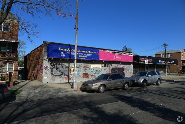
3145 Bruckner Blvd, Bronx, NY 10461


NEARBY LISTINGS FOR SALE OR LEASE
Property Detail
3145 Bruckner Blvd
05340-0040
Property Sisters Of Charity
Storebuilding
Bronx
X
New York
3604970104F
40
2024
0.12 AC
2025
Bronx
028400
Westchester/So Connecticut
5,500 SF
New York-Jersey City-White Plains, NY-NJ
DEMOGRAPHICS near 3145 Bruckner Blvd
1 mile
3 mile
5 mile
2024 Total Population
34,929
394,820
1,325,722
2029 Population
30,524
355,989
1,225,069
Pop Growth 2024-2029
(12.61%)
(9.84%)
(7.59%)
Average Age
41
40
39
2024 Total Households
13,167
142,489
464,360
HH Growth 2024-2029
(13.46%)
(10.54%)
(8.27%)
Median Household Inc
$68,004
$52,958
$46,083
Avg Household Size
2.60
2.60
2.70
2024 Avg HH Vehicles
1.00
1.00
1.00
Median Home Value
$687,320
$545,948
$572,040
Median Year Built
1953
1954
1953
Nearby Places
Map Layers
Map Styles
 Street
 Aerial
Transit
 Traffic
 Biking
Places
Listings with unknown addresses are not visible on the map
- Restaurants
- Banks
- Shops
- Fitness
- Groceries
PUBLIC TRANSPORTATION
TRANSIT/SUBWAY
Buhre Avenue (6 - New York MTA Subway (The Subway))
Drive
Walk
Distance
Buhre Avenue (6 - New York MTA Subway (The Subway))
2 min
15 min
0.7 mi
Middletown Road (6 - New York MTA Subway (The Subway))
Drive
Walk
Distance
Middletown Road (6 - New York MTA Subway (The Subway))
3 min
17 min
0.9 mi
Westchester Square-East Tremont Avenue (6 - New York MTA Subway (The Subway))
Drive
Walk
Distance
Westchester Square-East Tremont Avenue (6 - New York MTA Subway (The Subway))
4 min
20 min
1.0 mi
COMMUTER RAIL
Williams Bridge Station (Harlem Line - Metro-North Commuter Railroad Company (Metro-North))
Drive
Walk
Distance
Williams Bridge Station (Harlem Line - Metro-North Commuter Railroad Company (Metro-North))
11 min
4.4 mi
Tremont Station (Harlem Line - Metro-North Commuter Railroad Company (Metro-North))
Drive
Walk
Distance
Tremont Station (Harlem Line - Metro-North Commuter Railroad Company (Metro-North))
10 min
4.8 mi
AIRPORT
LaGuardia
Drive
Walk
Distance
LaGuardia
18 min
8.9 mi
John F Kennedy International
Drive
Walk
Distance
John F Kennedy International
27 min
16.5 mi
Westchester County
Drive
Walk
Distance
Westchester County
34 min
22.0 mi
Freight Ports
NY - Red Hook Container Terminal
Drive
Walk
Distance
NY - Red Hook Container Terminal
34 min
19.4 mi
Nearby Properties
Address
Land Use
TOTAL SIZE
Lot Size
Zoning
Address
Land Use
TOTAL SIZE
Lot Size
Zoning
115.90 AC
R6
Address
Land Use
TOTAL SIZE
Lot Size
Zoning
115.90 AC
R6
Address
Land Use
TOTAL SIZE
Lot Size
Zoning
115.90 AC
R6
Address
Land Use
TOTAL SIZE
Lot Size
Zoning
115.90 AC
R6
Address
Land Use
TOTAL SIZE
Lot Size
Zoning
115.90 AC
R6
Address
Land Use
TOTAL SIZE
Lot Size
Zoning
115.90 AC
R6
Address
Land Use
TOTAL SIZE
Lot Size
Zoning
115.90 AC
R6
Address
Land Use
TOTAL SIZE
Lot Size
Zoning
115.90 AC
R6
Address
Land Use
TOTAL SIZE
Lot Size
Zoning
115.90 AC
R6
Address
Land Use
TOTAL SIZE
Lot Size
Zoning
115.90 AC
R6
Address
Land Use
TOTAL SIZE
Lot Size
Zoning
115.90 AC
R6
Address
Land Use
TOTAL SIZE
Lot Size
Zoning
115.90 AC
R6
Address
Land Use
TOTAL SIZE
Lot Size
Zoning
115.90 AC
R6
Address
Land Use
TOTAL SIZE
Lot Size
Zoning
115.90 AC
R6
Address
Land Use
TOTAL SIZE
Lot Size
Zoning
115.90 AC
R6
Address
Land Use
TOTAL SIZE
Lot Size
Zoning
115.90 AC
R6
Address
Land Use
TOTAL SIZE
Lot Size
Zoning
115.90 AC
R6
Address
Land Use
TOTAL SIZE
Lot Size
Zoning
115.90 AC
R6
Address
Land Use
TOTAL SIZE
Lot Size
Zoning
115.90 AC
R6
Address
Land Use
TOTAL SIZE
Lot Size
Zoning
115.90 AC
R6
Address
Land Use
TOTAL SIZE
Lot Size
Zoning
115.90 AC
R6
Address
Land Use
TOTAL SIZE
Lot Size
Zoning
115.90 AC
R6
Address
Land Use
TOTAL SIZE
Lot Size
Zoning
115.90 AC
R6
Address
Land Use
TOTAL SIZE
Lot Size
Zoning
115.90 AC
R6
Address
Land Use
TOTAL SIZE
Lot Size
Zoning
115.90 AC
R6
Address
Land Use
TOTAL SIZE
Lot Size
Zoning
550,000 SF
8.75 AC
M1-1
Address
Land Use
TOTAL SIZE
Lot Size
Zoning
13,243,398 SF
115.90 AC
R6
Address
Land Use
TOTAL SIZE
Lot Size
Zoning
44.83 AC
R6
Address
Land Use
TOTAL SIZE
Lot Size
Zoning
44.83 AC
R6
Address
Land Use
TOTAL SIZE
Lot Size
Zoning
1,427,393 SF
39.94 AC
R4
The World's #1 Commercial Real Estate Marketplace
Connect with us
© 2026 CoStar Group
The information above has been obtained from sources believed reliable. While we do not doubt its accuracy we have not verified it and make no guarantee, warranty or representation about it. It is your responsibility to independently confirm its accuracy and completeness. Any projections, opinions, assumptions, or estimates used are for example only and do not represent the current or future performance of the property. The value of this transaction to you depends on tax and other factors which should be evaluated by your tax, financial, and legal advisors. You and your advisors should conduct a careful, independent investigation of the property to determine to your satisfaction the suitability of the property for your needs.