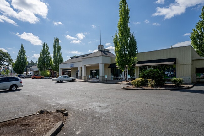
Property Record
3175 Nw Glencoe Rd, Hillsboro, OR 97124


Save to a Folder
{{folder.Name}}
{{folder.ListingIds.length}} Properties
{{folder.ListingIds.length}} Property
Create a New Folder
Property Detail
3175 Nw Glencoe Rd
R0739721
MILNE ACRES, LOT PT 26, ACRES 1.16
Commercialbuilding
WASHINGTON
C-N
Oregon
B and X Area of moderate flood hazard, usually the area between the limits of the 100-year and 500-year floods.
26
2024
1.16 AC
2026
Sunset Corridor/Hillsboro
032603
Portland
18,200 SF
Portland-Vancouver-Hillsboro, OR-WA
NEARBY LISTINGS FOR SALE OR LEASE
DEMOGRAPHICS near 3175 Nw Glencoe Rd
1 mile
3 mile
5 mile
2025 Total Population
8,429
47,780
114,471
2030 Population
8,460
48,378
116,243
Pop Growth 2025-2030
+ 0.37%
+ 1.25%
+ 1.55%
Average Age
40
39
39
2025 Total Households
2,872
15,732
40,181
HH Growth 2025-2030
+ 0.49%
+ 1.30%
+ 1.61%
Median Household Inc
$124,774
$103,594
$105,005
Avg Household Size
2.90
2.90
2.80
2025 Avg HH Vehicles
2.00
2.00
2.00
Median Home Value
$654,034
$513,921
$522,071
Median Year Built
1993
1985
1993
Nearby Places
Map Layers
Map Styles
 Street
 Aerial
Layers
 Traffic
 Biking
Places
Listings with unknown addresses are not visible on the map
- Restaurants
- Banks
- Shops
- Fitness
- Groceries
PUBLIC TRANSPORTATION
AIRPORT
Portland International
Drive
Walk
Distance
Portland International
49 min
30.7 mi
SALE & LEASE HISTORY
LISTING DATE
SALE/LEASE

Sep 25, 2016
For Lease
May 02, 2018
For Lease
Aug 08, 2023
For Sale
Nearby Properties
Address
Land Use
TOTAL SIZE
Lot Size
Zoning
Address
Land Use
TOTAL SIZE
Lot Size
Zoning
1,619,885 SF
115.71 AC
I-P
Address
Land Use
TOTAL SIZE
Lot Size
Zoning
9.97 AC
SCC-DT
Address
Land Use
TOTAL SIZE
Lot Size
Zoning
3,126 SF
11.38 AC
FD-20
Address
Land Use
TOTAL SIZE
Lot Size
Zoning
47.85 AC
I-P
Address
Land Use
TOTAL SIZE
Lot Size
Zoning
2,016 SF
0.10 AC
I-S
Address
Land Use
TOTAL SIZE
Lot Size
Zoning
0.05 AC
I-S
Address
Land Use
TOTAL SIZE
Lot Size
Zoning
0.17 AC
I-P
Address
Land Use
TOTAL SIZE
Lot Size
Zoning
248,332 SF
4.26 AC
SCC-DT
Address
Land Use
TOTAL SIZE
Lot Size
Zoning
20.33 AC
I-S
Address
Land Use
TOTAL SIZE
Lot Size
Zoning
53.49 AC
SCFI
Address
Land Use
TOTAL SIZE
Lot Size
Zoning
82,297 SF
175.24 AC
I-G
Address
Land Use
TOTAL SIZE
Lot Size
Zoning
2,822 SF
13.23 AC
Address
Land Use
TOTAL SIZE
Lot Size
Zoning
13,368 SF
112.70 AC
I-G
Address
Land Use
TOTAL SIZE
Lot Size
Zoning
0.06 AC
I-P
Address
Land Use
TOTAL SIZE
Lot Size
Zoning
252,251 SF
2.62 AC
SCC-DT
Address
Land Use
TOTAL SIZE
Lot Size
Zoning
3,616 SF
0.85 AC
SCC-DT
Address
Land Use
TOTAL SIZE
Lot Size
Zoning
2,016 SF
17.53 AC
I-S
Address
Land Use
TOTAL SIZE
Lot Size
Zoning
24.26 AC
I-P
Address
Land Use
TOTAL SIZE
Lot Size
Zoning
240,000 SF
39.66 AC
SFR-7
Address
Land Use
TOTAL SIZE
Lot Size
Zoning
147 SF
14.87 AC
I-S
Address
Land Use
TOTAL SIZE
Lot Size
Zoning
205,467 SF
19.44 AC
C-G
Address
Land Use
TOTAL SIZE
Lot Size
Zoning
285,970 SF
1.58 AC
SCC-DT
Address
Land Use
TOTAL SIZE
Lot Size
Zoning
83,200 SF
17.96 AC
SFR-7
Address
Land Use
TOTAL SIZE
Lot Size
Zoning
180,900 SF
6.33 AC
SCR-HD
Address
Land Use
TOTAL SIZE
Lot Size
Zoning
1.22 AC
I-G
Address
Land Use
TOTAL SIZE
Lot Size
Zoning
9.47 AC
SFR-7
Address
Land Use
TOTAL SIZE
Lot Size
Zoning
11,904 SF
128.70 AC
Address
Land Use
TOTAL SIZE
Lot Size
Zoning
72,500 SF
11.48 AC
SCR-MD
Address
Land Use
TOTAL SIZE
Lot Size
Zoning
20.62 AC
I-G
The World's #1 Commercial Real Estate Marketplace
Connect with us
© 2026 CoStar Group
The information above has been obtained from sources believed reliable. While we do not doubt its accuracy we have not verified it and make no guarantee, warranty or representation about it. It is your responsibility to independently confirm its accuracy and completeness. Any projections, opinions, assumptions, or estimates used are for example only and do not represent the current or future performance of the property. The value of this transaction to you depends on tax and other factors which should be evaluated by your tax, financial, and legal advisors. You and your advisors should conduct a careful, independent investigation of the property to determine to your satisfaction the suitability of the property for your needs.