Property Record
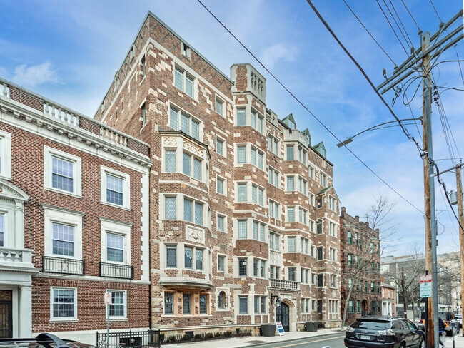
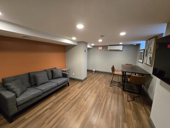
32 High St, New Haven, CT 06510


Save to a Folder
{{folder.Name}}
{{folder.ListingIds.length}} Properties
{{folder.ListingIds.length}} Property
Create a New Folder
Property Detail
32 High St
NHVN-000261-000231-001700
South Central Ct
Apartmenthouse5plusunits
Connecticut
BD
1700
B and X Area of moderate flood hazard, usually the area between the limits of the 100-year and 500-year floods.
0.32 AC
2025
Downtown New Haven
2025
Westchester/So Connecticut
361401
New Haven, CT
48,759 SF
NEARBY LISTINGS FOR SALE OR LEASE
DEMOGRAPHICS near 32 High St
1 mile
3 mile
5 mile
2025 Total Population
41,082
161,748
259,346
2030 Population
41,863
162,122
261,429
Pop Growth 2025-2030
+ 1.90%
+ 0.23%
+ 0.80%
Average Age
34
36
39
2025 Total Households
16,522
61,530
102,416
HH Growth 2025-2030
+ 2.34%
+ 0.32%
+ 0.97%
Median Household Inc
$43,893
$57,598
$65,767
Avg Household Size
2.00
2.30
2.30
2025 Avg HH Vehicles
1.00
1.00
1.00
Median Home Value
$280,045
$273,200
$287,657
Median Year Built
1954
1950
1957
Nearby Places
Map Layers
Map Styles
 Street
 Aerial
Layers
 Traffic
 Biking
Places
Listings with unknown addresses are not visible on the map
- Restaurants
- Banks
- Shops
- Fitness
- Groceries
PUBLIC TRANSPORTATION
TRANSIT/SUBWAY
New Haven-State Street Station (New Haven Line - Metro-North Commuter Railroad Company (Metro-North))
Drive
Walk
Distance
New Haven-State Street Station (New Haven Line - Metro-North Commuter Railroad Company (Metro-North))
3 min
13 min
0.7 mi
New Haven-Union Station (New Haven Line - Metro-North Commuter Railroad Company (Metro-North))
Drive
Walk
Distance
New Haven-Union Station (New Haven Line - Metro-North Commuter Railroad Company (Metro-North))
4 min
20 min
1.0 mi
COMMUTER RAIL
New Haven-State Street Station (New Haven Line - Metro-North Commuter Railroad Company (Metro-North))
Drive
Walk
Distance
New Haven-State Street Station (New Haven Line - Metro-North Commuter Railroad Company (Metro-North))
3 min
12 min
0.6 mi
Drive
Walk
Distance
3 min
18 min
0.9 mi
AIRPORT
Tweed/New Haven
Drive
Walk
Distance
Tweed/New Haven
12 min
5.7 mi
Freight Ports
Port of New Haven
Drive
Walk
Distance
Port of New Haven
7 min
2.8 mi
Nearby Properties
Address
Land Use
TOTAL SIZE
Lot Size
Zoning
Address
Land Use
TOTAL SIZE
Lot Size
Zoning
289,886 SF
2.21 AC
BD2
Address
Land Use
TOTAL SIZE
Lot Size
Zoning
56,359 SF
17.09 AC
RCPD
Address
Land Use
TOTAL SIZE
Lot Size
Zoning
347,604 SF
6.37 AC
RM2
Address
Land Use
TOTAL SIZE
Lot Size
Zoning
83,314 SF
2.14 AC
BA
Address
Land Use
TOTAL SIZE
Lot Size
Zoning
49,582 SF
1.62 AC
RH2
Address
Land Use
TOTAL SIZE
Lot Size
Zoning
81,870 SF
3.86 AC
RM2
Address
Land Use
TOTAL SIZE
Lot Size
Zoning
132,345 SF
3.48 AC
RH2
Address
Land Use
TOTAL SIZE
Lot Size
Zoning
302,262 SF
10.40 AC
RM1
Address
Land Use
TOTAL SIZE
Lot Size
Zoning
446,320 SF
BD1
Address
Land Use
TOTAL SIZE
Lot Size
Zoning
217,040 SF
2.20 AC
RH2
Address
Land Use
TOTAL SIZE
Lot Size
Zoning
101,654 SF
1.45 AC
PDU 14
Address
Land Use
TOTAL SIZE
Lot Size
Zoning
122,856 SF
1.66 AC
RH2
Address
Land Use
TOTAL SIZE
Lot Size
Zoning
133,767 SF
1.25 AC
BD2
Address
Land Use
TOTAL SIZE
Lot Size
Zoning
8,758 SF
12.74 AC
IH
Address
Land Use
TOTAL SIZE
Lot Size
Zoning
111,274 SF
22.62 AC
CEM
Address
Land Use
TOTAL SIZE
Lot Size
Zoning
258,313 SF
23.50 AC
PDU 34
Address
Land Use
TOTAL SIZE
Lot Size
Zoning
9,767 SF
33.63 AC
RM1
Address
Land Use
TOTAL SIZE
Lot Size
Zoning
486,703 SF
2.12 AC
BD
Address
Land Use
TOTAL SIZE
Lot Size
Zoning
72,708 SF
1.91 AC
PDU 87
Address
Land Use
TOTAL SIZE
Lot Size
Zoning
117,902 SF
1.41 AC
BD
Address
Land Use
TOTAL SIZE
Lot Size
Zoning
318,210 SF
2.73 AC
BA
Address
Land Use
TOTAL SIZE
Lot Size
Zoning
316,781 SF
9.20 AC
PDU 94
Address
Land Use
TOTAL SIZE
Lot Size
Zoning
102,115 SF
0.77 AC
RH2
Address
Land Use
TOTAL SIZE
Lot Size
Zoning
180,310 SF
2.70 AC
RH2
Address
Land Use
TOTAL SIZE
Lot Size
Zoning
2.55 AC
BD
Address
Land Use
TOTAL SIZE
Lot Size
Zoning
57,339 SF
3.46 AC
RM2
Address
Land Use
TOTAL SIZE
Lot Size
Zoning
78,878 SF
3.12 AC
RM2
Address
Land Use
TOTAL SIZE
Lot Size
Zoning
123,166 SF
2.33 AC
RH2
Address
Land Use
TOTAL SIZE
Lot Size
Zoning
68,706 SF
3.34 AC
BA1
Address
Land Use
TOTAL SIZE
Lot Size
Zoning
75,139 SF
3.54 AC
RM1
The World's #1 Commercial Real Estate Marketplace
Connect with us
© 2026 CoStar Group
The information above has been obtained from sources believed reliable. While we do not doubt its accuracy we have not verified it and make no guarantee, warranty or representation about it. It is your responsibility to independently confirm its accuracy and completeness. Any projections, opinions, assumptions, or estimates used are for example only and do not represent the current or future performance of the property. The value of this transaction to you depends on tax and other factors which should be evaluated by your tax, financial, and legal advisors. You and your advisors should conduct a careful, independent investigation of the property to determine to your satisfaction the suitability of the property for your needs.