Property Record
32 Steere Dr, Johnston, RI 02919
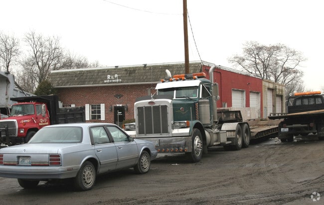

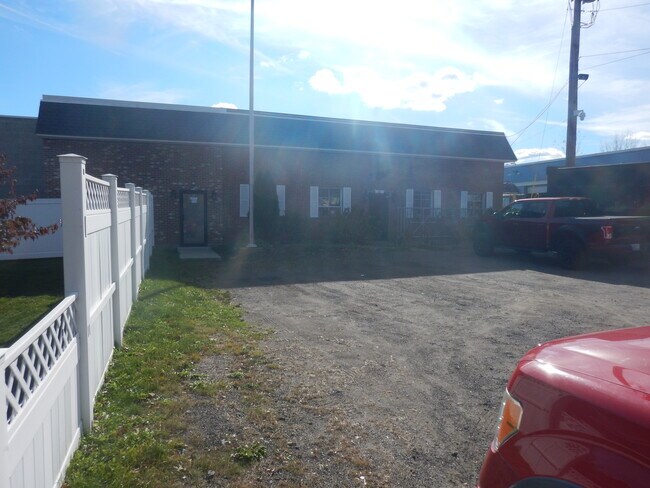
Property Detail
32 Steere Dr
JOHN-000005-000000-000206
Providence
Industrialgeneral
Rhode Island
I
206
B and X Area of moderate flood hazard, usually the area between the limits of the 100-year and 500-year floods.
1.24 AC
2025
Johnston
2025
Providence
012401
Providence-Warwick, RI-MA
8,472 SF
NEARBY LISTINGS FOR SALE OR LEASE
DEMOGRAPHICS near 32 Steere Dr
1 mile
3 mile
5 mile
2025 Total Population
11,792
110,300
300,318
2030 Population
12,287
113,480
308,976
Pop Growth 2025-2030
+ 4.20%
+ 2.88%
+ 2.88%
Average Age
44
40
39
2025 Total Households
5,143
41,709
115,019
HH Growth 2025-2030
+ 4.24%
+ 3.02%
+ 3.13%
Median Household Inc
$79,900
$75,800
$74,736
Avg Household Size
2.20
2.50
2.40
2025 Avg HH Vehicles
2.00
2.00
2.00
Median Home Value
$353,672
$360,591
$361,286
Median Year Built
1978
1959
1954
Nearby Places
Map Layers
Map Styles
 Street
 Aerial
Layers
 Traffic
 Biking
Places
Listings with unknown addresses are not visible on the map
- Restaurants
- Banks
- Shops
- Fitness
- Groceries
PUBLIC TRANSPORTATION
COMMUTER RAIL
Providence (Providence/Stoughton Line - Massachusetts Bay Transportation Authority Commuter Rail (Purple Line))
Drive
Walk
Distance
Providence (Providence/Stoughton Line - Massachusetts Bay Transportation Authority Commuter Rail (Purple Line))
14 min
8.7 mi
AIRPORT
Rhode Island Tf Green International
Drive
Walk
Distance
Rhode Island Tf Green International
22 min
13.2 mi
Freight Ports
Port of Davisville, RI
Drive
Walk
Distance
Port of Davisville, RI
34 min
22.4 mi
SALE & LEASE HISTORY
LISTING DATE
SALE/LEASE

Nov 15, 2021
For Lease
Nearby Properties
Address
Land Use
TOTAL SIZE
Lot Size
Zoning
Address
Land Use
TOTAL SIZE
Lot Size
Zoning
123.25 AC
R40
Address
Land Use
TOTAL SIZE
Lot Size
Zoning
1,792 SF
28.46 AC
Address
Land Use
TOTAL SIZE
Lot Size
Zoning
333,161 SF
25.85 AC
B1
Address
Land Use
TOTAL SIZE
Lot Size
Zoning
32.30 AC
I
Address
Land Use
TOTAL SIZE
Lot Size
Zoning
30.14 AC
R40
Address
Land Use
TOTAL SIZE
Lot Size
Zoning
13,542 SF
95.26 AC
R10
Address
Land Use
TOTAL SIZE
Lot Size
Zoning
1 AC
R40
Address
Land Use
TOTAL SIZE
Lot Size
Zoning
7.06 AC
R20
Address
Land Use
TOTAL SIZE
Lot Size
Zoning
96.12 AC
I
Address
Land Use
TOTAL SIZE
Lot Size
Zoning
122,836 SF
15.10 AC
R40
Address
Land Use
TOTAL SIZE
Lot Size
Zoning
8.33 AC
R10
Address
Land Use
TOTAL SIZE
Lot Size
Zoning
8,742 SF
16.26 AC
R40
Address
Land Use
TOTAL SIZE
Lot Size
Zoning
21.86 AC
I
Address
Land Use
TOTAL SIZE
Lot Size
Zoning
80,602 SF
20.30 AC
B2
Address
Land Use
TOTAL SIZE
Lot Size
Zoning
133.14 AC
R10
Address
Land Use
TOTAL SIZE
Lot Size
Zoning
93,878 SF
14.15 AC
B2
Address
Land Use
TOTAL SIZE
Lot Size
Zoning
10.50 AC
B2
Address
Land Use
TOTAL SIZE
Lot Size
Zoning
13.89 AC
B2
Address
Land Use
TOTAL SIZE
Lot Size
Zoning
11.40 AC
R10
Address
Land Use
TOTAL SIZE
Lot Size
Zoning
133,908 SF
13.26 AC
B2
Address
Land Use
TOTAL SIZE
Lot Size
Zoning
86,428 SF
7.37 AC
B2
Address
Land Use
TOTAL SIZE
Lot Size
Zoning
72,328 SF
4.53 AC
R40
Address
Land Use
TOTAL SIZE
Lot Size
Zoning
32.59 AC
M2
Address
Land Use
TOTAL SIZE
Lot Size
Zoning
51,261 SF
8.29 AC
B3
Address
Land Use
TOTAL SIZE
Lot Size
Zoning
4.57 AC
B2
Address
Land Use
TOTAL SIZE
Lot Size
Zoning
40,586 SF
3.40 AC
RS-1
Address
Land Use
TOTAL SIZE
Lot Size
Zoning
55.25 AC
A80
Address
Land Use
TOTAL SIZE
Lot Size
Zoning
77,132 SF
4.50 AC
M2
Address
Land Use
TOTAL SIZE
Lot Size
Zoning
48,750 SF
2.26 AC
M2
Address
Land Use
TOTAL SIZE
Lot Size
Zoning
58,613 SF
7.31 AC
B2
The World's #1 Commercial Real Estate Marketplace
Connect with us
© 2026 CoStar Group
The information above has been obtained from sources believed reliable. While we do not doubt its accuracy we have not verified it and make no guarantee, warranty or representation about it. It is your responsibility to independently confirm its accuracy and completeness. Any projections, opinions, assumptions, or estimates used are for example only and do not represent the current or future performance of the property. The value of this transaction to you depends on tax and other factors which should be evaluated by your tax, financial, and legal advisors. You and your advisors should conduct a careful, independent investigation of the property to determine to your satisfaction the suitability of the property for your needs.