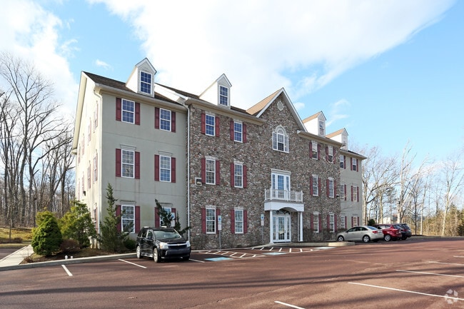
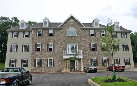
Property Record
3254 W Ridge Pike, Norristown, PA 19403

Current Lease Availabilities
NEARBY LISTINGS FOR SALE OR LEASE
Property Detail
3254 W Ridge Pike
37-00-03997-007
ASSESSOR BLOCK-UNIT NUMBER 3-12
Officebuilding
Montgomery
X
Pennsylvania
42029C0025G
12
2024
1.77 AC
2025
West Montgomery County
206004
Philadelphia
16,584 SF
Philadelphia-Camden-Wilmington, PA-NJ-DE-MD
DEMOGRAPHICS near 3254 W Ridge Pike
1 Mile
3 Mile
5 Mile
2024 Total Population
2,269
30,020
103,804
2029 Population
2,320
30,805
106,141
Pop Growth 2024-2029
+ 2.25%
+ 2.61%
+ 2.25%
Average Age
42
41
40
2024 Total Households
833
11,234
39,704
HH Growth 2024-2029
+ 2.52%
+ 2.76%
+ 2.29%
Median Household Inc
$98,508
$97,031
$89,631
Avg Household Size
2.70
2.60
2.50
2024 Avg HH Vehicles
2.00
2.00
2.00
Median Home Value
$310,077
$296,864
$286,907
Median Year Built
1990
1992
1978
Nearby Places
Map Layers
Map Styles
 Street
 Aerial
- Restaurants
- Banks
- Shops
- Fitness
- Groceries
PUBLIC TRANSPORTATION
AIRPORT
Lehigh Valley International
DRIVE
WALK
Distance
Lehigh Valley International
67 min
39.4 mi
Philadelphia International
DRIVE
WALK
Distance
Philadelphia International
66 min
43.8 mi
Freight Ports
South Jersey Port
DRIVE
WALK
Distance
South Jersey Port
60 min
39.9 mi
Nearby Properties
Address
Land Use
TOTAL SIZE
Lot Size
Zoning
Address
Land Use
TOTAL SIZE
Lot Size
Zoning
605,161 SF
78.08 AC
LLI
Address
Land Use
TOTAL SIZE
Lot Size
Zoning
1,298,806 SF
305.46 AC
HI
Address
Land Use
TOTAL SIZE
Lot Size
Zoning
309,443 SF
20.56 AC
GE
Address
Land Use
TOTAL SIZE
Lot Size
Zoning
268,366 SF
32.55 AC
R4
Address
Land Use
TOTAL SIZE
Lot Size
Zoning
316,623 SF
15.26 AC
R4
Address
Land Use
TOTAL SIZE
Lot Size
Zoning
185,077 SF
6.10 AC
MS
Address
Land Use
TOTAL SIZE
Lot Size
Zoning
152,928 SF
20.28 AC
R1
Address
Land Use
TOTAL SIZE
Lot Size
Zoning
123,946 SF
39.60 AC
R2
Address
Land Use
TOTAL SIZE
Lot Size
Zoning
103,819 SF
33 AC
R1
Address
Land Use
TOTAL SIZE
Lot Size
Zoning
97,188 SF
13.13 AC
OLI
Address
Land Use
TOTAL SIZE
Lot Size
Zoning
147,444 SF
16.09 AC
LLI
Address
Land Use
TOTAL SIZE
Lot Size
Zoning
82,802 SF
29.01 AC
R1
Address
Land Use
TOTAL SIZE
Lot Size
Zoning
214,914 SF
48.17 AC
OLI
Address
Land Use
TOTAL SIZE
Lot Size
Zoning
222,272 SF
21.60 AC
OLI
Address
Land Use
TOTAL SIZE
Lot Size
Zoning
74,270 SF
7.25 AC
MS
Address
Land Use
TOTAL SIZE
Lot Size
Zoning
245,651 SF
20.79 AC
R2
Address
Land Use
TOTAL SIZE
Lot Size
Zoning
68,775 SF
14.91 AC
OLI
Address
Land Use
TOTAL SIZE
Lot Size
Zoning
73,584 SF
0.74 AC
LI
Address
Land Use
TOTAL SIZE
Lot Size
Zoning
73,584 SF
0.64 AC
LI
Address
Land Use
TOTAL SIZE
Lot Size
Zoning
73,584 SF
0.72 AC
LI
Address
Land Use
TOTAL SIZE
Lot Size
Zoning
73,584 SF
0.68 AC
LI
Address
Land Use
TOTAL SIZE
Lot Size
Zoning
0.70 AC
LI
Address
Land Use
TOTAL SIZE
Lot Size
Zoning
70,315 SF
15.64 AC
R4
Address
Land Use
TOTAL SIZE
Lot Size
Zoning
39,310 SF
4.63 AC
OLI
Address
Land Use
TOTAL SIZE
Lot Size
Zoning
73,443 SF
13.14 AC
R2
Address
Land Use
TOTAL SIZE
Lot Size
Zoning
79,265 SF
8.26 AC
MS
Address
Land Use
TOTAL SIZE
Lot Size
Zoning
66,912 SF
4 AC
R3
Address
Land Use
TOTAL SIZE
Lot Size
Zoning
165,111 SF
15.87 AC
OLI
Address
Land Use
TOTAL SIZE
Lot Size
Zoning
34,952 SF
4.23 AC
OLI
Address
Land Use
TOTAL SIZE
Lot Size
Zoning
11,152 SF
12.35 AC
R5
The World's #1 Commercial Real Estate Marketplace
Connect with us
© 2025 CoStar Group
The information above has been obtained from sources believed reliable. While we do not doubt its accuracy we have not verified it and make no guarantee, warranty or representation about it. It is your responsibility to independently confirm its accuracy and completeness. Any projections, opinions, assumptions, or estimates used are for example only and do not represent the current or future performance of the property. The value of this transaction to you depends on tax and other factors which should be evaluated by your tax, financial, and legal advisors. You and your advisors should conduct a careful, independent investigation of the property to determine to your satisfaction the suitability of the property for your needs.