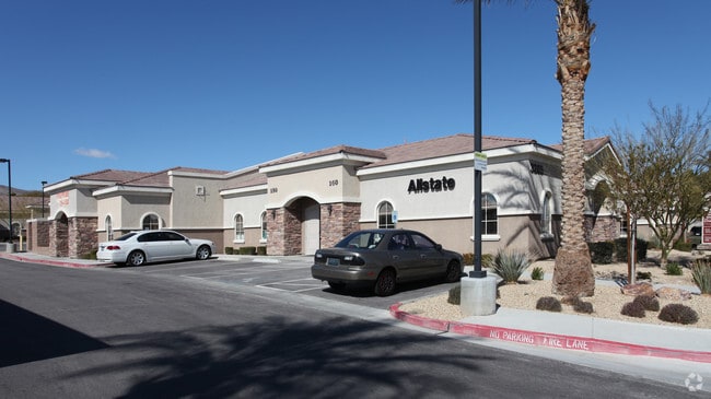
Property Record
3265 N Fort Apache Rd, Las Vegas, NV 89129


NEARBY LISTINGS FOR SALE OR LEASE
Property Detail
3265 N Fort Apache Rd
Las Vegas-Henderson-Paradise, NV
Tamarindo Professional Parc
138-07-821-003
TAMARINDO PROFESSIONAL PARC PLAT BOOK 125 PAGE 30 PT LOT 1
Commercialnec
Clark
X
Nevada
32003C2135F
1
2025
0.07 AC
2025
Northwest Las Vegas
003241
Las Vegas
2,440 SF
DEMOGRAPHICS near 3265 N Fort Apache Rd
1 Mile
3 Mile
5 Mile
2024 Total Population
16,731
118,492
330,761
2029 Population
17,906
127,254
356,325
Pop Growth 2024-2029
+ 7.02%
+ 7.39%
+ 7.73%
Average Age
48
45
41
2024 Total Households
7,023
48,681
129,769
HH Growth 2024-2029
+ 7.05%
+ 7.37%
+ 7.69%
Median Household Inc
$72,473
$76,589
$70,813
Avg Household Size
2.30
2.40
2.50
2024 Avg HH Vehicles
2.00
2.00
2.00
Median Home Value
$376,459
$399,708
$387,086
Median Year Built
1994
1995
1995
Nearby Places
Map Layers
Map Styles
 Street
 Aerial
- Restaurants
- Banks
- Shops
- Fitness
- Groceries
PUBLIC TRANSPORTATION
AIRPORT
Harry Reid International
DRIVE
WALK
Distance
Harry Reid International
29 min
17.6 mi
Boulder City Municipal
DRIVE
WALK
Distance
Boulder City Municipal
49 min
37.6 mi
SALE & LEASE HISTORY
LISTING DATE
SALE/LEASE

Jul 18, 2022
For Sale
Aug 04, 2020
For Lease
Nearby Properties
Address
Land Use
TOTAL SIZE
Lot Size
Zoning
Address
Land Use
TOTAL SIZE
Lot Size
Zoning
157,011 SF
31.41 AC
Address
Land Use
TOTAL SIZE
Lot Size
Zoning
161.14 AC
CV
Address
Land Use
TOTAL SIZE
Lot Size
Zoning
5,643 SF
10.29 AC
Address
Land Use
TOTAL SIZE
Lot Size
Zoning
9,840 SF
19.89 AC
PD
Address
Land Use
TOTAL SIZE
Lot Size
Zoning
37.31 AC
CV
Address
Land Use
TOTAL SIZE
Lot Size
Zoning
7,148 SF
7.26 AC
Address
Land Use
TOTAL SIZE
Lot Size
Zoning
14,793 SF
9.57 AC
CPB
Address
Land Use
TOTAL SIZE
Lot Size
Zoning
12,031 SF
17.45 AC
PC
Address
Land Use
TOTAL SIZE
Lot Size
Zoning
30.07 AC
Address
Land Use
TOTAL SIZE
Lot Size
Zoning
263,881 SF
7.49 AC
R-4
Address
Land Use
TOTAL SIZE
Lot Size
Zoning
21.12 AC
RE
Address
Land Use
TOTAL SIZE
Lot Size
Zoning
4,084 SF
1.84 AC
CPB
Address
Land Use
TOTAL SIZE
Lot Size
Zoning
80.99 AC
RE
Address
Land Use
TOTAL SIZE
Lot Size
Zoning
3,620 SF
12.96 AC
PD
Address
Land Use
TOTAL SIZE
Lot Size
Zoning
11,086 SF
14.50 AC
PC
Address
Land Use
TOTAL SIZE
Lot Size
Zoning
7,103 SF
14.27 AC
L:R-3
Address
Land Use
TOTAL SIZE
Lot Size
Zoning
99,487 SF
22.61 AC
PC
Address
Land Use
TOTAL SIZE
Lot Size
Zoning
18.02 AC
PF
Address
Land Use
TOTAL SIZE
Lot Size
Zoning
6,020 SF
10.30 AC
PC
Address
Land Use
TOTAL SIZE
Lot Size
Zoning
9,789 SF
2.10 AC
R3
Address
Land Use
TOTAL SIZE
Lot Size
Zoning
48,060 SF
7.25 AC
CPB
Address
Land Use
TOTAL SIZE
Lot Size
Zoning
107,464 SF
7.07 AC
PC
Address
Land Use
TOTAL SIZE
Lot Size
Zoning
18.70 AC
PC
Address
Land Use
TOTAL SIZE
Lot Size
Zoning
107,464 SF
6.70 AC
PC
Address
Land Use
TOTAL SIZE
Lot Size
Zoning
48.04 AC
CV
Address
Land Use
TOTAL SIZE
Lot Size
Zoning
82,709 SF
17.64 AC
PC
Address
Land Use
TOTAL SIZE
Lot Size
Zoning
103,846 SF
0.68 AC
PC
Address
Land Use
TOTAL SIZE
Lot Size
Zoning
99,893 SF
9.96 AC
PC
Address
Land Use
TOTAL SIZE
Lot Size
Zoning
78,716 SF
6.11 AC
PC
The World's #1 Commercial Real Estate Marketplace
Connect with us
© 2025 CoStar Group
The information above has been obtained from sources believed reliable. While we do not doubt its accuracy we have not verified it and make no guarantee, warranty or representation about it. It is your responsibility to independently confirm its accuracy and completeness. Any projections, opinions, assumptions, or estimates used are for example only and do not represent the current or future performance of the property. The value of this transaction to you depends on tax and other factors which should be evaluated by your tax, financial, and legal advisors. You and your advisors should conduct a careful, independent investigation of the property to determine to your satisfaction the suitability of the property for your needs.