Property Record
327 E Kennedy St, Spartanburg, SC 29302


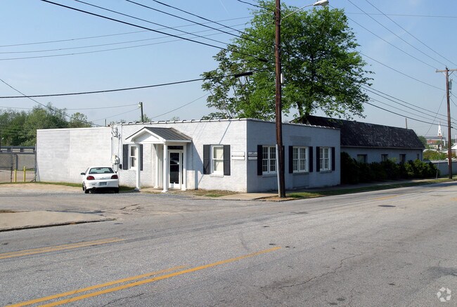
Property Detail
327 E Kennedy St
7-12-11-215.02
S SIDE E KENNEDY ST E SIDE UNION ST DB 130G-751 PB 178-544 DB 87R-614 PB 179-557 DB 132P-43 PB 180-3
Commercialnec
Spartanburg
B and X Area of moderate flood hazard, usually the area between the limits of the 100-year and 500-year floods.
South Carolina
0
3.15 AC
2025
Spartanburg CBD
021200
Greenville/Spartanburg
106,389 SF
Spartanburg, SC
NEARBY LISTINGS FOR SALE OR LEASE
DEMOGRAPHICS near 327 E Kennedy St
1 mile
3 mile
5 mile
2025 Total Population
8,130
52,834
106,330
2030 Population
9,025
58,989
118,651
Pop Growth 2025-2030
+ 11.01%
+ 11.65%
+ 11.59%
Average Age
37
39
39
2025 Total Households
3,354
21,637
42,794
HH Growth 2025-2030
+ 11.87%
+ 11.88%
+ 11.81%
Median Household Inc
$48,905
$47,473
$51,590
Avg Household Size
2.00
2.30
2.30
2025 Avg HH Vehicles
1.00
2.00
2.00
Median Home Value
$255,284
$183,391
$204,643
Median Year Built
1959
1969
1976
Nearby Places
Map Layers
Map Styles
 Street
 Aerial
Layers
 Traffic
 Biking
Places
Listings with unknown addresses are not visible on the map
- Restaurants
- Banks
- Shops
- Fitness
- Groceries
PUBLIC TRANSPORTATION
COMMUTER RAIL
Spartanburg Amtrak Station (Crescent - Amtrak)
Drive
Walk
Distance
Spartanburg Amtrak Station (Crescent - Amtrak)
3 min
1.1 mi
AIRPORT
Greenville Spartanburg International
Drive
Walk
Distance
Greenville Spartanburg International
34 min
19.6 mi
Freight Ports
North Charleston Terminal
Drive
Walk
Distance
North Charleston Terminal
221 min
194.1 mi
Nearby Properties
Address
Land Use
TOTAL SIZE
Lot Size
Zoning
Address
Land Use
TOTAL SIZE
Lot Size
Zoning
2,134 SF
27.72 AC
Address
Land Use
TOTAL SIZE
Lot Size
Zoning
9,312 SF
9.06 AC
Address
Land Use
TOTAL SIZE
Lot Size
Zoning
141,112 SF
3.38 AC
Address
Land Use
TOTAL SIZE
Lot Size
Zoning
15,108 SF
16.27 AC
Address
Land Use
TOTAL SIZE
Lot Size
Zoning
6,148 SF
4.18 AC
Address
Land Use
TOTAL SIZE
Lot Size
Zoning
7,245 SF
18.10 AC
Address
Land Use
TOTAL SIZE
Lot Size
Zoning
18,600 SF
3.41 AC
Address
Land Use
TOTAL SIZE
Lot Size
Zoning
2,100 SF
10.12 AC
Address
Land Use
TOTAL SIZE
Lot Size
Zoning
3,171 SF
21.41 AC
Address
Land Use
TOTAL SIZE
Lot Size
Zoning
12,740 SF
1.48 AC
Address
Land Use
TOTAL SIZE
Lot Size
Zoning
106,100 SF
24.56 AC
Address
Land Use
TOTAL SIZE
Lot Size
Zoning
6,517 SF
6.68 AC
Address
Land Use
TOTAL SIZE
Lot Size
Zoning
44,301 SF
7.47 AC
Address
Land Use
TOTAL SIZE
Lot Size
Zoning
40,995 SF
0.74 AC
Address
Land Use
TOTAL SIZE
Lot Size
Zoning
31,913 SF
1.03 AC
Address
Land Use
TOTAL SIZE
Lot Size
Zoning
30,016 SF
1.07 AC
Address
Land Use
TOTAL SIZE
Lot Size
Zoning
31,054 SF
0.48 AC
Address
Land Use
TOTAL SIZE
Lot Size
Zoning
2,022 SF
3.50 AC
Address
Land Use
TOTAL SIZE
Lot Size
Zoning
6,110 SF
6.01 AC
Address
Land Use
TOTAL SIZE
Lot Size
Zoning
2,864 SF
3.72 AC
Address
Land Use
TOTAL SIZE
Lot Size
Zoning
109,024 SF
2.30 AC
Address
Land Use
TOTAL SIZE
Lot Size
Zoning
19,796 SF
3.56 AC
Address
Land Use
TOTAL SIZE
Lot Size
Zoning
3,648 SF
20.77 AC
Address
Land Use
TOTAL SIZE
Lot Size
Zoning
18,443 SF
0.58 AC
Address
Land Use
TOTAL SIZE
Lot Size
Zoning
25,380 SF
0.75 AC
Address
Land Use
TOTAL SIZE
Lot Size
Zoning
6,907 SF
17.39 AC
Address
Land Use
TOTAL SIZE
Lot Size
Zoning
11,402 SF
7.21 AC
Address
Land Use
TOTAL SIZE
Lot Size
Zoning
27,608 SF
17.61 AC
Address
Land Use
TOTAL SIZE
Lot Size
Zoning
337,199 SF
2.17 AC
The World's #1 Commercial Real Estate Marketplace
Connect with us
© 2026 CoStar Group
The information above has been obtained from sources believed reliable. While we do not doubt its accuracy we have not verified it and make no guarantee, warranty or representation about it. It is your responsibility to independently confirm its accuracy and completeness. Any projections, opinions, assumptions, or estimates used are for example only and do not represent the current or future performance of the property. The value of this transaction to you depends on tax and other factors which should be evaluated by your tax, financial, and legal advisors. You and your advisors should conduct a careful, independent investigation of the property to determine to your satisfaction the suitability of the property for your needs.