Property Record
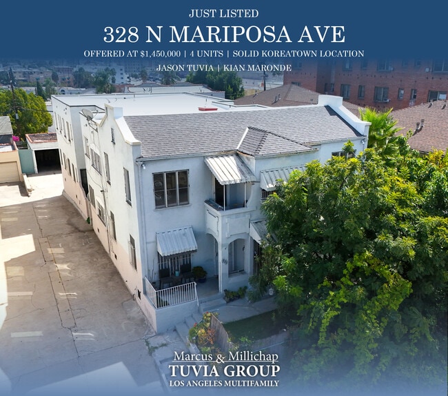
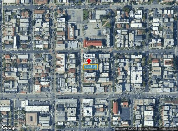
328 N Mariposa Ave, Los Angeles, CA 90004

This Property Is For Sale
NEARBY LISTINGS FOR SALE OR LEASE
Property Detail
328 N Mariposa Ave
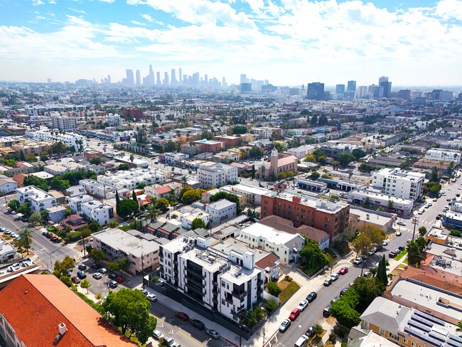
Los Angeles-Long Beach-Glendale, CA
3125
5520-024-011
TRACT # 3125 LOT COM AT SW COR OF LOT 29 TH N 0 0310 E 54.29 FT TH N 89 4810 E 107.5 FT TH SE 28.18 FT TH N 89 4810 E 20 FT TO E LINE OF SD LOT TH S THEREON 51.79 FT TO S LINE OF SD LOT TH W FT TO BEG PART OF LOTS 28 AND LOT 29
Quadruplex
Los Angeles
X
California
06037C1610F
29
2024
0.19 AC
2025
East Hollywood
192620
Los Angeles
5,782 SF
DEMOGRAPHICS near 328 N Mariposa Ave
1 Mile
3 Mile
5 Mile
2024 Total Population
100,665
575,115
1,111,413
2029 Population
100,784
576,731
1,111,644
Pop Growth 2024-2029
+ 0.12%
+ 0.28%
+ 0.02%
Average Age
39
40
40
2024 Total Households
40,613
244,160
464,079
HH Growth 2024-2029
(0.11%)
+ 0.25%
+ 0.01%
Median Household Inc
$56,676
$64,334
$69,280
Avg Household Size
2.40
2.20
2.20
2024 Avg HH Vehicles
1.00
1.00
1.00
Median Home Value
$1,009,045
$1,070,913
$1,041,478
Median Year Built
1964
1961
1961
Nearby Places
Map Layers
Map Styles
 Street
 Aerial
- Restaurants
- Banks
- Shops
- Fitness
- Groceries
PUBLIC TRANSPORTATION
TRANSIT/SUBWAY
Vermont/Beverly Station (Red Line - Los Angeles County Metropolitan Transportation Authority (Metro))
DRIVE
WALK
Distance
Vermont/Beverly Station (Red Line - Los Angeles County Metropolitan Transportation Authority (Metro))
1 min
10 min
0.5 mi
COMMUTER RAIL
DRIVE
WALK
Distance
8 min
4.2 mi
Union Station (91 Line - Southern California Regional Rail Authority (Metrolink), Antelope Valley Line - Southern California Regional Rail Authority (Metrolink), Orange County Line - Southern California Regional Rail Authority (Metrolink), Riverside Line - Southern California Regional Rail Authority (Metrolink), San Bernardino Line - Southern California Regional Rail Authority (Metrolink), Ventura County Line - Southern California Regional Rail Authority (Metrolink))
DRIVE
WALK
Distance
Union Station (91 Line - Southern California Regional Rail Authority (Metrolink), Antelope Valley Line - Southern California Regional Rail Authority (Metrolink), Orange County Line - Southern California Regional Rail Authority (Metrolink), Riverside Line - Southern California Regional Rail Authority (Metrolink), San Bernardino Line - Southern California Regional Rail Authority (Metrolink), Ventura County Line - Southern California Regional Rail Authority (Metrolink))
10 min
4.4 mi
AIRPORT
Bob Hope
DRIVE
WALK
Distance
Bob Hope
21 min
11.1 mi
Los Angeles International
DRIVE
WALK
Distance
Los Angeles International
28 min
14.5 mi
Long Beach (Daugherty Field)
DRIVE
WALK
Distance
Long Beach (Daugherty Field)
37 min
26.8 mi
Freight Ports
Port of Long Beach
DRIVE
WALK
Distance
Port of Long Beach
40 min
28.4 mi
Nearby Properties
Address
Land Use
TOTAL SIZE
Lot Size
Zoning
Address
Land Use
TOTAL SIZE
Lot Size
Zoning
2,832,748 SF
4.20 AC
LAC2
Address
Land Use
TOTAL SIZE
Lot Size
Zoning
930,249 SF
7.39 AC
LAC2
Address
Land Use
TOTAL SIZE
Lot Size
Zoning
108,464 SF
9.17 AC
LALASED
Address
Land Use
TOTAL SIZE
Lot Size
Zoning
969,264 SF
0.94 AC
LAC2
Address
Land Use
TOTAL SIZE
Lot Size
Zoning
949,529 SF
1.50 AC
LAC2
Address
Land Use
TOTAL SIZE
Lot Size
Zoning
709,584 SF
1.80 AC
LAPB
Address
Land Use
TOTAL SIZE
Lot Size
Zoning
738,975 SF
2.71 AC
LAC2
Address
Land Use
TOTAL SIZE
Lot Size
Zoning
1,094,768 SF
0.73 AC
LAC2
Address
Land Use
TOTAL SIZE
Lot Size
Zoning
161,046 SF
6.88 AC
LAM1
Address
Land Use
TOTAL SIZE
Lot Size
Zoning
966,466 SF
3.99 AC
LAC2
Address
Land Use
TOTAL SIZE
Lot Size
Zoning
67,126 SF
48.09 AC
LAM1
Address
Land Use
TOTAL SIZE
Lot Size
Zoning
472,363 SF
3.24 AC
LAC4
Address
Land Use
TOTAL SIZE
Lot Size
Zoning
641,453 SF
2.93 AC
LAC4
Address
Land Use
TOTAL SIZE
Lot Size
Zoning
497,377 SF
3.29 AC
LAC4
Address
Land Use
TOTAL SIZE
Lot Size
Zoning
651,289 SF
3.79 AC
LACW
Address
Land Use
TOTAL SIZE
Lot Size
Zoning
1.28 AC
LAC2
Address
Land Use
TOTAL SIZE
Lot Size
Zoning
793,274 SF
7.80 AC
LAR4
Address
Land Use
TOTAL SIZE
Lot Size
Zoning
724,958 SF
5.88 AC
LAC2
Address
Land Use
TOTAL SIZE
Lot Size
Zoning
749,061 SF
2.39 AC
LAC2
Address
Land Use
TOTAL SIZE
Lot Size
Zoning
520,825 SF
2.13 AC
LAC2
Address
Land Use
TOTAL SIZE
Lot Size
Zoning
289,633 SF
1.55 AC
LAP
Address
Land Use
TOTAL SIZE
Lot Size
Zoning
323,927 SF
0.85 AC
LALASED
Address
Land Use
TOTAL SIZE
Lot Size
Zoning
255,868 SF
9.58 AC
WDC2C*
Address
Land Use
TOTAL SIZE
Lot Size
Zoning
289,108 SF
0.57 AC
LAC2
Address
Land Use
TOTAL SIZE
Lot Size
Zoning
746,938 SF
0.98 AC
LAC4
Address
Land Use
TOTAL SIZE
Lot Size
Zoning
786,423 SF
11.74 AC
LAC2
Address
Land Use
TOTAL SIZE
Lot Size
Zoning
465,561 SF
0.93 AC
LAC2
Address
Land Use
TOTAL SIZE
Lot Size
Zoning
556,235 SF
4.22 AC
LAC4
Address
Land Use
TOTAL SIZE
Lot Size
Zoning
406,948 SF
8.04 AC
LAC2
Address
Land Use
TOTAL SIZE
Lot Size
Zoning
9.17 AC
LALASED
The World's #1 Commercial Real Estate Marketplace
Connect with us
© 2025 CoStar Group
The information above has been obtained from sources believed reliable. While we do not doubt its accuracy we have not verified it and make no guarantee, warranty or representation about it. It is your responsibility to independently confirm its accuracy and completeness. Any projections, opinions, assumptions, or estimates used are for example only and do not represent the current or future performance of the property. The value of this transaction to you depends on tax and other factors which should be evaluated by your tax, financial, and legal advisors. You and your advisors should conduct a careful, independent investigation of the property to determine to your satisfaction the suitability of the property for your needs.