Property Record
3295 W Stetson Ave, Hemet, CA 92545

Save to a Folder
{{folder.Name}}
{{folder.ListingIds.length}} Properties
{{folder.ListingIds.length}} Property
Create a New Folder
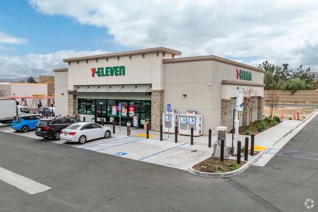
Property Detail
3295 W Stetson Ave
460-150-045
ACRES 0.77000000 ACREAGEQUALCODE NT LOTTYPE P PARCEL 1 MAPPLATB 255 MAPPLATP 62 SUBDIVISIONNAME PM 37779
Servicestation
RIVERSIDE
B and X Area of moderate flood hazard, usually the area between the limits of the 100-year and 500-year floods.
California
2025
0.77 AC
2025
Beaumont/Hemet
043316
Inland Empire (California)
4,088 SF
Riverside-San Bernardino-Ontario, CA
NEARBY LISTINGS FOR SALE OR LEASE
DEMOGRAPHICS near 3295 W Stetson Ave
1 mile
3 mile
5 mile
2025 Total Population
12,894
76,896
154,671
2030 Population
13,117
79,347
159,501
Pop Growth 2025-2030
+ 1.73%
+ 3.19%
+ 3.12%
Average Age
43
41
39
2025 Total Households
4,533
27,886
50,606
HH Growth 2025-2030
+ 1.50%
+ 2.81%
+ 2.78%
Median Household Inc
$68,424
$54,241
$63,016
Avg Household Size
2.70
2.60
2.90
2025 Avg HH Vehicles
2.00
2.00
2.00
Median Home Value
$358,381
$311,969
$383,477
Median Year Built
1989
1982
1984
Nearby Places
Map Layers
Map Styles
 Street
 Aerial
Layers
 Traffic
 Biking
Places
Listings with unknown addresses are not visible on the map
- Restaurants
- Banks
- Shops
- Fitness
- Groceries
PUBLIC TRANSPORTATION
AIRPORT
Palm Springs International
Drive
Walk
Distance
Palm Springs International
56 min
46.4 mi
Ontario International
Drive
Walk
Distance
Ontario International
65 min
49.9 mi
SALE & LEASE HISTORY
LISTING DATE
SALE/LEASE

Nov 20, 2023
For Sale
Jun 08, 2023
For Sale
Jan 31, 2024
For Sale
Nearby Properties
Address
Land Use
TOTAL SIZE
Lot Size
Zoning
Address
Land Use
TOTAL SIZE
Lot Size
Zoning
168,761 SF
20.67 AC
Address
Land Use
TOTAL SIZE
Lot Size
Zoning
4,550 SF
127.73 AC
Address
Land Use
TOTAL SIZE
Lot Size
Zoning
306,540 SF
7.69 AC
Address
Land Use
TOTAL SIZE
Lot Size
Zoning
94,476 SF
4.86 AC
R3
Address
Land Use
TOTAL SIZE
Lot Size
Zoning
165,401 SF
13.45 AC
C1
Address
Land Use
TOTAL SIZE
Lot Size
Zoning
459,613 SF
18.24 AC
Address
Land Use
TOTAL SIZE
Lot Size
Zoning
9,184 SF
4.75 AC
R3
Address
Land Use
TOTAL SIZE
Lot Size
Zoning
50,160 SF
5.93 AC
R3
Address
Land Use
TOTAL SIZE
Lot Size
Zoning
27,964 SF
5.47 AC
Address
Land Use
TOTAL SIZE
Lot Size
Zoning
53,140 SF
6.74 AC
C2
Address
Land Use
TOTAL SIZE
Lot Size
Zoning
89,317 SF
5.77 AC
Address
Land Use
TOTAL SIZE
Lot Size
Zoning
66,482 SF
9.11 AC
A1
Address
Land Use
TOTAL SIZE
Lot Size
Zoning
167,396 SF
9.36 AC
Address
Land Use
TOTAL SIZE
Lot Size
Zoning
44,600 SF
6.41 AC
Address
Land Use
TOTAL SIZE
Lot Size
Zoning
59,680 SF
5.80 AC
C2
Address
Land Use
TOTAL SIZE
Lot Size
Zoning
42,064 SF
4.71 AC
C1
Address
Land Use
TOTAL SIZE
Lot Size
Zoning
69,306 SF
6.02 AC
Address
Land Use
TOTAL SIZE
Lot Size
Zoning
101,172 SF
7.48 AC
Address
Land Use
TOTAL SIZE
Lot Size
Zoning
79,683 SF
7.97 AC
C1
Address
Land Use
TOTAL SIZE
Lot Size
Zoning
24,656 SF
4.32 AC
R3
Address
Land Use
TOTAL SIZE
Lot Size
Zoning
88,530 SF
18.41 AC
Address
Land Use
TOTAL SIZE
Lot Size
Zoning
202,852 SF
11.37 AC
Address
Land Use
TOTAL SIZE
Lot Size
Zoning
104,713 SF
7.49 AC
Address
Land Use
TOTAL SIZE
Lot Size
Zoning
100,155 SF
8.28 AC
Address
Land Use
TOTAL SIZE
Lot Size
Zoning
26,035 SF
6.90 AC
Address
Land Use
TOTAL SIZE
Lot Size
Zoning
299,341 SF
5.85 AC
C2
Address
Land Use
TOTAL SIZE
Lot Size
Zoning
28,882 SF
4.35 AC
IP
Address
Land Use
TOTAL SIZE
Lot Size
Zoning
47,046 SF
4.48 AC
The World's #1 Commercial Real Estate Marketplace
Connect with us
© 2026 CoStar Group
The information above has been obtained from sources believed reliable. While we do not doubt its accuracy we have not verified it and make no guarantee, warranty or representation about it. It is your responsibility to independently confirm its accuracy and completeness. Any projections, opinions, assumptions, or estimates used are for example only and do not represent the current or future performance of the property. The value of this transaction to you depends on tax and other factors which should be evaluated by your tax, financial, and legal advisors. You and your advisors should conduct a careful, independent investigation of the property to determine to your satisfaction the suitability of the property for your needs.