Property Record
3301 Navone Rd, Stockton, CA 95215

Property Detail
3301 Navone Rd
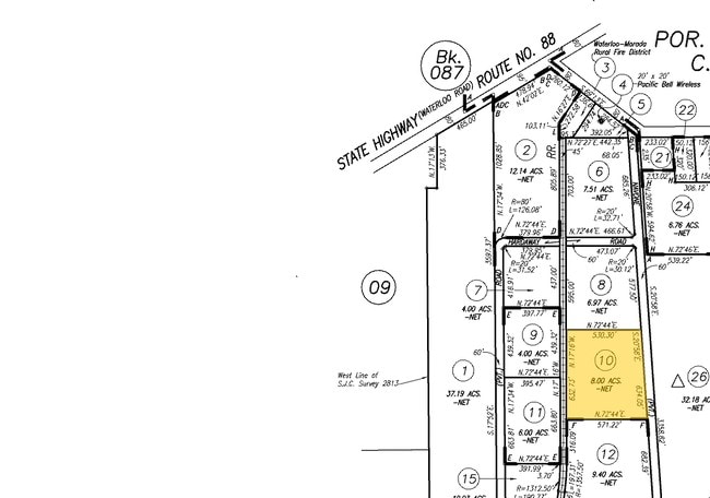
101-290-10
REDRAWN APR-06-2007 FROM ORIGINAL APN 101-110-65
Lightindustrial
San Joaquin
IL
California
C and X Area of minimal flood hazard, usually depicted on FIRMs as above the 500-year flood level.
8 AC
2025
NE Stockton
2025
Stockton/Modesto
003601
Stockton-Lodi, CA
NEARBY LISTINGS FOR SALE OR LEASE
DEMOGRAPHICS near 3301 Navone Rd
1 mile
3 mile
5 mile
2025 Total Population
533
23,561
155,387
2030 Population
538
24,407
161,797
Pop Growth 2025-2030
+ 0.94%
+ 3.59%
+ 4.13%
Average Age
43
37
36
2025 Total Households
184
7,038
45,983
HH Growth 2025-2030
+ 1.09%
+ 3.58%
+ 4.25%
Median Household Inc
$128,017
$70,828
$67,698
Avg Household Size
2.80
3.30
3.20
2025 Avg HH Vehicles
2.00
2.00
2.00
Median Home Value
$750,000
$373,710
$398,549
Median Year Built
1971
1970
1975
Nearby Places
Map Layers
Map Styles
 Street
 Aerial
Layers
 Traffic
 Biking
Places
Listings with unknown addresses are not visible on the map
- Restaurants
- Banks
- Shops
- Fitness
- Groceries
PUBLIC TRANSPORTATION
COMMUTER RAIL
Drive
Walk
Distance
12 min
5.7 mi
Drive
Walk
Distance
13 min
7.4 mi
AIRPORT
Stockton Metro
Drive
Walk
Distance
Stockton Metro
19 min
11.1 mi
Freight Ports
Port of Stockton
Drive
Walk
Distance
Port of Stockton
18 min
10.0 mi
Nearby Properties
Address
Land Use
TOTAL SIZE
Lot Size
Zoning
Address
Land Use
TOTAL SIZE
Lot Size
Zoning
9,750 SF
136.94 AC
AU20
Address
Land Use
TOTAL SIZE
Lot Size
Zoning
652,548 SF
35.24 AC
IL
Address
Land Use
TOTAL SIZE
Lot Size
Zoning
192,389 SF
47.61 AC
Address
Land Use
TOTAL SIZE
Lot Size
Zoning
1,312 SF
7.44 AC
Address
Land Use
TOTAL SIZE
Lot Size
Zoning
219,572 SF
16.53 AC
IL
Address
Land Use
TOTAL SIZE
Lot Size
Zoning
90,142 SF
26.25 AC
Address
Land Use
TOTAL SIZE
Lot Size
Zoning
62,588 SF
43.56 AC
IW
Address
Land Use
TOTAL SIZE
Lot Size
Zoning
5,264 SF
9.82 AC
IL
Address
Land Use
TOTAL SIZE
Lot Size
Zoning
261,860 SF
7.48 AC
IW
Address
Land Use
TOTAL SIZE
Lot Size
Zoning
199,500 SF
8.74 AC
IW
Address
Land Use
TOTAL SIZE
Lot Size
Zoning
202,752 SF
9.40 AC
IL
Address
Land Use
TOTAL SIZE
Lot Size
Zoning
4.55 AC
CG
Address
Land Use
TOTAL SIZE
Lot Size
Zoning
34,148 SF
5.36 AC
Address
Land Use
TOTAL SIZE
Lot Size
Zoning
58,998 SF
8 AC
Address
Land Use
TOTAL SIZE
Lot Size
Zoning
1,253 SF
4.99 AC
IL
Address
Land Use
TOTAL SIZE
Lot Size
Zoning
8,539 SF
20 AC
CG
Address
Land Use
TOTAL SIZE
Lot Size
Zoning
42,880 SF
15.32 AC
IW
Address
Land Use
TOTAL SIZE
Lot Size
Zoning
165,000 SF
12.14 AC
IL
Address
Land Use
TOTAL SIZE
Lot Size
Zoning
1,719 SF
6.08 AC
RL
Address
Land Use
TOTAL SIZE
Lot Size
Zoning
33,106 SF
8.14 AC
IL
Address
Land Use
TOTAL SIZE
Lot Size
Zoning
75,000 SF
2.67 AC
IW
Address
Land Use
TOTAL SIZE
Lot Size
Zoning
86,931 SF
9.49 AC
CFS
Address
Land Use
TOTAL SIZE
Lot Size
Zoning
44,717 SF
3.13 AC
IL
Address
Land Use
TOTAL SIZE
Lot Size
Zoning
98,249 SF
8.52 AC
IL
Address
Land Use
TOTAL SIZE
Lot Size
Zoning
36,000 SF
7.40 AC
IL
Address
Land Use
TOTAL SIZE
Lot Size
Zoning
50,000 SF
4.95 AC
IW
Address
Land Use
TOTAL SIZE
Lot Size
Zoning
84,780 SF
5.62 AC
IW
Address
Land Use
TOTAL SIZE
Lot Size
Zoning
37,864 SF
2.90 AC
IL
Address
Land Use
TOTAL SIZE
Lot Size
Zoning
100,000 SF
3.49 AC
IW
The World's #1 Commercial Real Estate Marketplace
Connect with us
© 2026 CoStar Group
The information above has been obtained from sources believed reliable. While we do not doubt its accuracy we have not verified it and make no guarantee, warranty or representation about it. It is your responsibility to independently confirm its accuracy and completeness. Any projections, opinions, assumptions, or estimates used are for example only and do not represent the current or future performance of the property. The value of this transaction to you depends on tax and other factors which should be evaluated by your tax, financial, and legal advisors. You and your advisors should conduct a careful, independent investigation of the property to determine to your satisfaction the suitability of the property for your needs.